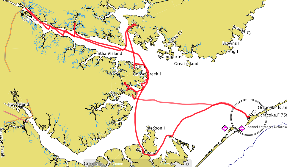
 Very cold and rainy here, chance of snow Monday. Haven't achieved much. But I did come across a great website on the resources page of the OBX130. It is NOAA's Nautical Chart Online Viewer. Here is the link for the Atlantic Coast page of charts. I did not know they were out there. Plenty of daydreams in the charts.
 At top left is a detail from Chart 11548, Pamlico Sound Western Part. It shows Fisherman Bay inside of Maw Point where Bruce and I might anchor on day seven of the trip. Well protected from the typical southwest wind, Bonner Bay right around the corner offers protection in a couple of small creeks should the forecast call for wind out of the north. (I've got to think that those Bonner Bay creeks, with steep drop offs to 10 feet, ought to be pretty "fishy".)
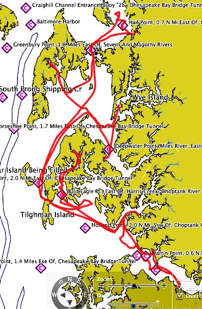
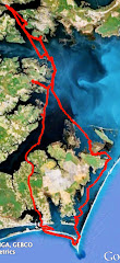
 The second photo down is a screen shot from Google Maps showing the same spot. We'll carry a handful of Google Map or Google Earth images on the boat, a good reference when we get to a possible anchorage (plus the shoals and dropoffs visible on the photo give a hint for good fishing areas).
 The second photo down is a screen shot from Google Maps showing the same spot. We'll carry a handful of Google Map or Google Earth images on the boat, a good reference when we get to a possible anchorage (plus the shoals and dropoffs visible on the photo give a hint for good fishing areas).
 I also did a test meal for the trip, seen at the bottom. That is grilled lamb and polenta with roasted red pepper sauce. The basil/garlic polenta comes in a tube and does not need refrigeration. A box of red pepper soup (again, no refrigeration), with a few added spices, is cooked down in a pot to make the sauce. The lamb (or beef or chicken) would probably be sliced in to strips, frozen and kept in a soft-sided cooler with dry ice. Improving our menu is one of the goals for the trip. I'll experiment with dry ice once things warm up here. But this was an excellent, very practical meal for the trip. Who needs to rough it?
 Less than a week until the start of the 2009 Everglades Challenge. The Chief says they will be offering a challenge viewer so we can follow all the competitors (I think). It's a great race and worth checking out.
-Steve


No comments:
Post a Comment