Calm night with a little light rain. After a thousand miles on the road I dream of of diesel trucks on the highway. I wake and still hear the diesels. Confused for a moment, I shake my head when I realize the diesels engines are on the lobster boats working outside Herrick Bay.
A light rain while bringing down the boom tent. Slip on the foul weather gear. A pretty morning with clouds and nice light. Sail off anchor 6:25. Seals roll and dive nearby, moments later a school of baitfish erupts out of the calm water.
Light northwest wind. Making 1.3 with a helping tide. I can see Mt. Desert Island to the east, and also a string of low islands between here and there. I look at my gps, the all-too-basic screen doesn't help, I can't figure out which island is which, which islands I need to leave to port or starboard. I open up Navionics on my phone and it gives a much clearer image. For starters leave Pond Island to starboard, then go from there.
7:30 sailing with a light breeze, 1.8. More wind and making 3.0 through a filed of lobster pot markers. A friendly wave from a lobsterman. Then a not so friendly wave from a couple on a trawler. The woman points forward of SPARTINA then gestures with her arm that they are going to cut across my bow. Plenty of room for them to go out and around, but I guess if you have a big boat you go where you want to go.
Making 3.1 with wind over port quarter. I realize I will have to use my phone to navigate. I set out the solar panel and plug the phone in to keep it charged. At Ship Island I can hear a bell ringing on a green buoy near Ships and Barges Ledge. Pass between the island and the ledge making 3.7. Porpoises, small and dark, swim nearby. Navionics shows Bass Harbor Head 2.5 NM due east. 10:00 making less than a knot. Wind disappears, under power. 10:30 motoring against a strong tide running over the shallows of Bass Harbor Bar. Very choppy. 10:45 over the bar, water much calmer. See waves breaking to the northeast on Long Ledge. Wind at 11:20, past the ledge and turn north, the southern-most part of Mt. Desert Island to port and Great Cranberry Island to starboard.
Better wind off of Spruling Cove on the north side of Great Cranberry Island. I tack in to look at the cove, filled with mooring balls and boats, trying to figure out possible anchorages. The little harbor looks full and I still don't understand the depths with the ten foot tidal changes. This anchoring thing will be interesting.
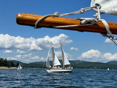
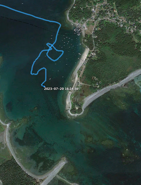
Tack back out to open water south of Sutton Island. It is a spectacular day. Small boats, big boats, classic boats, schooners and sloops, all out enjoying the afternoon southwesterlies. Tack back in and out of Southwest Harbor, again the harbor is filled with mooring and boats. Back out into the open water and fresh breeze. Head east to Little Cranberry Island. The Navionics app says there are a few "town guest" moorings. Winding through the mooring field I do see the town guest moorings, all with boats tied to them. Just as last night, I find an open spot of water in line with the moored boats. Anchor down in Cranberry Harbor 4:20.
23.02 NM


No comments:
Post a Comment