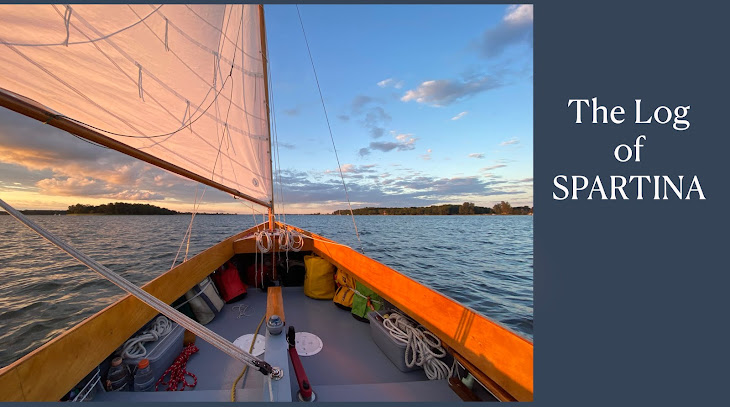

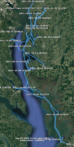
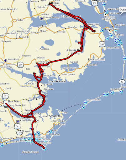
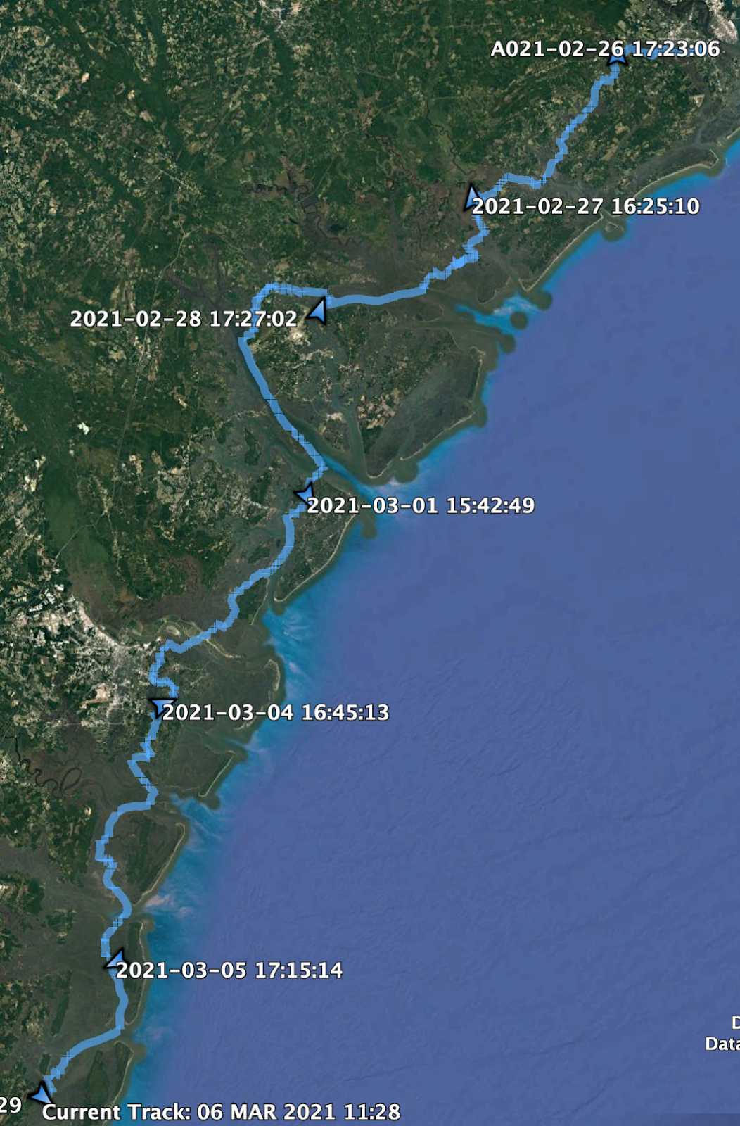
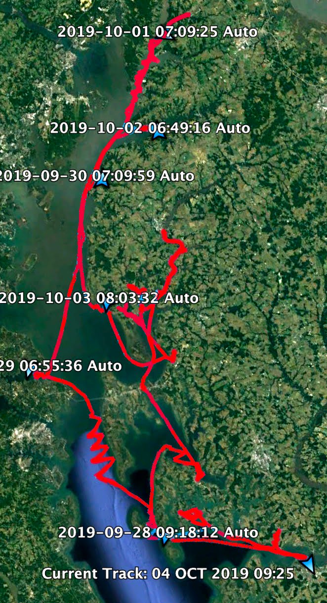
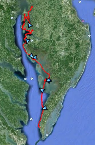
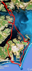
Cool, grey morning with a strong NE wind. As I attempt to lower the centerboard it hits bottom. Low tide, lower than usual I think because what the weather radio is calling a "backdoor cold front" has blown water out of the Honga River. I haul in the anchor line to see if that will pull us to slightly deeper water. It does but when I raise the anchor off the bottom the wind blows us back into the shallow water. I toss out the anchor again so we don't lose any more ground. It is so shallow the anchor shaft is standing up out of the water. Swimsuit and water boots on, I step over the side of SPARTINA to find the bottom is sand and solid enough to walk on. I walk forward to pick up the anchor then keep walking to open water. About 200 yards and the water is not quite knee deep. A couple hundred more yard and it is up to my waist. Not the way I want to start the day. Anchor set in the sand, back on board, get my clothes back on.

Sailing south on the Honga River with a double-reefed main at 7:45, making 4.5. Shake out the second reef at 8:05, 4.9.

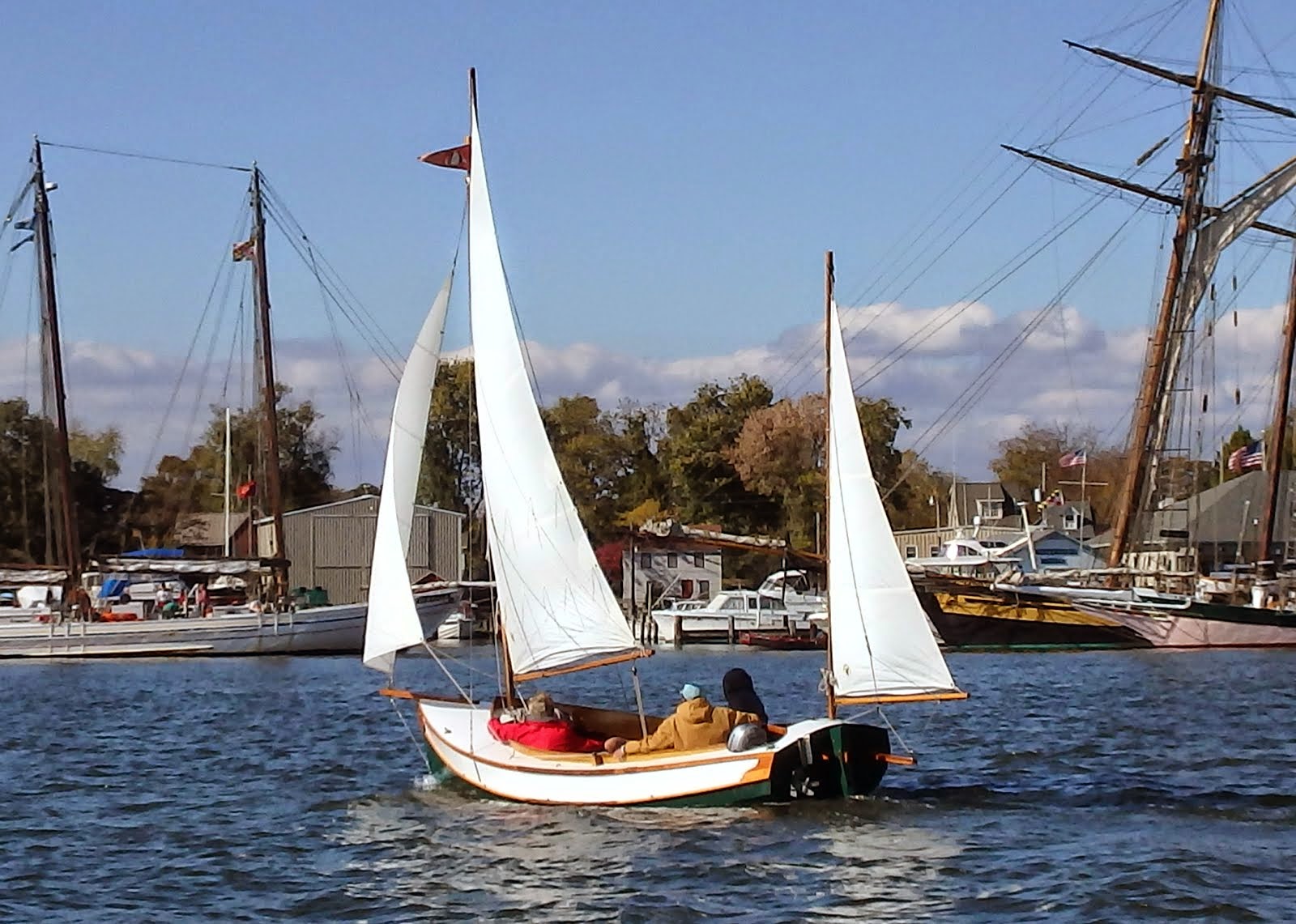
Pass by the deadrise MADISON with a crew and a dog on board, get a friendly wave. Full sail at 8:45 as the wind slacks a bit.

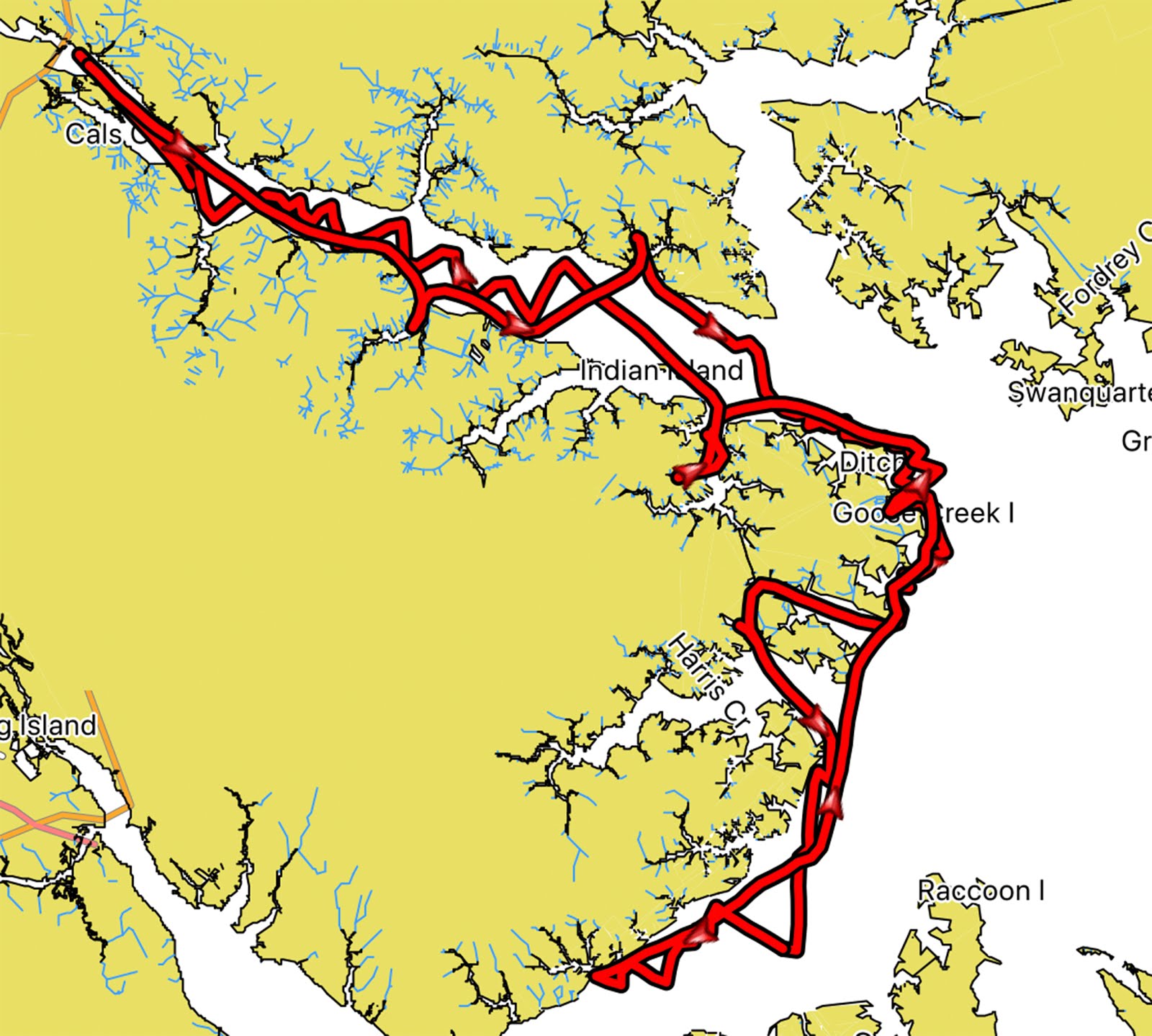
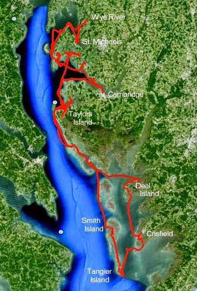
Hooper Straits at 9:05, 5.5 in very rough water. Waves and chop slow us to 2.0 to 3.5 at times, doing 5+ after crossing the middle of the straits on leave the rough water behind. Dark grey clouds overhead. Approaching Deal Island at 9:50, lots of boats off the NE corner of the island. Getting closer I can see it is a fleet of oyster boats with mechanical tongs. The tongs drop down to the bottom, grab oysters and rocks and whatever then hauls it all up to a culling board where the crew sorts through the catch. The boats move very slowly so I see no reason why I can sail through the middle of the fleet. I get a few looks, a couple of waves.

Much calmer at 10:30 in the lee of Deal Island. Overcast lighter and maybe a hint of sun.

Darker clouds moving in from the NE at 11:45, making 4.3 with wind just aft of port beam. I have no planned destination for the day and wind is perfect for making my way south on Tangier Sound.

Entrance channel to the Little Annemessex River in sight. Consider going into the river and then taking Broad Creek behind the marsh down to Pocomoke Sound. Decide to bypass the river and sound. Heading towards tiny Fox Island. At 1:50 pass the buoy that marks the Virginia/Maryland state line. 2:45 past Fox Island and turning to SE to cross the shoal that runs from Fox Island to Watts Island. Crab pot markers help me avoid the shallows. Making 5.4 with wind forward of beam.

At 3:15 on a SE heading see an old house next to a tree on a sandy point straight ahead. Skies are getting brighter. Check the GPS to see if it is Beach Island. It is. Pass the island and tack into the marshes behind at 4:10.

After my experience with the shallow in the morning I use the Navionics app on my phone to find my way through the marsh. Anchor down near a little island on Pompco Creek at 4:40. The sun comes out. All is well after a long day of sailing.

Sausage and biscuits for dinner, perfect.
39.62 NM


No comments:
Post a Comment