Friday, October 30, 2009
Monday, October 26, 2009
Fisherman Island
I got a chance to run over to Fisherman Island today. That is the tiny little island at the very southern tip of the Eastern Shore. You'll see it on various charts, maps and signs as Fishermen's Island or Fisherman's Island, but the real name is Fisherman Island.
 Somebody was smart enough years ago to make it a federal national wildlife refuge. Access is very limited. I had driven over it countless times over the last 20 years - the last high rise bridge of the Chesapeake Bay Bridge-Tunnel touches down there as you head north on to the shore - but I had never set foot on it. I was very glad to go today.
 Signs of wildlife, both marine and otherwise, were everywhere. Those are deer tracks below. There were thousands of birds, ghost crabs, horse shoe crabs, sand dollars and just about anything else you could imagine.
It was the first time I had been around the water since the sailing trip. And of course it got me to thinking about where we might go sailing next year. There was one pretty little creek that reminded me of some of the places we saw on the last trip. I would like to head back north on the Bay maybe in late spring to visit the creeks around the Honga, Little Choptank and Choptank Rivers. We would probably cover less territory, but spend more time checking out the creeks, marshes and fishing villages.
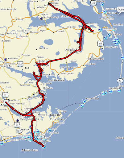
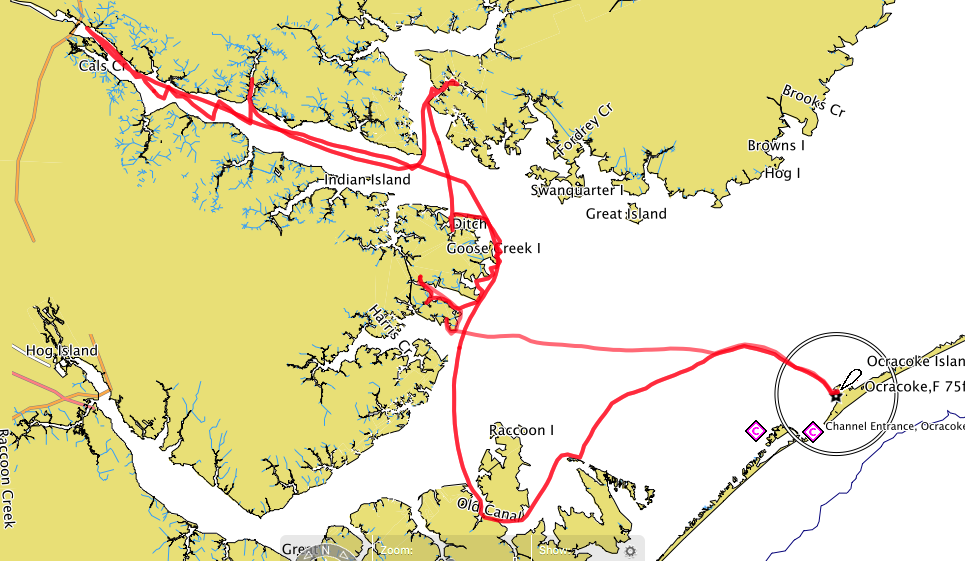
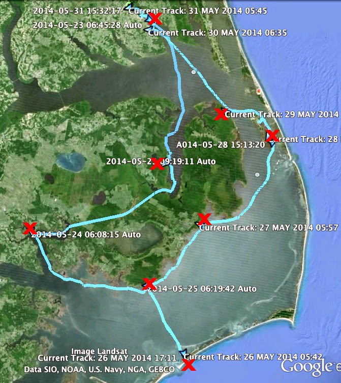
And I would like to head south in late summer or early fall to Pamlico Sound. I've done four cruises down there, two solo and two with Bruce, but there is lots more to see. Bruce is checking on his schedule - I didn't realize retired life could be so busy - so we can compare notes and work things out. The planning will be a fun project for winter.
We've had bad weather the two weekends since we got back from the trip. But the forecast is looking better this Saturday and Sunday so maybe I'll get out for a day sail on the Elizabeth River. Now is a great time to sail - if the weather is good - as the snowbird fleet of sailboats are passing through our area on their way to Florida and the Bahamas for the winter. A lot of spectacular boats and very nice people are out there on the ICW right now.
Today on Fisherman Island we could feel the weather shifting back and forth. Early in the morning it was hot and humid, then it cleared and cooled down. A very nice, interesting day on a beautiful little island.
no muss, no fuss
Yes, this is the one very popular piece of gear I forgot to mention, thanks Bruce for pointing that out. It is the Sealand 962 Sanipottie Portable Toilet. About $75 and worth every penny. Odor free, easy to use and maintain. My feeling is that the secret to keeping it that way is a quick spray of citrus-based cleaner in to the bowl before and after each use. It fits up forward of the mast under the foredeck (there is a ton of storage room under the foredeck on a Pathfinder). You don't even know it is there.
(You may not know it's there but you are really glad it is. It is very comfortable as well. Additionally, you can't be too modest to be able to relax and enjoy the moment. If the tent isn't set up, well, it's just you and the good Lord. Fortunately we usually anchor in secluded places and nobody is around anyway. This really is a great piece of equipment.)
steve

Sunday, October 25, 2009
favorite gear
We've had a few people ask about the equipment we used on the trip. I thought I would list, in no particular order, some gear that I am really glad to have on the trip....
I can't imagine going on a trip now without a SPOT satellite messenger. I got mine, a gift from my Mom, for $125. A year of service, including tracking, is about $150. It is safe. It is fun (a lot of people told us they enjoyed watching our trip on the SPOT track page). Bruce and I each bring our own SPOT on the trip, you see them both below (we've since added snap hooks to them so we can quickly clip them on our flotation vests).

We carry two gps's on each trip, Bruce's newer GPSMAP 76CSx, right, and my older Garmin eTrex Legend (no longer available). We use both, plus a chart book. My eTrex has very low-tech gray scale charts and sometimes that is a good thing. It gives me a very simple overall geography, the electronic hand-held version of someone up forward in the cockpit pointing with their arm saying "go that way!" Bruce has put Garmin's Bluecharts on his gps, easily readable on a nice color screen. It shows navigation markers, depth contours, all sorts of information. We use that for the finer points of navigation - skirting shoals, entering harbors.

We carry two Rubbermaid RoughNeck tubs. The one on the starboard side contains the cook kit, the one on the port side the tub contains our lights, notebooks, candles, etc. I've added bungee cord that runs across the top to hold the lid in place and allow for storing items on top of the tubs. These things are great. Cheap, indestructible and very reliable. Rain, spray and occasional waves get in the boat and yet I've never had a drop of water get inside of these tubs.
Inside the cook kit tub is the MSR Quick 2 System cook set. That was a gift to the boat this year from Bruce. Good even cooking, plates with tall sides so food stays on the plate, easy to clean. And it all tucks together in a very small package.


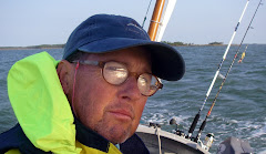
I'm wearing a couple of my favorite pieces of gear in the photo below, my West Marine Third Reef Foul Weather Gear and West Marine inflatable collar pfd with built in harness (the one in the link is not the exact one we use, but it is very close).
If you watch the sales, and there should be a lot of discounts this holiday season, you can find the full foul weather suit - jacket and bib pants - for about $130. This is their low-end product, but I have been very happy with it. If you cruise in an open cockpit boat you are going to want gear that will keep you comfortable and dry. This suit will do that. I leave mine rolled up and tucked under a bungee beneath the port coaming year round.
The inflatable pfd is very comfortable in hot, humid weather. We wear them all them time while sailing. When things get rough we connect the tethers to the harness (when I am on a solo cruise I wear the tether all the time). This is not a cheap piece of gear, but in my opinion it is well worth the price.
I made the boom tent out of polytarp, three-inch wide tape, grommets and rope for about $60. It takes less than five minutes to set up and we do that only when there is a good chance of rain. It keeps the boat reasonably dry even in a heavy rain. (If there is no rain in the forecast we leave the tent stowed and just use the bivy's.) When tied up in slip along the way we'll set up the tent at night just to minimize access to the boat and to keep rain/dew out.
The l.e.d. anchor light cost under $10 at WalMart. It uses three aa batteries. I'll hang it from the lazy jacks or jib halyward. It is not waterproof, but I've put it up several times in heavy rain and wind and it keeps on going.
I'm very happy with the gear we are using these days. It works, it fits and it stands up to the water, salt and sun we deal with on cruises. After each trip I sort through the gear and try to see where I can improve things. Right now I think we are in good shape.
steve
Sunday, October 18, 2009
DAY SEVEN - on to St. Michaels
On the last official sailing day of the trip we raised anchor at 7:20 and followed Slip Jig down Dividing Creek on our way to St. Michaels.
 The wind was great out on the Wye River, I think John Welsford would have been proud to see a Navigator and a Pathfinder sailing along together in a nice breeze. Bruce took a lot of photos of Kevin's boat, it looked great in the morning light.
 Kevin zipped around behind us and moved up forward, Slip Jig is a very quick and nimble boat. Kevin certainly knows how to sail her.
Kevin led the way up the Miles River into St. Michaels and pointed out a good spot to tie up at the Chesapeake Bay Maritime Museum. We straightened things up on Spartina and then borrowed Kevin's car (thanks! saved us a bunch on a rental) to drive to Crisfield to get my jeep and the trailer. By the time we got back to the museum grounds oysters were being served, both raw and roasted.
 And of course steamed crabs. Not much better place to have steamed crabs than St. Michaels. Spicy and hot, they made for a great afternoon snack.
We had planned on staying on the boat that night, but rain was hovering around and a southeast wind was rocking Spartina in her slip. So where could we stay that night? In our bivy's in the park? In our sleeping bags in back of the jeep? We decided to discuss it over a beer in one of the pricey restaurants in St. Michaels. We came to no clear decision. But as we walked back to the museum I turned around to see Bruce standing motionless on the sidewalk, looking up as if he saw a vision in the sky. He was staring at a "vacancy sign" on a hotel.
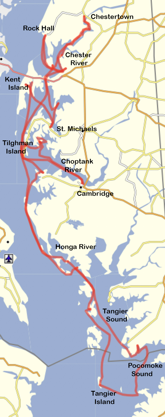
Distance - 8.26 nm
Max Speed - 5.6 kts
Ave Speed - 3.5 kts
Moving time - 2 hours 22 minutes
For the entire trip......
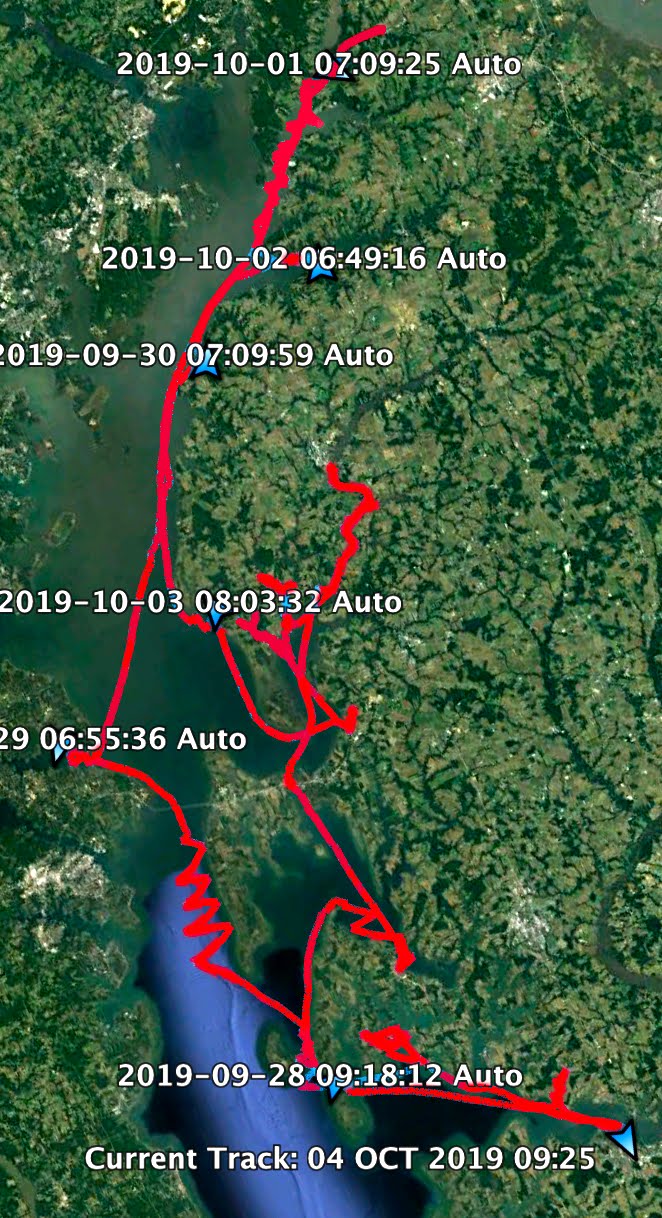
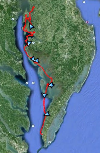
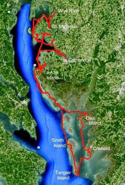
Distance - 136 nm (less than we expected, but the wind was with us the entire way, every mile sailed was a mile made good, virtually no tacking)
Max Speed - 8.6 kts (somewhere off of Hoopers Island on day two, surfing down the front of a wave)
Ave Speed - 3.7 kts (pretty good when we consider that our goal is an average of 3.0 knots)
Moving Time - 36 hours 24 min (of pure adventure, excitement and fun)
See you on the water.
steve
on to Dividing Creek
With two fish on ice we headed southeast and entered the Miles River. To the south I could see a group of sails rounding the point from St. Michaels, the overnight fleet from the Mid-Atlantic Small Craft Festival.

Bruce and I turned east and then north as we entered the Wye River, a beautiful meandering River that surrounds Wye Island. We took the eastern branch and followed it to Dividing Creek, the anchorage for the overnight fleet. When we entered the creek, which was both long and wide, we were surprised to see four larger boats (three sail and one motor yacht) anchored there already. We later heard it was one of the more popular anchorages on that part of the bay.
We followed the creek all the way to the back and anchored where we could see a small clearing on the shore. We figured that must be where the camping would take place. (Turned out we were right.) Once we were settled in I got the fish out, that is the rockfish (also known as striped bass or striper) below, the blue fish and cleaned them. The fillets were zip-lock bagged and tucked away in our remaining ice. About an hour later we looked down the creek and saw a series of small sailboats coming in to view. A total of eight boats, some single-handed, some with a few people on board, tacked in a light breeze up to our anchorage. Some of the boats were old classics, some were recently built. Some wood, some fiberglass. Some professionally built, others home made. They were all great boats. They looked great as they came up the creek.
I don't know the designs of all the boats in the fleet, but in the photo below you can see a Core Sound 17, at left, a Sea Pearl 21, center, and a John Welsford Navigator, second from the right.
 In the Navigator, called Slip Jig, was Kevin B, a sailor and boat builder I had exchanged emails with over the last year or so. This was my first chance to meet him in person, also my first chance to see a Navigator on the water.
 Kevin tied alongside Spartina, Bruce, Kevin and I spent an hour sitting in the warm sun, drinking a cold beer (thanks Kevin) and talking about boats and trips on the water. It was a treat. I was thrilled to hop into Slip Jig for a few minutes and get a feel of that classic design. Though I eventually built the Pathfinder, it was the Navigator that first caught my eye. What a great boat, and in this case, a very well built one.
 Later on Pete Lesher, the curator of the Chesapeake Bay Maritime Museum came by with supplies for the overnighters and stopped to say hello. He's a very nice guy that runs a great museum. (If you are ever on the eastern shore be sure to stop by in St. Michaels and check that place out - give yourself a few hours and even then you won't see it all.)
 Later we motored over to shore, tied alongside the other boats and carried our food and stove up to the clearing for dinner. I guess the other sailors thought we were kidding when we said we had caught some fish. A few were surprised, to say the least, as they saw Bruce cooking up surf (our fresh fish filets) and turf (cubes of sirloin that had been frozen in our cooler since the start of the trip) with sauteed garlic, onion and sweet peppers and a side of mashed potatoes for dinner. Bruce took it seriously enough that he had me splashing white wine on the griddle in the final minutes of cooking - the steam from the wine, he said, softened the garlic and onion just right. It was a great meal and there was plenty to share with others. And the others were generous with their meals too. The wine, sitting around the campfire, tasted extra good that night. (I don't know what those guys thought about the boat or our cruise, but I think they were impressed by the chef.)
 In the Navigator, called Slip Jig, was Kevin B, a sailor and boat builder I had exchanged emails with over the last year or so. This was my first chance to meet him in person, also my first chance to see a Navigator on the water.
 Kevin tied alongside Spartina, Bruce, Kevin and I spent an hour sitting in the warm sun, drinking a cold beer (thanks Kevin) and talking about boats and trips on the water. It was a treat. I was thrilled to hop into Slip Jig for a few minutes and get a feel of that classic design. Though I eventually built the Pathfinder, it was the Navigator that first caught my eye. What a great boat, and in this case, a very well built one.
 Later on Pete Lesher, the curator of the Chesapeake Bay Maritime Museum came by with supplies for the overnighters and stopped to say hello. He's a very nice guy that runs a great museum. (If you are ever on the eastern shore be sure to stop by in St. Michaels and check that place out - give yourself a few hours and even then you won't see it all.)
 Later we motored over to shore, tied alongside the other boats and carried our food and stove up to the clearing for dinner. I guess the other sailors thought we were kidding when we said we had caught some fish. A few were surprised, to say the least, as they saw Bruce cooking up surf (our fresh fish filets) and turf (cubes of sirloin that had been frozen in our cooler since the start of the trip) with sauteed garlic, onion and sweet peppers and a side of mashed potatoes for dinner. Bruce took it seriously enough that he had me splashing white wine on the griddle in the final minutes of cooking - the steam from the wine, he said, softened the garlic and onion just right. It was a great meal and there was plenty to share with others. And the others were generous with their meals too. The wine, sitting around the campfire, tasted extra good that night. (I don't know what those guys thought about the boat or our cruise, but I think they were impressed by the chef.)
We carried our gear back down to the boat. I had to use the paddle to push Spartina off the mud bottom as the tide had gone out. We anchored out for a great evening. We could hear laughter and singing coming from the sailors on shore.
Just one more day to go for the Crab House 150.
Distance - 25.03 nm
Max Speed - 6.5 knts
Ave Speed - 3.4 kts
Moving Time - 7 hours 26 minutes
DAY SIX - fish on!
After our day off in Rock Hall we carried our gear in the darkness back to Spartina at the marina. It was cool ( so cool that we slipped on our foul weather gear for warmth) and clear. Stiff breeze out of the north, perfect for our southbound trip. We motored away from the dock a little after 7:00, Roxy (or was it Roxanne??), who we had met on our arrival, wished us a safe journey as we passed behind the Catalina that she and her husband weekend on.
 We navigated out the harbor (Rock Hall Harbor is fairly shallow but has well marked channels) and set mizzen and jib. The wind was still pretty stiff and we headed south in one to two foot chop at 4 to 4.6 knots.
The Kent Narrows bridge was in sight by 8, we raised double reefed main at 8:30 and then by 9:00 we were under a single reefed main doing 4.8 to 5.1 knots. The wind continued to drop and by 9:15 we were under full sail.
That says something about the wind on this trip - we had been sailing for six days and this was only the second time we had been under full sail.
 We were in the Kent Narrows by 9:45 headed southbound for the bridge. We passed Harris Crab House, above, where we had been served great crab cakes a couple of days earlier. We still had about 15 minutes before the bridge opened so we circled around under power in the channel.
 We were in the Kent Narrows by 9:45 headed southbound for the bridge. We passed Harris Crab House, above, where we had been served great crab cakes a couple of days earlier. We still had about 15 minutes before the bridge opened so we circled around under power in the channel.
I learned a bit about bridge etiquette that morning. A northbound sailboat had put in the first request for a lift, I called the bridge tender with a request for the same 10 a.m. opening a few minutes later. When the bridge started to open I contacted the bridge tender on my vhf radio and asked if I should let the north bound vessel go through first. He said no, I was the south bound vessel and the current was running south at that time. The boat going with the current has the right of way in this situation. So we passed through first, giving a wave of thanks to the tender looking out from his small window above.
 We continued south under full sail, a sunny warmish day, passing through the narrows into Prospect Bay and eventually entered Eastern Bay. It was very pleasant out there on the calm blue water (about time!).
 Half way across Eastern Bay we saw gulls and terns diving for the surface. I pushed the tiller over and grabbed the fishing rod. Those gulls were feeding on bait fish that were chased to the surface by schools of hungry blue fish and rockfish. Our gps track shows us chasing the school around as they popped up to the surface, disappeared and popped up again and again over the next twenty minutes. The first couple of fish I caught were too small and I threw them back.
 But then we got a tug on the lure we were trolling behind the boat. It was a nice taylor blue. (In blue fish terminology "taylor" blues are the smaller ones, maybe 24 inches or less, and usually the best tasting. "Chopper" blues are bigger than that - up in to the 36 inch range, they put up a great fight. But my experience is the chopper blues tend to be oily and are best eaten only when smoked and made into a blue fish pate with cream cheese, horse radish and a few other ingredients.)
 By this time Bruce had taken the tiller while I cast away. The school disappeared for a while, then popped up again where he put me in the perfect position to cast and catch a nice 22 inch rock fish.
 We continued south under full sail, a sunny warmish day, passing through the narrows into Prospect Bay and eventually entered Eastern Bay. It was very pleasant out there on the calm blue water (about time!).
 Half way across Eastern Bay we saw gulls and terns diving for the surface. I pushed the tiller over and grabbed the fishing rod. Those gulls were feeding on bait fish that were chased to the surface by schools of hungry blue fish and rockfish. Our gps track shows us chasing the school around as they popped up to the surface, disappeared and popped up again and again over the next twenty minutes. The first couple of fish I caught were too small and I threw them back.
 But then we got a tug on the lure we were trolling behind the boat. It was a nice taylor blue. (In blue fish terminology "taylor" blues are the smaller ones, maybe 24 inches or less, and usually the best tasting. "Chopper" blues are bigger than that - up in to the 36 inch range, they put up a great fight. But my experience is the chopper blues tend to be oily and are best eaten only when smoked and made into a blue fish pate with cream cheese, horse radish and a few other ingredients.)
 By this time Bruce had taken the tiller while I cast away. The school disappeared for a while, then popped up again where he put me in the perfect position to cast and catch a nice 22 inch rock fish.
Fresh seafood was quickly added to the menu for that night.
steve
Saturday, October 17, 2009
wild ride to Rock Hall
 Bruce and I had a long discussion about our goals for the afternoon before leaving Kent Narrows (above). The wind had picked up with sustained wind in the mid to high 20's and gusts to 30 mph. Rock Hall was almost due north, we agreed to give it a try and see how Spartina handled on a beam reach in the wind and waves. Our fallback, if we weren't comfortable, would be to head back in to the Chester River and go to either Queenstown or one of the creeks along the way.
 We don't have any photographs from that sail. It was just too rough to mess with the camera. The wind was now out of the west and the waves built with a fetch of about eight miles across the bay.
We made it out of the winding channel north of Kent Narrows under power, then raised mizzen and jib - plenty of sail with all that wind on the port beam. For a while were in the protection of Kent Island. But as we passed Love Point, the northern tip of the island, we got the full force of the wind and waves. And we kept on going. The boat handled fine. It was an eerie feeling being surrounded by the tall waves, many of them three feet tall and often breaking as they approached the shallows on the eastern side of Chesapeake Bay. The waves seemed to come in groups of three. Sometimes I tried to turn in to them and cross them at 90 degrees, but if I angled properly in to the first two waves I would be out of position for the third wave. Sometimes I tried to take them on the beam and worked fine for the smaller ones, but I thought it best to turn directly into the big ones. It just depended on the size of the wave and our speed at any given time. We did pretty good for the most part with one notable exception. I'll let Bruce explain that. But all I'll say from my point of view is that it was only for a brief moment that I lost sight of Bruce in a wall of white water.
We hung in there sailing north with the feeling that the boat could handle it. I stayed at the tiller and Bruce sponged the spray out of the boat. One thing that helped was that we could see the water tower in Rock Hall for most of the trip - being able to see our destination seemed to make the trip do-able. My biggest concern was that if we had a problem we could be blown towards the beach a mile and a quarter to the east. If we got closer to the beach the waves would be bigger. So I focused on keeping us on a due north heading.
Along the way we had to dodge of series of fish traps and what I thought at the time were gill nets (we later found out they were strings of crab pots placed out over the bottom of the bay with flag markers at either end). It was too hard to turn into the wind to pass the obstacles on the windward side, so we ducked between them and the shore with Bruce tracking the depths on his gps.
And finally we got to the entrance channel to Rock Hall. The entrance there was not as simple as I would have liked because there are two entrance channels - one to Rock Hall and one to Swan Creek just slightly north of Rock Hall. We eventually figured it out by looking at the chart and gps. When we were due west of Rock Hall we brought in the mizzen and ran downwind under the jib, starting the outboard just outside the jetties.
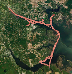
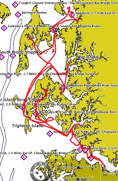
 By this time on a typical day of sailing Bruce would be at the tiller and I would be looking at my notes on the harbor, marina, etc so I would know exactly where to go. But we were so busy throughout the afternoon that I had not even glanced at my notes. You can see us above in the harbor, a nice photo from Mary Lou (thank you) trying to find our marina (I just could not remember the name). Below you'll see our gps track as we wondered about the harbor finally finding the right marina by chance.
 And there at the dock were two folks waiting for us, Mary Lou and Fred. They had watched our SpotTrack during the day and came down to the harbor to welcome us. Boy it was a great feeling, after such a long afternoon, to be greeted by friendly smiles. I had never met Mary Lou in person before, but she had been in touch with me during the summer passing along helpful information. It was a pleasure to meet them in person. Below is a photo of them when they dropped by at St. Michaels to say hello.
 They helped us get tied up at the marina and then joined us later for a great dinner at Waterman's Crab House. And that was just the beginning of their hospitality.
 By this time on a typical day of sailing Bruce would be at the tiller and I would be looking at my notes on the harbor, marina, etc so I would know exactly where to go. But we were so busy throughout the afternoon that I had not even glanced at my notes. You can see us above in the harbor, a nice photo from Mary Lou (thank you) trying to find our marina (I just could not remember the name). Below you'll see our gps track as we wondered about the harbor finally finding the right marina by chance.
 And there at the dock were two folks waiting for us, Mary Lou and Fred. They had watched our SpotTrack during the day and came down to the harbor to welcome us. Boy it was a great feeling, after such a long afternoon, to be greeted by friendly smiles. I had never met Mary Lou in person before, but she had been in touch with me during the summer passing along helpful information. It was a pleasure to meet them in person. Below is a photo of them when they dropped by at St. Michaels to say hello.
 They helped us get tied up at the marina and then joined us later for a great dinner at Waterman's Crab House. And that was just the beginning of their hospitality.
Looking back I've got to say that the twenty four hours, from 3 pm the previous day until we tied up in Rock Hall just after 3 pm, were the most pleasant, interesting and exciting days I have spent on Spartina. A great afternoon anchored on Warehouse Creek, a beautiful evening under the stars and a wild ride to Rock Hall. Can't beat that.
Distance - 23.35 nm
Max Speed - 7.4 knots
Ave Speed - 3.8 knots
Moving Time - 6 hours 7 minutes
steve
DAY FIVE - north to Kent Narrows
It was a really great night on Warehouse Creek. A cool front had moved in on the previous afternoon and it was the clearest, coolest night ever on the boat. No need for the bug screens on the bivy's. I would wake up now and then, enjoy the stars above and curl back up in my sleeping bag. Just fantastic.

The next morning the wind, still strong, had swung to the southwest. We still had small craft warnings, in fact we had had four days of small craft warnings in five days of sailing. We raised mizzen, jib and double reefed main for the reach down Cox Creek out towards Eastern Bay. That is the mouth of Cox Creek Below.
 We used Bruce's gps, with the great charts that showed all the shoal depths, to sail east past the remants of Long Marsh and Bodkin Islands (and their shoal areas which were once part of the islands) and then on past Parsons Island (with a beautiful-looking farm on it) in a pretty stiff breeze. On the open water we dropped the double reefed main and sailed under mizzen and jib doing a respectable 4+ knots. The swells were still up on Eastern Bay and we spent some time trying to photograph them without much success. Below is the closest we got to a good picture, but it really doesn't convey the size, force and thrill of riding down the front of the wave. You'll just have to take our word for it. It was a great ride
By 9:45 we could see the bridge at Kent Narrows. I had been sweating the currents in area for a long time but with some wonderful advice from our friend Mary Lou we timed it to be running north with a moderate north-bound current. Another sailboat was ahead of us and requested a lift.
 I called the bridge tender and gave him our position near red marker #6 and asked if we could make this lift or wait until the next lift 30 minutes later. He said keep on coming so we throttled up the outboard and made it through no problem at all.
The Narrows are lined with marinas and restaurants so we decided to tie up, top off the tank, get some ice and have lunch (a good move here). We tied up at a place called Red-Eye's or something along those lines. Nice marina with a helpful attendant, but their restaurant was closed for the day. But he said we could leave Spartina tied up there and walk to a restaurant nearby. Below you see the wind tugging at the boat alongside the fuel dock, the wind was getting stronger.
 We walked next door to Harris Crab House, an old family restaurant and had a great lunch - crabcakes - looking out over the Narrows. From my notes......
Crabcake sandwich on a potato roll with a big serving of perfectly cooked french fries. Fresh lump crab meat, large patty pressed flat like a thick hamburger and broiled a rich brown color. No filler, light seasoning. Excellent. Came with tartar sauce, lettuce and a large slice of tomato. Very good service from our waitress Kim.
It was an unplanned stop that worked out very well. By the time we fueled up and packed the ice it was just after noon. We still had a long way to go that day.
steve
a step back in time
Here, in no particular order, are some photographs from the Great Chesapeake Bay Schooner Race. Many thanks to Captain Moseley and the crew of the Schooner Virginia, a beautiful ship with great people on board.


Subscribe to:
Posts (Atom)
