"When I think of all the fools I've been it's a wonder that I've sailed this many miles." -Guy Clark

Friday, September 20, 2024

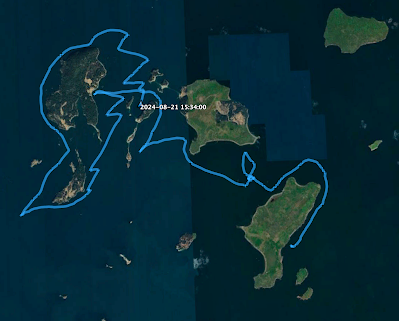
day twenty-one - a day sail


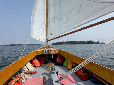
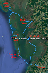
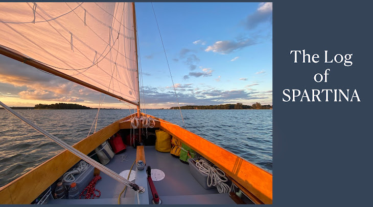
Wake to a thick fog 5:45.  Breakfast with hot tea as I watch the fog clearing.  Sail off anchor 8:15 in light wind.  8:55 the long-forgotten blue skies put in an appearance as we sail by the Eagle Island Lighthouse.  How nice.


The bell on green "3A" buoy ringing nearby as we drift through a swirling tide line at the point.  9:20 a little breeze, 1.7.


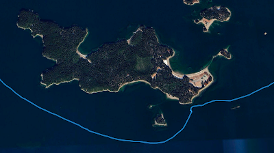
Forecast is for blue skies and light winds, I decide to enjoy the day at this little archipelago.  Along with Eagle Island, I can see Butter Island, Barred Island, Great Spruce Head Island and Bear Island, not to mention Scrag and Channel Rocks and several unnamed rocks and ledges.

I sail through the anchorage on the west side of Eagle Island, a mixture of sailboats and lobster boats.  A cruising couple on the JENNIE TEAL out of Rockport motor over to say hello.  


12:00 some wind rounding Butter Island.  12:45 stronger wind fills in, 4.9 passing Barred Island and turning upwind past Great Spruce Head Island.  Wonderful sailing.


2:15 light wind turning north to round Bear Island.  Ospreys in flight and seals sunning on the rocks.


Some good afternoon wind as we complete the little circumnavigation.  Anchor down at 3:30.  Boom tent up to get out of the sun, solar panel mounted outside the boom tent to charge batteries.  A great afternoon for reading and relaxing.

12.21 NM
 

day twenty - searching for an anchorage


I wake to a thunderstorm in the night.  Heavy rain, thunder and lightning.  Wake at 4:00.  The storm is gone, fog moving in.


Windless overcast morning.  Under power at 6:30 to Castine.  Tied up at the town dock at 7:00.


The Harbormaster lets me put a couple of power packs in his office to charge.  


And breakfast at a restaurant for the second day in a row, I must be living right.  I take a walk through the little town, pick up a couple of bottled drinks at the little grocery store/gas station.  Back at SPARTINA a dockhand tells me there is a bed and breakfast up the way where I could get a shower for $10. 


Cast off 10:10, sails up just off the dock with a good north wind.  Feels like it might rain so put on the drysuit.  Even with good wind we make just 1.7 against a strong flood tide.  Then more wind and we do a little better.


11:05 out on East Penobscot Bay, 4.3 and raining.  Holbrook Island to port.  11:30 2.8 with wind and swells on the starboard quarter.  12:00 3.0 sailing south in a light, steady rain.  12:25 jibe at Head of the Cape.  12:45 the rain finally stops.  


I had chosen Pickering Island for an anchorage.  I get there and drop the anchor in a little cove at the east end of the island.  There is a little islet to the south and shallows between that and the main island, I thought they would give me enough protection.  With a northwest wind they do not, I can feel the swells rolling into the cove.  


Raise anchor and sail northeast past rocks and ledges towards Carney Island.  Looking at the chart and feeling the wind I decide I don't want to anchor there either.  

Turn to the southwest towards Eagle Island.  There seems to be a little cove that might work well.  Motorsailing in light winds, there is a strong starboard to port current running.  Exchange greetings with the windjammer HERITAGE.


Better wind and sailing, come into the little unnamed cove with two small islands to port.  A nice gravelly beach and calm water.  Anchor down 4:15.


20.07 NM


day nineteen - out of the fog


The day starts with a diner, Traci's Diner.  Wall to wall crowd yesterday with a waiting list, this morning only one other customer.  Eggs over easy, bacon, home fries, and whole wheat toast.  

Back to the boat to stow the gear, top off the water and pay Kathy for the slip.  Fog on the harbor.  She tells me to watch for traffic in the shipping channels.  I check AIS on my phone and done' see any traffic.  I thank Kathy for her hospitality.


Cast off 9:05, motor past the mooring field and get out past the channel markers.  Thick fog, slip on the drysuit.  Wearing sunglasses but the white fog still hurts my eyes.  Sails up but struggling with light and shifting winds.  


Get a more consistent wind and finally get moving in the right direction.   11:15 Turtle Head off the starboard bow.  Navionics shows that I'm crossing the shipping lane.  Fog lifts a bit and I can see there is no traffic.  11:30 out of the shipping channel. 


Better wind and sailing at 3.2.  Distant thunder.  Turtle Head and the north end of Islesboro is visible, but only for a short while.  Watch the fog move up from the south and land disappears.  12:00 more wind, but cold wind.  More fog, 3.5, and watching a mega yacht coming up from the south.  Sprinkling rain.


12:20 nothing but fog.  Hear a boat, maybe two.  Give a blast of the fog horn.  Get two blasts in return.


Wait a couple minutes, sound the horn.  Get a response.  Then see a dark vertical shape ahead.  First thought - a crane on a barge.  Then the shape of sails.. dark tanbark sails.  A tall ship.  


I can hear a voice on the bow telling the captain they see me.


It is one of the windjammer fleet, the ANGELIQUE out of Camden.


Coming within shouting distance, we greet each other, waves from the crew.  The captain shouts across the water "You are completely invisible on radar, we don't see you at all."  I thank him for the information, and wonder about the type-style radar reflector mounted at the top of my mizzen.


And then the ANGELIQUE disappears into the fog.


12:30 still hear motors in the fog, lobster boats.  And then a bell.  12:50 Dice Head emerges from the fog 1.2 NM away.  We are making 2.4 and fall off to the south when we see the red channel marker leading into Castine Harbor.  Fog lifting now, Nautilus Island to the north and Holbrook Island to the south.  Slip in between the two.  Look at the anchorages around tiny Ram Island but continue east.  Maybe a storm tonight and I want better protection from the north.  Anchor down 2:10.

Boom tent up and a glass of hot tea.


 13.0 NM

Thursday, September 19, 2024

day eighteen - Belfast


Sails up 6:25 and no wind.  Under power.  Low overcast.  7:00 some wind, motorsailing northwest.


8:35 see the red marker for Belfast Harbor.


And soon the forest of masts of boats in the mooring field.  


Tied up 9:30 Belfast with help from Kathy, the world's nice Harbor Master.  She can't help but smile.


And of course the delights of visiting an exotic port: laundry, shower, lunch (caesar salad with shrimp), a trip to the co-op for supplies and dinner (broiled haddock and a couple of beers).


It is a nice town and the folks on the waterfront are very friendly.


Then back to the boat to repack breakfasts and lunches for the second half of the cruise.


day seventeen - north to Islesboro


Up at 5:45.  Fresh clothes!  Quiet on the creek, fog comes and goes over the trees on the north side.  Hot chocolate with breakfast.  7:10 thicker fog and a hint of wind.  


8:05 under power out of Ministers Creek.  Follow the creek to Pulpit Harbor, then north out through the channel between the rocks.  Sails up 8:25.  


8:50 making 1.1 through the fog with a helping tide.  9:20 more wind and 2.9.  9:30 thicker fog, and I can see nothing but grey haze.  


9:45 wind on beam, 4.1.  Tiny and low-lying  Mouse Island emerges from the fog, the first in a string of islands that leads to Islesboro.  


Lime Island off port bow as fog begins to lift.  Less wind and now on the stern, 1.8.  


Islesboro off the starboard bow.  10:25 fog is gone.  Approaching the islands, the channel between Job Island and Islesboro emerges dead ahead.


11:10 slip into the channel with Pendleton Point, the southern most point on Islesboro, to starboard.  Cling to the right side of the channel to avoid the gravelly sandbar to port.


Follow the yellow markers past Minot Island and 700 Acre Island, Warren and Spruce Islands.  Easy, relaxed sailing.


11:30 can see the ferry docks.  12:05 a seal pops up to port and with dark eyes watches us sail past Thrumcap, a rock too small to be called an island.


2.6 on a downwind sail.  12:20 jibe at the ferry docks and sail northwest towards the mainland just south of Spruce Head.  Jibe again with perfect wind and head toward Marshall Point at the very north end of Islesboro.  Making 3.4 on a single tack with the mainland to port and Islesboro to starboard.

2:40 round Marshall Point, low tide and keep my distance from the rocky point. Wind on the beam makes for a couple of excellent tacks across Turtle Head Cove.  A woman sitting on the aft deck of a cruiser out of Belfast waves and says "Beautiful!"  Anchor down 3:05. 


18.09 NM


Wednesday, September 18, 2024

day sixteen - "no, no, no"


Diesel engines and roosters crowing before dawn.  Up at 6:00.  Fog.  Under power 7:05 with fog beginning to clear.


8:10 a ferry slips up from behind, I hadn't seen her.   Must have come from the fog bank sitting on the open water.  Sun finally trying to break through.  Following the path marked as The Reach on the charts, the waterway between a string of islands with the coast of Vinalhaven to port.


Turn to port at Norton Point and follow the water into crowded Carvers Harbor.  It is a working harbor filled left and right with lobster boats.  Business along the shoreline are all about lobsters.


9:00 tied up at the town dock in the northeast corner of the harbor.  I look at the signs with the rules for the dock.  One says "two hour limit."  I ask a local about where I'm tied up.  He says I should be good, but reminds me of the two hour limit.


A short walk across the parking lots take me to the coffee shop for a strawberry-rhubarb muffin and glass of iced tea, and the always welcome access to high-speed wifi.  Then a walk through town and a visit to the well stocked grocery store.


Back down at SPARTINA I'm pouring peanuts into a storage jar when I hear a voice asking when I am going to leave.  I look up to see a man leaving over the railing, tell him I can leave right now if he wants me to.  "No, no, no,"  he says, "that is not what I asked you."  He says he just wants to know "when" I'll be leaving.  He explains that he is the harbor master and I'm tied up where lobster boats offload their catch.  "How about in twenty minutes?" I ask.  He tells me that is fine.  "I am just trying to help you, " he says.  I tell him I understand that, and thank him.


Soon I cast off and wave goodbye to the harbormaster.  Just down the way I tie up at a lobster co-op.  They top off my gas can, I walk up to the office with the receipt and pay the less-than $2.00 bill.  

From the co-op I motor my way out of the harbor, turn to starboard and drop anchor in Sandy Cove, a nice spot to enjoy the submarine sandwich, chips and iced tea I picked up at the grocery.


11:45 under sail in a light following wind.  Making a steady 2.0.  Soon an opposing tide and 1.6 as I wait for the afternoon wind.  It is a relaxing sail along the islands of the reach. 


Afternoon wind at 3:50, 2.4 wing and wing.


We round Stand-In Point and follow along the shore of North Haven.  4:00 see the entrance to Pulpit Creek just as stronger winds fill in. 


Making 4+ kts as we turn into the entrance, wind on the starboard beam.  Pulpit Hrbor is filled with boats but just to starboard is smaller and narrower Minister Creek with plenty of room and protection.  Anchor down 5:15.  A nice woman named Hope, anchored on a boat nearby, sends me a photograph.


18.43 NM