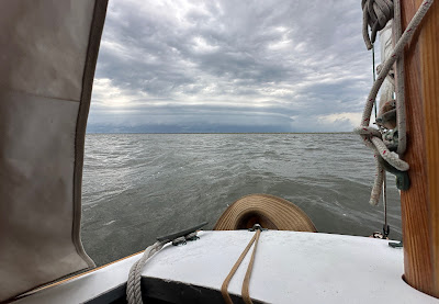
Cool morning, west wind, light overcast. Sail off anchor 6:30, making 4.7 with a single reef tied in the main. Sail east, round the shoals in the middle of the bight. Turn north and pass the lighthouse. 6:50 doing 5.5 wind on the beam into Barden Inlet. A flood tide helps as we sail on calm water with great wind. Easy sailing and it feels like we aren't moving that fast but gps shows 6+ knots at times.
I had been told in Beaufort that there was some well-needed dredging going on at the inlet. The times I have sailed through to or from Cape Lookout it has been a series of winding and often shallow channels. Heading up through the inlet I am pleased to find a well-marked, straight channel to follow. In the distance I can see the dredges are still at work. Two small fishing boats headed for Cape Lookout slow down to reduce wake for me, passing close enough that I can say thank you across the water.
Making 6.2 with wind just forward of beam, noisy flocks of terns take flight from the spoil islands to the west. I look ahead trying to figure out where the channel might be. I see a red marker to the north and choose to sail parallel to the dredges.
The centerboard touches bottom. I turn back south, looking around to see where I might go. Looking back north I realize the red marker is an anchor marker for the dredge. I find a little deeper water, turn back north. And again the cb touches bottom. I raise the cb and rudder, sliding to the northwest. I see the shoal is getting shallower and shallower, but just beyond I see deeper water. I sail/drift as far as I can, jump out of SPARTINA and walk her up and over the shoal, give the boat a shove to the deeper water and hop on board. 7:25 sailing again.
7:40 approaching the east end of Harkers Island, unsure of the channel with the gps and Navionics showing different paths north. I see a marker to the northeast and head for that.
7:50 less wind in the lee of the land, 4.3. I think I have found the channel, gps shows that I should be passing marker "37A" but the marker is missing. 8:30 jibe to red "36", which is in fact where it should be. 9:50 3.4 with steady wind on beam. See a green marker in the distance. 10:00 getting warmer, reach the marker to confirm it is green "30". 10:45 wind building, round up and tie in the second reef. Getting warmer, light grey overcast.
11:30 approaching Atlantic and find we are surrounded by shoals. Deeper water to both east and west. The channel marked on the gps is marked on the water with sticks that indicate shallow water. Raise cb and rudder, drift across the shoal to deeper water.
11:45 main and jib down, heading into Atlantic for lunch. Find the entrance channel with a marker for shallow water in the middle. Try to pass to the right, cb touches bottom. Try to pass to the left, cb touches bottom. Tired of shoals, I turn back south and raise sail. Cross one last shoal, then turn north.
12:00 sailing north with a double reefed main. Deeper water and easier sailing, we are past the worst of the shallows. 12:25 shake out second reef. 1:05 round up to shake out the second reef as we enter Thorofare Bay. A handful of tacks to a little notch in the marsh to the north. Anchor down 2:15. Dragon flies all around.
Late afternoon the wind swings around to the south. A thunderstorm in the distance. Forecast says the wind will swing to the north in the evening. It does.
30.04 NM


No comments:
Post a Comment