"When I think of all the fools I've been it's a wonder that I've sailed this many miles." -Guy Clark

Wednesday, March 30, 2022

home waters


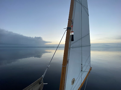
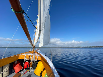
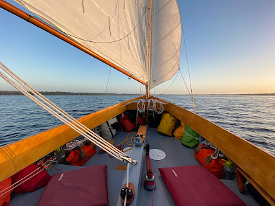
Launched SPARTINA this morning, the first time since returning from the trip down south.  At the ramp at 9:00, launched and motored downriver with all sails up by 10:00.  I had just meant to leave SPARTINA at the dock but the wind was so nice I sailed for a few hours, tacking back and forth across the Elizabeth River.  It was a summer kind of breeze, out of the southwest, but without the benefit of heat and humidity. That will come soon enough.


Also coming soon will be the snowbirds.  Just after Easter we will see the boats, sail and power, big and small, heading north after enjoying winter in the south.  They will find a new sight in Craford Bay, the FANTASY sitting on a shoal.  The boat - I'm not quite sure if it is a ketch or a schooner - has been on her side since December, surprisingly intact after a series of winter storms.  FANTASY is the third shipwreck in the anchorage, the other two being a sunken power boat marked by buoys and the burned out hull of another power boat sitting not too far from FANTASY.  

This week I have received packages of tuna, buffalo bars and a few other supplies.  Just about a month until the North Carolina cruise.


Tuesday, March 29, 2022

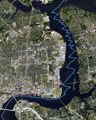
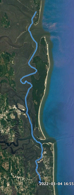
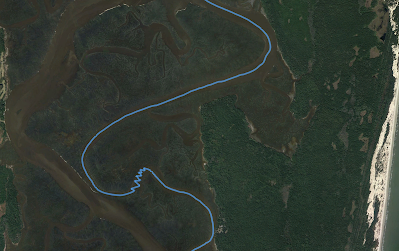
Sea Islands track video


 I made this video clip of the Google Earth track of the Sea Islands sail.  I wish I could find a way to zoom in and have the cursor stay centered in the screen do that the detail of the waterway can be seen.  Still working on that.

Saturday, March 26, 2022

day thirteen - the last few miles


Glassy calm night anchored just off Pine Bluff.  Only surprise was late evening when what I took to be a flashing strobe turned out to be a high powered light someone on shore was shining on SPARTINA.  


It feels to me like old Florida.  White hulled boats along shore, trees dripping with Spanish moss, old wooden docks with houses tucked back in the woods.


No wind and forecast says that could continue for the day.  Under power 6:55 with clouds to the NE.  7:50 I watch a fog bank sliding across the river.


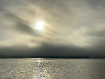
8:00 heavy fog.  I hear one other boat in the fog but I'm well outside the channel, keep going.  8:15 slip out of the fog.


9:10 a nice little breeze arrives near Forrester Point.  I know I will see a bridge is just around the corner, the bridge will mark Palatka and the end of the trip.  Sails up, 2.5.


And the little breeze dies.  Becalmed 10:05.  A check of my apps tell me no wind and an opposing tide for the rest of the morning.  


Under power we motor up river, pass under the bridge.


11:20 docked Palatka, Florida.  A nice sailing trip.


16.08 NM
Steak dinner with a couple glasses of Chardonnay as a storm crosses the St. Johns River.


day twelve - St. Johns River


Sail off anchor 7:00.  Some power boats and jet skis made some noise last night, they finally went home around sunset.  Peaceful night, slept well.
Downwind sail on Doctors Inlet, 2.3.  Steak and eggs for breakfast, buffalo bar and chocolate sea salt Rx bar.  

On St. Johns River 8:00, steady tack across river at 3.6.  Navionics app tells me I will be sailing against the tide most of the morning.  


11:00 making 3.7, 12:00 tack at Wilkie Point.


Tack at 12:20, then tack again at 1:00 off Governors Creek, another tack 2:30.  Main down to pass under a bridge.  Motorsailing on the far side of bridge.  Struggle to find some wind, catch a breeze 3:25.


4:10 no wind, under power.  I can see showers moving in from the west.


I slip on the foul weather gear but for no point as the rain showers pass north and south of us.


Anchor down 5:40, skies clearing and a beautiful evening.


43.08 NM
Mac and cheese for dinner.  


Friday, March 25, 2022

day eleven - concrete river


Peaceful night.  I could hear voices carrying across the water, maybe from the sailboat anchored not too far away, maybe from the park and boat ramp on the other side of the creek.

Dawn comes with soft light, glassy water.  Stow the boom tent.  


A small cloud of gnats arrives, first time I've noticed any bugs on the trip.  Under power at 6:45.  Out on the St. Johns and crossing the shipping channel at 6:55.  No traffic in the channel, a barge and ocean going tug anchored just south of the channel.


Maybe I see some wind to the west at 7:15, but no.  Motoring against the tide.  7:20 cross the channel to the north side where there is more room.  Just after 8:00 the tug and the barge that had been anchored comes up the channel.  I'm well outside the markers and no problem.  


8:25 under the Danes Point Bridge, pass a cruise ship docked on the north side.  Clouds coming in from the east.  A tug coming downriver, plenty of room.  


Lots of powerboats throwing up wakes, all running at full throttle.  


Wind at 9:30, tacking up the channel at 2.9.  Plenty of power boats in the channel, I sail to the east outside the channel.


A long tack across the river and we pass under a bridge, the tide now seems to be in our favor.  Pass Exchange Island at noon, less wind, then more wind.  Pass under another bridge.


12:10 very choppy water.  It is a weekend day and a beautiful one at that.  Everyone with a boat is out on the water running at full speed.  The river through downtown Jacksonville is line with concrete on both sides and the face of the concrete bulkheads reflect every bit of chop from the wind, the rushing tide and the powerboats.  SPARTINA bounces across the water.  Making 3.0 but doesn't feel like it at all.


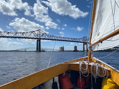
It seems like bridge after bridge going through downtown.  Motorsailing through the last set, a bridge and a railroad trestle.  Finally through Jacksonville 12:40, 3.1 tacking south a the St. Johns Rivers opens up wide.


Tack through the afternoon, wind building and very choppy, good hard sailing.   Doing 5.7 close hauled.  


Hot and sunny, definitely Florida weather.  Tack the width of the river, plenty of depth right up to shore.  After downtown Jacksonville I enjoy the solitude.


3:30 one more bridge to pass under.  Plenty of wind out of the SSW but I worry the bridge will block my wind and the tide would push me back.  Drop the main and power through.  Enough wind to sail mizzen and jib so raise the outboard and just keep on going.  Round Orange Point 4:30, wind now on port quarter, and sail through one last bridge into Doctors Inlet.  Calm inside the inlet and I follow the shore south, dropping anchor 5:10.


38.62 NM
Creamy pasta and beef

Thursday, March 24, 2022

day ten - the last sound


Wake to a heavy fog.  Can't see any channel markers.  Outgoing tide, I check GPS and Navionics and worry that I'll end up in mud by the time the fog clears.  6:50 raise anchor and motor down the creek to a little deeper water, seems like about 4' as I re-anchor.  


I read, relax, do some cleaning on SPARINTA.  Not going anywhere until the fog at least begins to lift.  White pelicans huddle on a nearby sand spit.  A perfect north with that would carry me down the Amelia River, just waiting on the fog.  I can hear power boats on the channel about 50 yards away, see shadows racing by.  Water drips from the sails and the rigging.  I'm wearing a sweater and foul weather gear.  


7:25 a hint of blue above.  8:10 raise anchor and motoring down the creek.  Fog gets thicker, put out the anchor.  9:45 fog getting lighter, I can see a couple of channel markers.  Raise a reefed main, jib, sail of anchor.  Thicker fog comes in, decide I'm going anyway.   Under sail 10:00.


10:15, round up to shake out the reef, full sail, 3.3 and blue sky mixed with fog.  Now I can see multiple channel markers.  10:45 passing Little Amelia River, wished I had anchored there last night.  


11:20 lighter wind, motor sailing on Nassau Sound.  Light green water, brown marsh and bits of white sandy beach on shore.   Frustrated with the light winds for crossing the last sound.


12:20 enter Sawpit Creek on the south side of the sound, wind finally arrives and making 3.0.  Round up in a little side creek but I can hear lots of noise, people yelling.  There's a boat ramp up the creek and lots of power boats soon headed my way.  Slip back out on to Sawpit Creek.


1:15 1.0 and the wind fills in.  1:50 passing Nassau River, then the Mud River, making 2.6.  Lots and lots of power boats and they seem to go only at full throttle.  I hang to the side of the channel, tacking only when there is a gap between power boats.  


I sit in the shade of the main and enjoy the steady sail south.  The river bends here and there but the wind seems to bend with it.  I look at anchorages along the way, there are only a few, but decide to keep going as long as I have the wind.  2:00 off the George River, 2.6, ebb tide in our favor and across the marsh grass I can see the tall buildings of downtown Jacksonville.


Wind swings for the last stretch and sailing close-hauled, 2.4 sailing just outside the edge of the channel, tacking when I can to avoid the shallows.  Looking ahead over the marsh grass can see a huge cruise ship heading to sea.  3:00 anchor down Three Sisters Creek with deep water but surrounded by nearby oyster reefs that are exposed at low tide.  Turned in to the creek just shy of a bridge.  Beyond the bridge is the St. Johns River.


 15.58 NM

Chicken noodle casserole


Tuesday, March 22, 2022

day nine - the dividings


Cast off Jekyll Island 7:15.  Cool, clear with a tiny hint of a north wind.  Steak and eggs, blueberry Rx bar.


7:40 mouth of Jekyll Creek, sails up but motor sailing.  7:50 green marker "25" and sailing on Jekyll Sound, 1.9, then 2.4.  8:30 calm water, light wind, white sandy beaches on the point that separates Jekyll and St. Andrews Sounds, north end of Cumberland Island to the southeast. 


 9:20 wind here and there. 10:00 wind!  Full sail and filling in steadily....2.8...3.3...4.2...4.7...5.4.


10:25 enter the Brickhill River with a wave from crew of the SOUJOURNER, cruising sailboat anchored at river's mouth and that name thinks I might have talked to them on the dock at Jekyll Islands the evening I arrived.  3.5 in the lee of Cumberland Island.  Just beautiful sailing.


Marsh to starboard, marsh backed by trees to port.  11:00 downwind at 5.0, 11:35 Cumberland River so close I could throw a rock across a small stretch of marsh and beach from one river to the other.  I keep coming across the term "Cumberland Dividings" and wonder if this is what they are talking about.  The larger river so close but no way to reach it from here.  


11:40 river curves to east, wind forward of port beam, 4.1.  11:50 river curves to north-northeast and a series of tacks against the wind and tide, 3.2.  Soon crab pot floats show the current is in my favor, must have crossed the head of the tide.  Confused water leaving Brickhill Creek and entering Cumberland River at 12:50, wind over starboard quarter and doing 4.9.  Pass statue mile marker 705.  


1:15 passing Kings Bay Submarine Base, huge buildings to the southwest, structures along shore and range markers on the river.  1:25 a patrol boat with a gun mounted on the bow comes up from the south, making 5.0 as the patrol boat hovers just outside of the channel.  1:35 leave the Navy patrol behind.  


On the St. Mary's River and feels like a full ebb tide.  The ebb seems to be coming from both the north and the south, colliding in the inlet.  Round up to tuck in a reef 2:05 and realize I've crossed the line into Florida.  Still rough and wind building, round up to bring down the main, sail with mizzen and jib as we cut across the shallows approaching Amelia Island, 4.8 in a gust.  


2:45 Fernandina Beach to port, 3.2 against the ebb tide.  Along the way notice four wrecked boats, a big power boat sitting on a shoal, one large sailboat on its side on the beach and the remnants of two small power boats on shore.  3:00 making 4.6 south of Fernandina Beach.  Getting chilly, can feel the cool air coming off the ocean, slip on a sweater.


3:25 a tug and a barge coming up from the south on the Amelia River.  It is a narrow river and we can pass port to port but the tug stops, turns to the east and then backs across the channel in front of me blocking the entire channel.  I round up to see what is going on, hailing the captain on channel 13.  Low tide, he says, and he ran out of water on his side of the channel, says he'll turn in my direction in a minute and we can pass starboard to starboard.  And we do.  


3:50 doing 3.9 as we pass through a trestle and under a bridge.  Tired, looking for an anchorage.  Anchor down in a little creek surrounded by oyster reefs just west of the Amelia River 4:55.  


 38.8 NM

Chili Mac with beef for dinner.