"When I think of all the fools I've been it's a wonder that I've sailed this many miles." -Guy Clark

Monday, June 30, 2014

day five - wind and waves, mizzen and jib

I wake in the night and listen to the wind.  It howls.  

Before sunrise I wake again and from the bivy I look straight up and the JW pennant blowing straight aft from the mast.  I turn on weather radio in time to catch the Pamlico Sound forecast:  small craft warnings, 20 to 25 mph wind and two to three foot waves.


Under cloudy skies I tuck the sleeping gear away, tie a reef in the main, tie a second reef and then wrap a line tightly around the main boom, sail and gaff.  Spartina is ready to sail.  I sit back in the cockpit for a few minutes, listen to the radio one more time and get the same forecast.  I look north across Silver Lake to the pier where the schooner Windfall is tied.  At the base of the pier is the dinghy dock and Rob's shop.  Maybe another day on Ocracoke would be nice.  But maybe not - I want to get back on the water.


Under mizzen and jib we sail off anchor.  Two ferries are at the dock just inside of Silver Lake.  I start the outboard and head out between the jetties and directly into the wind on the channel.  I could, under m and j, tack my way down to the marker, but with two ferries coming behind me I want to get out of the way as quickly as possible.  We reach the marker where the channel doglegs, cut the power and fall off the wind.

The skies are getting lighter and the sun is breaking through to the east.  I hold up my waterproof camera and take a few photographs, my attention going from the channel markers to the camera and back.  I hear a horn toot, look behind me to see the ferry Pamlico coming up the channel behind me.  By now I know the drill.  I call the captain on channel 13, identify myself, tell him we'll cling to the red markers to let him pass by.  

We're out of the channel onto Pamlico Sound at 7:00, lots of spray and I put on the foul weather gear. We make five knots under mizzen and jib, steering by Lower Middle Ground light which I keep just to the port of the bow sprit.  The forecast is accurate and we barrel along through the water heading NE with SW wind on the beam.  Perfect.  

Past the light tower we get the biggest waves, waves that have rolled across Pamlico Sound and built on the Lower Middle Ground shallows.  Coming in batches of two or three, a few of the waves break.  The waves hit the bow, throw spray up into the air and the spray is blown into Spartina's cockpit.  I use a cup to get the water out of the aft cockpit, the bunk flat up forward will have to wait and I watch the water collect on the starboard side around the cook kit.

I think of dropping the mizzen and heading downwind, thinking I could make a good run north on the sound.  But the waves are big and hours of surfing down the waves doesn't appeal to me.  Better to get across the sound and get in the lee of the mainland.  I steer with my legs braced against the starboard seat, the tiller in the crook of my right arm.  The tree line is showing on the horizon ahead.  The gps shows six knots.

At 9 a.m. we are approaching Bluff Point, the waves smaller but more confused.  East Bluff Bay at 9:30, we sail up into the bay and drop the anchor near our anchorage from a couple of days earlier.  I sponge out the boat, spread the foul weather gear out to dry and have some crackers.  And I relax.  My arm hurts and I look inside my right elbow to see a bruise from the tiller.  The sun comes out, terns squawk nearby, I must have anchored over their fishing grounds.


A little after 10:00 we raise the anchor and sail off under jib alone.  The water is calm, the strong SW wind pushing us north along the western shore of Pamlico Sound.  The am/fm radio is soaked from the salt spray, but I'm still able to pick up a classic rock station.  

North Bluff Point slips by, as does the marker for the Lake Mattamuskeet out flow channel.  Just after 11:00 I watch flocks of ibis heading from Wysocking Bay to Hog Island, a few minutes later we are crossing the wide mouth of Wysocking Bay.  

The wind slacks at noon approaching Long Point.  Sailing out around the shoal we feel the waves coming up the sound.  Mizzen and the double reefed main go up in the early afternoon, only to be brought down a few minutes later as we reach out again into the sound and feel the waves and wind tugging at Spartina's stern.


Not yet 3:00 and we turn west into Otter Creek.  Not as much protection as I had hoped, the marsh is flat and the wind howls across it, the waves wrap around the point.  We set out the anchor and hope for a falling wind.  Tired, I take a nap.  Then a light dinner and some reading.  

I crawl into the bivy before the sun is down.


Boston and back

Not even time for a good lobster roll.

Sunday, June 29, 2014

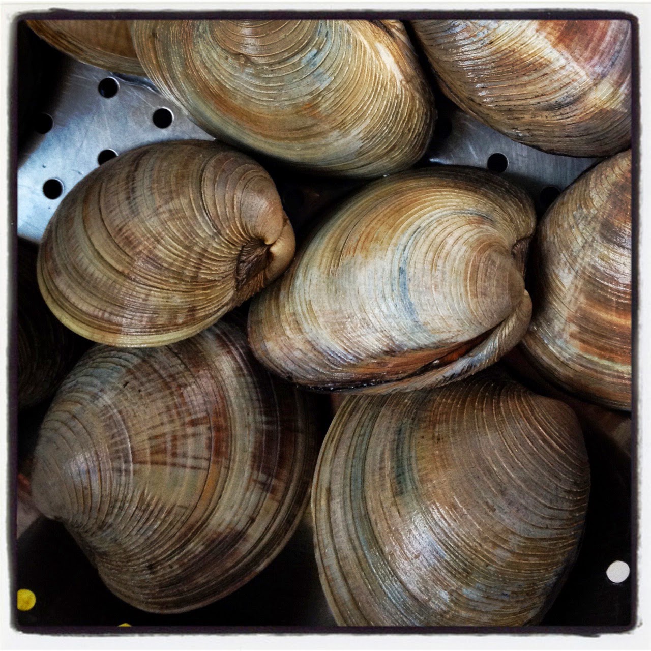
it was going to be a simple dinner...

...until Hannah, partner in crime with

Uncle Chuck the shellfish guy, 


started talking about how great the scallops are.


I know, I know.  Sailing.  We'll get back to that.


at the slip


Picking to friends for a sail. Beautiful day with NE wind. 
Is this really summer?

Saturday, June 28, 2014

the Ocracoke pennant

Here's my (in my opinion) well-earned Ocracoke pennant from Rob's shop.  Photograph was taken while anchored on Otter Creek the following evening.  It now hangs on the my man-wall (I don't rate a man-cave, just a wall) in the garage (and it's only part of a wall).


Work has been busy and I've been on the road quite a bit.  Hope to get back to the sailing log Monday.  I could do it tomorrow, but I would rather go sailing.

Wednesday, June 25, 2014

day four - a little harbor, a little island


The mainsail gaff is peaked high, the main and jib sheets pulled taught, the sun not yet showing on the horizon.  A strong and steady WSW wind, we fall off to round the point that had protected us from the swell overnight.  To the south is the Bluff Point shoal marker, and the water is rough on the back side of the shoal.  We round up to slip on foul weather pants.  Clear skies and 5.8 knots with wind on the beam.  It doesn't take too long and there is just a thin line of trees to the stern.  Ahead the sun glares on the water with the silhouette of a ferry moving east to west.  So far on the trip I had been sailing on rich brown water coming from the swamps and marshes, now we're sailing blue green water with white spray leaping to port.


Patches of clouds hang over Hatteras Island to the east, clear to the south and west.  It is steady sailing and I'm living a long-held dream of crossing Pamlico Sound.  I point up a little higher than needed, preferring to come in high and fall off once I see the Ocracoke's channel markers.  A cup a fruit, granola bar and a few sips of water.  Cool and comfortable, I could not ask for a better day.  Spartina moves along at 5.5 to 6 knots.


 The trees to stern have disappeared.  Ahead I see a marker, and nothing else but water.  I look at my charts, zoom in and out on the gps, realizing the marker is the Lower Middle Ground Light.  I see on the charts that it is about two-thirds the way across the sound.  I glance up at the marker, look to the left and I am surprised to see the water towers and antennas of Ocracoke.  We fall off and head towards the island.  It is only 7:30.


Soon the 75-foot-tall 1823 lighthouse shows on the horizon..  A few minutes later I pick out the the entrance markers.  Blue skies and rolling waves out of the SW.  In the channel a little after 8:30, a line of sailboats heads out at the end of a holiday weekend.  Lots of waves and smiles.  Passing the spoil island at the south end of Howard's Reef I look aft and see a ferry entering the channel behind me.  To starboard the mast of a sunken sailboat juts at an angle out of the water.  The ferry, Carteret, is coming fast on our stern.  I hail them on channel 13, saying I'll move to the side them let them pass.  The captain comes back, says "hang to the green side" and I realize I should have been more specific.  The charts show plenty of water so we slide to starboard as the ferry slips by.


We are off Springer's Point, Blackbeard's old hang out, a little after 9:00, jibing toward the entrance to Silver Lake.  At the jetties wing and wing, sailing through the entrance, past the ferry docks and into the harbor.  A dozen or more sailboats are anchored out.  We make a couple of laps of the small harbor, enjoying the perfect wind and blue skies.


I notice the National Park docks are empty.  Sailing closer I see small "No Docking" signs taped to the pilings.  I tie up anyway, walk to the park service office and ask about the signs.  The docks are being refurbished, I'm told, won't be open for a couple of weeks.  But the ranger says with a boat Spartina's size, I can tie up at the dinghy dock.  We motor about fifty yards, tying up at the small floating dock.


It is a hot day and on the island itself there is no breeze.  I walk around the harbor to a small shop on Community Square to buy an Ocracoke pennant, a long-promised reward to myself for sailing to the island.  The gentleman behind the counter asks if I have a sailboat.  Yes, I do.  What kind?  I tell him a small wooden yawl.  "Was that you out on the harbor this morning?"  


It was Rob Temple, who runs charters on both his schooner Windfall and the skipjack Wilma Lee.  I had sailed with him years before, taking the family out on his schooner for evening sails.  He of course didn't remember me.  But he did have a lot of questions about Spartina and the trip.  And he extended the island's hospitality to me.  "Whatever you need just let me know."  

Soon Spartina is tied up next to his shop.  He loans me his golf cart to run errands.  And we sit on his shaded porch on the hot afternoon, drinking iced tea and talking with about sailing on North Carolina's waters.  

The hospitality doesn't end there.  The young couple who had just re-opened the Community Story, offer to sell me water at a discount (I decline and pay full fare).  And then there was Philip Howard, with a long line of ancestors going back generations to Blackbeard's crew, dropping by to say hello, offering his car to help with errands.  And Bud, who reads the blog and recognized Spartina on the harbor, coming by to visit.  And the dockmaster who said Spartina can tie up there anytime.  It is really a great afternoon with some very friendly and interesting people.


Mid-afternoon, with a building SW wind, we leave the dock and anchor in a few feet of water in the eastern corner of Silver Lake.  A relaxing swim and the chance to scrub the beginnings of barnacles off of Spartina's hull.  Fisherman coming in on skiffs motor by and say hello.


Early evening we move to deeper water near the lighthouse.  Dinner and reading, and listening to weather radio with reports of small craft warnings - 20 to 25 mph winds, two to three foot waves - the next day.

Evening fades with hints of pink and purple in the clouds.  The lighthouse turns orange from the setting sun, the beacon shines bright.  And I'm happy to be anchored in the little harbor of a little island that sits on the far side of Pamlico Sound.  

I slip into the bivy and fall asleep.


Monday, June 23, 2014

day three - light and variable

The morning's forecast is simple enough: light and variable winds.  I wonder how much motoring I will have to do to get down to the Pamlico River, out onto Pamlico Sound and east to the Bluff Point.


The morning sun paints the mainsail orange as we sail off anchor at dawn.  We motor sail in the forecast light and variable winds down Pantego Creek and through the wooden breakwater.  Just outside the breakwater the wind fills in from the west, making just over two knots at first, then soon almost four knots.  Not a cloud in the sky, cool and comfortable.  I decide I'm in no rush to go anywhere and will make the best of any wind I can find.

A tug, the Island Pilot, is pushing a barge up the Pungo River.  It looks like we will pass port to port until the tug makes a slow turn to the west and aims the barge in my direction.  I call the barge on channel 13, identify myself and ask about the tug's intended path.  He says he'll fall off a little and we can pass starboard to starboard, then wishes me a good day.  

Breakfast is a granola bar and a cup of fruit served on the waterproof chart book, the one with a fine layer of salt covering the pages and rust on the rings.


Passing Sandy Point our speed is down to 1.5 knots on the calm, peaceful morning.  A tern snatches at the water, laughing gulls cry in the distance.  I jot that down in my notebook, then wonder why laughing gulls cry.  More wind, variable wind.  Our speed goes to 2.3 knots, then 1.7, then 3.3.

At 9:00 the decks, which had been covered by morning new, are now dry.  I spread out the bivy, which had also been covered in dew, to dry up forward.


Heading SSE we sailing past the entrance to Fortescue Creek, then bear SE to Willow Point in winds stronger and more consistent then expected.  A lone dolphin plays near the point where we turn east towards marshy Judith Island.  The island, low and brown, can't be seen until we are a couple of hundred yards away.  We head to the south side of the island and cut through Judith Narrows, casting a lure along the way but probably moving too fast in a nice breeze to catch a fish.


We sail into Deep Cove, the marshy patches of the island blending together on the horizon and I use the gps to find The Narrows between Swan Quarter Island and the east end of Judith Island.  As we sail east the marsh goes from a drab brown to a bright rich green.  The sky is blue, the water brown and the marshes green.


Sailing at three knots across Swan Quarter Bay I see an Ocracoke bound ferry coming out of Swan Quarter.  A marker is about 150 yards ahead of me and I realize I will soon be directly in the path of the fast moving ferry.  I start the outboard and motor across the channel, cutting the power just after passing the marker.  


Calm water and a bright sun, I set up the solar panel on the foredeck to charge a couple of batteries.  We sail east behind Great Island, then across the mouth of Juniper Bay as the wind swings to the south.  I start to think about a place to anchor, a spot which would have protection from the south and southwest wind and also be a good jumping off place to head across the sound to Ocracoke.  


Past Juniper Bay there is a small bay, unnamed on the chart, just east of Juniper Bay Point.  I look closely at the charts and the shoreline, realizing there is no protection for me there in the increasing wind.


Just beyond that little bay, a hundred yards north on the shoreline, I see on the charts a tiny little cove heading west into the marsh.  That might be enough to tuck in out of the wind.  I think I see the cut, stand up on the cockpit seat to see a much larger expanse of water once through the narrow entrance.  The perfect spot!  I round up, drop the main, raise the cb and sail into the entrance under mizzen and jib.  Delighted with all that water tucked back in the marsh, I'm shocked to see that I had simply sailed through a cut back into the small bay I had just passed, the one with no protection.  The tiny little notch in the shoreline that I was looking at on the charts was farther to the north.  I'm hot and tired, and not happy with my navigation. 

I tack out of the bay under mizzen and jib, drop the cb, raise the main and head east to Bluff Point.


The wind is steady now and we are making almost five knots to the east.  Approaching Bluff Point the water is rough and confused as the swell builds out of the south on the Pamlico Sound.  At 3:50 we reach the point and turn north.  The water calms, then calms more as we turn into East Bluff Bay.  Sailing close along the shore of the bay we find a little cove to give us protection from the swell wrapping around the point, round up and drop the anchor.

I listen to the forecast for tomorrow.  Steady SW winds.  Ocracoke is to the SE.  I'm in a pretty good spot.  

Not too bad of a day for light and variable winds.


Sunday, June 22, 2014

rained out, drying out


Sailed in the rain all morning.  Rain is not a problem if you have good foul weather gear.  I do.  What can be a problem is stowing wet sails.

Called friends who were going to meet me and said it was not a good day to be on the water.  Into the ramp as the rain tapered off.  Put the sails up in a stiff wind to let them dry out for about an hour before wrapping them up in sail covers.  Back home now.  Patches of blue, patches of dark clouds above.

Saturday, June 21, 2014

day two - the swamp, the canal

Dusk.  Evening mosquitoes arrive, then depart.

Night.  Wake to brilliant stars.  Wake to swirling winds from a small thunderstorm passing to the north, the skies overhead still crystal clear.

Dawn.  Calm, with golden light on the horizon.


We sail off anchor just after 6:00 a.m., clear morning with a NNE wind.  Trees all around and I can't see the opening to get out of the swamp.  We follow the gps track from last night, curving up close to the wind in the Thorofare, then falling off to slip behind the stand of dead cypress trees as we leave the swamp and enter the river.  More wind out on the Alligator River and the dead trees rock back and forth in a surprisingly large swell.


The wind pushes us down the Alligator River, the large swells lifting Spartina's stern and we surf down the face of the waves.  I jot down 5.9 knots in my notebook, then a minute later 7.3.  I see the masts of sailboats heading north on the river, just one of them with sails raised.  They pound through the swells and I am happy to be heading south instead.  We pass by a little unnamed island that caught my eye on the charts yesterday when looking for an anchorage, but I see it would have offered no protection from the N and NE wind.  The same with Rattlesnake Bay, which we pass a few minutes later.


The marked channel heads due south then west.  With the wind behind us we cut across a spoil area and at Newport News Point we enter the narrowing section of the Alligator River that heads west.  The wind, blowing off the land to the north, feels warm.  Making 4.5 knots with wind on the beam we leave the channel and sail through some cruisers anchored in a wide bend in the river.  No signs of life this morning.  Farther west, past the crabber working his pots, is a smaller sloop, maybe 28 feet in length.  A man waves from the cockpit.


At 8:50 we enter the canal.  Tall trees on the north side block the wind so we round up to drop the sail.  Drifting to the edge of the canal there is a solid "thunk" as Spartina's steel cb hits a submerged tree stump.  With the outboard we back off.  I bring down main and jib, we motor along at just under 5 knots.  I put the solar panel on the foredeck to charge a camera battery.

Three cruising sailboats pass by headed north on the canal.  Everyone waves.  I look ahead to see large power boats headed my way, traveling fast enough to throw large wakes that turn into breaking waves on both sides of the canal.  A hundred yards away the first boat slows down.  As we pass I take off my hat to give a wave of thanks.  The captain points at Spartina and gives a thumbs up.  It is the same with the next couple of boats, yacht slows down, wave of thanks and a compliment for Spartina.  The next boat, black and looking like a space ship, slows down too.  I want to get ahead of the curve so I wave my hat in thanks, point at the million+ dollar yacht and give a thumbs up.  The captain points to Spartina and gives me a Hawaiin "hang loose" sign.  I smile.


The canal is lined by rich green trees and vines.  I enjoy motoring along, standing with legs on either side of the tiller and steering with my knees.

About a third of the way down the canal it crosses the narrow, winding beginnings of the Alligator River.  Trees disappear and I look north across a savanna of marsh grass.  A few hundred yards later the shoreline is again lined with trees.  Another loud "thunk" as we hit a log floating in the middle of the canal.


About 12:30 we pass beneath a tall bridge, then leave the canal into Wilkerson Creek.  Out of the creek into the Pungo River we round up into a nice NNE wind, raise the main and jib.  Under full sail we make 4.2 knots towards Belhaven, tiny white clouds against a deep blue sky.

At 1:50 the Belhaven water tower is in sight, an hour later sleek grey dolphins pass by Spartina outside of the breakwater.  By 3:00 we are tied to the town dock.  I plan to walk to the gas station, but Ron and his son Ronald jr say it is too far and offer a ride in their golf cart.  It is too far, the nearer of the two gas stations being closed for the day, the open station more than twice as far away.  At the gas station - I needed less that a quart of gas - I offer to buy drinks for Ron and Ronald.  Ron says thanks, but no, it's not necessary.  They drop me off at the docks and leave with a friendly wave.


I walk around Belhaven, quiet and hot on a Saturday afternoon of a holiday weekend.  I visit a couple of shops, sit on a bench and relax.  At 5:00 Fish Hooks Cafe opens and I enjoy crab cakes for dinner.  For a quiet town the restaurant is surprisingly busy.  The waitress serving the tables next to mine walks like a soldier, stomping back and forth.  I read my book, enjoy the air conditioning and have another glass of iced tea.


We push off from the town dock and motor across Pantego Creek, anchoring far enough away from the south shore to avoid the mosquitoes, and far enough away from the boat channel to the north with power boats running back and forth to the dock.  


I hear music coming across the river.  A crowd is arriving at Farm Boys, an open air restaurant just off the water, to celebrate the holiday weekend.  Maybe the town isn't as quiet as I had thought

Wednesday, June 18, 2014

day one - clean air


Pink and orange clouds over a calm Pasquotank River, I listen to the wind blowing through the trees next to the boat ramp.  A front had rolled through in the middle of the night, thunderstorms and reports of tornadoes to the north.  Morning comes with cool, dry air and a steady NW breeze.


We motor away from the ramp at 7:00 a.m.  It's just a short run to the pier at Millie's place and I could easily motor there.  But the wind is so perfect I raise sail, noticing that I had run the main halyards - peak and throat - through the wrong blocks, something to be easily fixed at Millie's.  I reach the dock nearly an hour before I had told my friend that I would be there, hoping to be able to walk back to the ramp and get my jeep without bothering her.  Walking around the corner I see Millie sitting on her porch reading the paper.  She smiles, knowing she caught me.  She drives me back to the ramp, we get the jeep and trailer, then tuck them around the corner at her place.  


I say goodbye a little after 8:00, pushing off from the dock, raising sail in a building wind.  We sail downriver at 4.3 to 5 knots, markers backlit by the rising sun and easily visible.  The river water is stained the color of tea by the swamps to the north.  Orange crab pot markers tilt downwind.  We pass Brickhouse Point and Newbegun Creek to starboard, a crabber working pots on the shoal at Miller Point to port.  We jibe at 10:30, then find a comfortable path wing and wing with Albemarle Sound ahead of us.  Nearing Wade Point I jibe accidentally while looking through the binoculars, then another unplanned jibe while taking photographs.  Maybe I should pay attention.


The wind falls off at the river entrance, then fills in once out on the sound.  The water is rougher on Albemarle Sound, but rolling in our direction.  Making over 5 knots, then 6.4 sliding down the face of a wave.  Blues skies and looking east I can see the Outer Banks on the horizon.

The crossing is pleasant.  Steady wind, a friendly wave from a cruising couple on a sailboat headed north.


The wind falls off approaching the Alligator River early afternoon, we motor sail past the entrance markers and duck blinds, dark shapes moving east and west on the horizon are cars and trucks on the Alligator River Bridge.  Leaving the entrance channel the wind fills in out of the west.  We have a nice run for the bridge as I request an opening on channel 13.  The bridge tender tells me to keep on coming.  I reply that I'll come through under power, then ask if he wants me to drop my sails.  "You can leave your sails up as long as you can control your boat," he says.  The sails carrying us into the opening, the outboard carries us through the dead spot in the wind shadow.  I look up and wave to the bridge tender.  "Have a nice trip" he says over the radio.


We're sailing south with the wind on the beam at five knots just outside of the channel.  Skies are clear but the weather tells me we are under thunderstorm watch #178.  I leave the weather radio on hoping to get an overnight and next day forecast, the automated voice repeatedly interrupting the local forecast for the thunderstorm watch.  We head towards the western shore, hoping to be near shelter should a thunderstorm erupt from the clear skies.  


We sail to the mouth of Second Creek, a possible anchorage for the night, but I'm not impressed.  We continue south to the mouth of Goose Creek, where I bring down the main and the jib, and drop the anchor.  If the wind is out of the W all night maybe I could stay here.  Two more warnings about watch #178, then, without pause, watch #178 is cancelled.  And finally the local forecast comes through, strong winds out of the NE and E, making the entrance to Goose Creek a terrible place to be.  Sails up, we head south.


I look on the charts at Rattlesnake Bay but I'm not sure how protected that would be.  On the way there I notice a body of water heading off the river to the west, The Frying Pan.  A narrow, winding entrance, but - according to the chart - deep water.  I head there, blindly passing the entrance hidden behind cypress trees.  Seeing on my gps that I have missed the entrance, I turn back and decide to trust the gps.  A wall of cypress trees to the west, a patch of cypress stumps and dying trees to the east, we work our way under full sail into the swamp.  We turn west into a narrow passage marked the Thorofare as an eagle lands on a tree.  The water opens to the west, shallow water to the south - maybe less than a foot deep - but marked with a depth of 17 feet near a little point straight ahead.  We round up and drop the anchor, paying out enough line to tell us it was every bit of 17 feet deep.  


Just after 7:00 I cook dinner - beef stroganoff - and clean up the boat.  Sleeping gear set out, I relax, read and enjoy being completely surround by a cypress marsh.  The wind may be blowing out on the river, but it is quiet and peaceful tucked back in The Frying Pan.