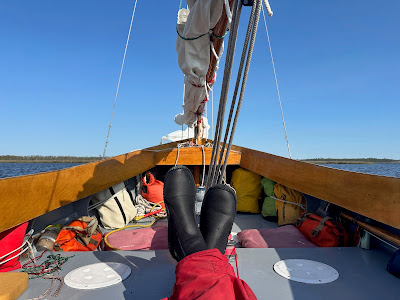
Wednesday, June 26, 2024

day fifteen - Dipping Vat Creek, storms all around


I take my time breaking down the boom tent, removing the sail covers and carrying my duffel and electronics box down to SPARTINA.  No rush to leave.  A muffin and iced tea at The Bean as I sit with Keith from TownDock and my friend Jimmy.  Jimmy and I worked together in a small town in Texas 40 years ago.  What are the odds we would be sitting together this many years later at The Bean?  


I grab a large iced tea to go, cast off 7:50, waving to friends on the PRINSES MIA and the neighboring boat PLANET WAVES.  Full sail in the harbor at 8:00, making as easy 1.3 on the Neuse at 8:05.  


It's a slow drift on waves rolling out of the south.  Then more wind, making 3.1 at 9:05.  The sail covers will be tucked away in a duffel for a few days, so I spread them out to dry off the morning dew.  


10:10 Piney Point Shoal marker in the distance.  Less wind and humid, motorsailing.  11:00 over the shoal, round up to refuel the outboard.  Wind!  


Sailing at 2.1, wing and wing, white beaches of Swan Creek to port.  2.4 then 3.3 with better wind.


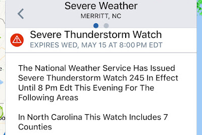
Noon crossing of Maw Point Shoal.  Wind swings to northeast, 3.3.  12:25 thunder in the distance.  Turn to the Bay River.  I get an alert on my phone for a severe thunderstorm watch.  Lightning to the south, skies getting darker.   Time to look for some shelter.  It's a few miles if I round Davis Island Point to get into the Bonner River.  Somewhere in the back of my mind a recall a narrow cut I took years ago than might get me into protected water sooner.


I check Navionics and find Dipping Vat Creek.  It's just a few hundred yards away.   1:00 drop the sails and motor in that direction.   


My only concern is a draw-bridge style foot bridge over the creek.  Years ago it was there, but in a raised position.  Motoring into the creek I see I have no worries.   A past storm must have taken out the bridge.


1:30 anchor down in Long Creek, boom tent up and rain begins to fall.  I wait for the storms but the seem to pass to the east and the west.  


Late afternoon is calm and incredibly pleasant.  Eating dinner I watch storms erupting in the distance.


Thunder in the evening.  Later I wake to lightning.  Once again, it is in the distance.  I go back to sleep.


17.43 NM


Tuesday, June 25, 2024

day fourteen - ignored


Dawn comes with storm clouds and humidity.  A breezy walk to the park that fronts the Neuse River.  Breakfast of a muffin and iced tea from The Bean.  Check into the hotel at the marina inn so I can do laundry, charge batteries and wait out the weather.


Rain begins at noon.  I sit on the porch and M and M's and enjoy a salad with scallops.  Excellent.


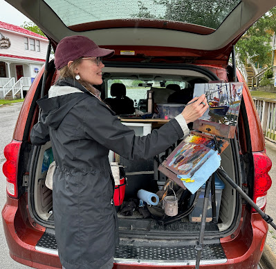
The artists begin showing up on the waterfront.  A couple artists set up near the Town Dock, some more around the corner by the commercial docks.


And they seem to paint every gd boat in the harbor except mine.  I keep hoping, but all the attention goes to the bigger boats.


Shrimp boats and Martijn's Prinses Mia get all the attention.  I am crushed.  How can they take a pass on the prettiest boat on the waterfront?  Mermaids, maybe I need mermaids painted on the site of SPARTINA.  On a phone call I run the idea past my wife and, uh, well, no.


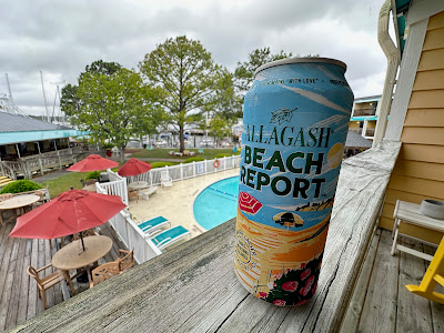
I console myself with fried oysters on a Caesar salad for dinner, a cold beer on the hotel room balcony.  Rejection can be painful.  


Monday, June 24, 2024

day thirteen - going with the flow, remembered


A calm, peaceful night.  The east wind that arrived last evening persists this morning.  I look at the charts and I will go with the flow.  The east wind is perfect for a downhill sail back to Oriental.  6:25 making 4.2 with wind on the beam north on Turnagain Bay.


The bay bends to the northwest, 6:55 wind on the starboard quarter making 3.4.  7:10 round the point, 3.8 on towards the Neuse River.  On the open river making 4.4 with wind on the stern.  7:47 jibe, gps briefly shows 7.3 sliding down the face of a wave.


It's a fun, easy sail, the gps going up and down from 4.3 to 5.7 depending on the following waves.  


9:30 approaching Oriental.


Sail in through the entrance channel, round up and bring down the main and jib.  


Motor to the town dock, drop the mizzen on the approach and tie up along the sea wall just next to the dock.  Docked 10:00.  


Iced tea at The Bean, then run over to the Provision Company for a few supplies and some water.  Then a nice lunch.  Across the street I see a woman painting at an easel.  I walk over to take a look at her work,  which was very nice.  She tells me there will be artists all around Oriental tomorrow.


I can't help but wonder if some fine artist will paint my favorite boat.


Afternoon comes with a small craft advisory.  That's fine, Oriental is a great place to wait out the weather.


 Late afternoon Martijn arrives on his PRINSES MIA.  I've seen him in Oriental several times, plus we've crossed paths in Norfolk and Chestertown over the years.  I walk over to say hello, telling him he won't remember me but....and the young lady on board says that when they came into the harbor Martijn pointed at SPARTINA and say "I know that boat."  It is nice to be remembered.

Sunday, June 23, 2024

day twelve - down and back again


The day starts with a new set of clothes.  How nice.  Calm morning, light southwest wind.  Sail off anchor 6:35, wind over port quarter.  7:05 making 4.4 as the wind fills in.  A friendly wave from a waterman headed south on Turnagain Bay.  


7:25 passing Abraham Bay, wind building.  Round up and tuck in a reef.  More wind than I had expected, it crosses my wind that I could easily get north of the Bay River, maybe the Pamlico River.  Maybe sail north, turn to starboard and head for Ocracoke.  7:35 more wind, tuck in a second reef.  Getting into open water I am caught completely off guard by the steep, choppy waves coming across the shallow seven-mile fetch of the mouth of the Neuse River.  Suddenly battered, the spray flying, I realize my plans for a long sail north are gone.  I grab the gps and the phone with Navionics to look for some options.  As SPARTINA gets pounded by the waves I realize I can't even focus on alternate plans.  I come about and head back to the sheltered waters of Turnagain Bay.


Anchor down 8:30.  Boom tent up, a hot breakfast and I think about how I wasn't ready for the rough water.  More wind, more waves than I had imagined.  So it's going to be an off day.  


Stronger winds arrive at noon, and I'm glad I am not out on Pamlico Sound.  Mid-afternoon the wind swings to the northwest.  I raise anchor and move to a spot with a little more protection from the chop rolling down the bay.


Evening I move one again to get out of the chop as the winds seem to moving.


Just as darkness falls, SPARTINA spins in a circle as the wind swings to the east.  I climb into the sleeping bag.


 7.01 NM

Friday, June 14, 2024

day eleven - warning, delay, canals


Morning comes with a small craft advisory.  North winds 15 to 20 knots, gusts to 25 knots.  Not sure if I will go anywhere today.  Hot chocolate with breakfast on a cool, grey morning.


I am well protected and very comfortable under the boom tent.  Catch up on the news, check in with the family.


Late morning winds die down save for the occasional strong gusts.  Still to windy to sail north on Pamlico Sound, I decide to head west through a couple of favorite canals.  

Sail off anchor 12:10 with a double reef tucked in the main.  4.7 in a gust, then we settle down to 3.1.  12:30 passing red marker "4:, decide the wind is good for a sail through the canal.  


Slip under the bridge where there is slight lull as the bridge structure blocks the wind, then out into the breeze on the Thorofare Canal.  


A series of tacks carries us down the canal, going shore to shore to make the most of the wind.  Out of the canal at 1:00.


1:30 tacking into wind and the waves rolling down from Pamlico Sound.  Good, steady sailing at 3.6.  1:20 round Long Bay Point, then one long tack across Long Bay.


At 3:20 enter Old Canal, a favorite place because it is so narrow and unkept, wild flowers growing along shore.  I sail the first portion, then lose the wind to the growth on shore.  Motorsailing.  Then towards the west end the wind fills in again, full sail on the canal's quiet waters.  Beautiful!


3:45 enter Turnagain Bay.  Wind is still strong out of the north.  I tack back and forth until I find protected water.  Overcast slips away, blue skies and white clouds.  Anchor down 4:10.


 13.76 NM

day ten - shoaled


Cool morning, west wind, light overcast.  Sail off anchor 6:30, making 4.7 with a single reef tied in the main.  Sail east, round the shoals in the middle of the bight.  Turn north and pass the lighthouse.  6:50 doing 5.5 wind on the beam into Barden Inlet.  A flood tide helps as we sail on calm water with great wind.  Easy sailing and it feels like we aren't moving that fast but gps shows 6+ knots at times.

I had been told in Beaufort that there was some well-needed dredging going on at the inlet.  The times I have sailed through to or from Cape Lookout it has been a series of winding and often shallow channels.  Heading up through the inlet I am pleased to find a well-marked, straight channel to follow.  In the distance I can see the dredges are still at work.  Two small fishing boats headed for Cape Lookout slow down to reduce wake for me, passing close enough that I can say thank you across the water. 


Making 6.2 with wind just forward of beam, noisy flocks of terns take flight from the spoil islands to the west.  I look ahead trying to figure out where the channel might be.  I see a red marker to the north and choose to sail parallel to the dredges.


The centerboard touches bottom.  I turn back south, looking around to see where I might go.  Looking back north I realize the red marker is an anchor marker for the dredge.  I find a little deeper water, turn back north.  And again the cb touches bottom.  I raise the cb and rudder, sliding to the northwest.  I see the shoal is getting shallower and shallower, but just beyond I see deeper water.  I sail/drift as far as I can, jump out of SPARTINA and walk her up and over the shoal, give the boat a shove to the deeper water and hop on board.  7:25 sailing again.


7:40 approaching the east end of Harkers Island, unsure of the channel with the gps and Navionics showing different paths north.  I see a marker to the northeast and head for that.


7:50 less wind in the lee of the land, 4.3.  I think I have found the channel, gps shows that I should be passing marker "37A" but the marker is missing.  8:30 jibe to red "36", which is in fact where it should be.  9:50 3.4 with steady wind on beam.  See a green marker in the distance.  10:00 getting warmer, reach the marker to confirm it is green "30".  10:45 wind building, round up and tie in the second reef.  Getting warmer, light grey overcast.  


11:30 approaching Atlantic and find we are surrounded by shoals.  Deeper water to both east and west.  The channel marked on the gps is marked on the water with sticks that indicate shallow water.  Raise cb and rudder, drift across the shoal to deeper water.  

11:45 main and jib down, heading into Atlantic for lunch.  Find the entrance channel with a marker for shallow water in the middle.  Try to pass to the right, cb touches bottom.  Try to pass to the left, cb touches bottom.  Tired of shoals, I turn back south and raise sail.  Cross one last shoal, then turn north.


12:00 sailing north with a double reefed main.  Deeper water and easier sailing, we are past the worst of the shallows.  12:25 shake out second reef.  1:05 round up to shake out the second reef as we enter Thorofare Bay.  A handful of tacks to a little notch in the marsh to the north.  Anchor down 2:15.  Dragon flies all around.

Late afternoon the wind swings around to the south.  A thunderstorm in the distance.  Forecast says the wind will swing to the north in the evening.  It does.  


30.04 NM