"When I think of all the fools I've been, it's a wonder that I've sailed this many miles." -Guy Clark

Sunday, April 29, 2018

"Is that a Pathfinder?"

It was almost 80 degrees yesterday.  Low 50s this morning.  I liked yesterday better.


Saturday was a pleasant sail.  Winds at time were light, filling in now and then.  Almost no clouds in the sky.  A NATO parade and festival on the waterfront, I could hear the singing from the stages and marching bands coming around Waterside Drive from before 9 a.m. until a little after noon.  Children waved from the waterfront, two military officers wearing kepis applauded as SPARTINA sailed by.

A man came down to the dock as I tied up for the evening to ask if the boat was a Pathfinder.  The exact same thing happened a week ago at the same dock - "Is that a Pathfinder?"  The question surprises me.  "Is that a Drascombe?" is the more common question.

More and more snowbirds are coming through, including EMMA, from Hamburg, Germany, above, which I believe to be a SWAN 60.

It is hard to sail when it is 50 degrees and gusty, particularly after a warm and pleasant sail the day before.  I could not have sailed today anyway - a cruise ship came into the terminal and blocked access to the basin where I leave SPARTINA.  I knew this would happen and planned to leave the boat there in the water while I did some trailer maintenance at home.

SPARTINA will be on the river all week.  I hope to sneak out for an evening sail or two, or maybe three, after work.

Friday, April 27, 2018

Beaufort, then and now


I found a photograph at my new favorite website that really touched my heart.  It is a photograph taken on the Beaufort, NC waterfront just a matter of feet where I dock SPARTINA when passing through town.  The boat in the foreground is the Nettie B. Smith, a 35-foot-long boat built for local freight hauling.  Behind the boats - there are three there including a sharpie, a kunner (the small dinghy in the foreground) and the Nettie - is the intersection of Front and Turner Streets.  You will see that same intersection in the satellite image below, the X marking the site where the old photograph seems to have been taken and the O marking the floating dock where the dock hands typically direct SPARTINA.  Just being able to see the history there makes me smile.  If you are interested in Mid-Atlantic maritime history it is worth reading the entire entry.  Below is the description of the freight being hauled by the boats, written by Michael B. Alford and David Cecelski.

"One of the boat’s hands is unloading split firewood, undoubtedly cut somewhere close by. A pair of high-wheeled drays pulled by mules wait to carry the firewood into town. Evidently the draymen are quite confident that unloading cargo is not their job. Barrels of naptha also lay on the shore.
The naptha— possibly just crude oil, but more likely a light petroleum distillate like kerosene or one that was even lighter—of course was not distilled anywhere near Beaufort.
The destination of the naphtha is anyone’s guess. Locals commonly used kerosene lamps in their homes, but in this quantity the oil might have had an industrial use.  Perhaps they are bound for a local menhaden factory, where heavy presses and furnaces turned the fish into fertilizer and oil.
Another, rather more romantic possibility, is that the Nettie B. Smith’s master intends to ferry the naphtha barrels to the Cape Lookout Light."

My good friend Barry - boatbuilder, photographer, videographer, writer and connoisseur of oysters - asked me if I had ever heard about the web page.  I had not, but I knew well of David Cecelski, the man behind the collection of new writings, essays and observations about life on the North Carolina coast.  I had read two of his books, The Waterman's Song, Slavery and Freedom in Maritime North Carolina, and the more personal A Historian's Coast, Adventures in the Tidewater Past.

Cecelski's site looks at the social, racial, economic and environmental history of the sounds, creeks and rivers of North Carolina.  That may sound a little on the dry side but it is not.  He weaves together rich stories of the coast, bringing historical characters to life and putting them into the context of the times.  Cecelski's books have changed the way I look at the shore as I sail by.  I see thriving communities that are no longer there, hard working fisherman and boat builders now long gone.  It is strange and sad how along the marshy shore villages and towns disappear, quickly pulled back into the bog and covered by vines.  Those places, people and lifestyles may be gone but I thank David Cecelski for keeping them alive.

Monday, April 23, 2018

spring

Two days of sailing.  Light winds, strong winds, no wind.  Sunshine, clouds.  


Glassy calm in the morning.  A cormorant breaks the surface, a striped bass in its beak.  The fish, surprisingly large, tries to wriggle free.  The bird shakes its head, leans back and swallows, the shape of the fish seen sliding down the bird's throat.

Midday the wind builds, as does the overcast.  Tired, chilled by the wind, I drop the main and jib, set out the anchor, lean back and put my hat over my face.  Sleep.  The boat rocks as tugs pass by in the channel.

An osprey sits on a crooked nest on a crooked post near shore, a chick no more than a month old next to the large bird.

A pipe band walks in a line across the park, five yards between each member.  Casually dressed, it must be a rehearsal.  The sound of the bagpipes carries across the water.


Breaking down the boom tent at the dock a man walks by.  Dressed in a suit and carrying a brief case, he stops and turns towards SPARTINA.  He watches for a minute, says nothing, turns and walks away.

A gusty southeast wind heading up Scuffletown Creek to the ramp.  No other trailers in the parking lot.  Blue sky.  Sunburn.  Spring.

Saturday, April 21, 2018

dinner, green


Steamer night at the household.  A week ago a neighbor boiled up 120 pounds of crawfish shipped live from Louisiana.  He realized he had bought way too much for his party.  I got three texts asking for help.  So I showed up and did my best, ate as much as I could.  He sent me home with several pounds more, which I froze and then enjoyed tonight.  I like to be a good neighbor, helping out anyway I can.


Green means "go."  A good forecast with temperatures in the 60s, a few clouds and some sunshine, and a decent breeze.  Can't wait.


Tuesday, April 17, 2018

downrigging memory


I just came across this photograph yesterday, don't think I had ever seen it before.  It is from the Downrigging Festival in Chestertown, Md, in 2013.  I haven't been to the downrigging in a few years now, I enjoyed it (when the weather was nice, which it isn't often in early November).  The tall ships in the background, from left to right, are Lady Maryland (distinctive pink and green hull), the very bow, with yellow stripe, of the Pride of Baltimore II (now on hard financial times), the Virginia (now owned by the city of Norfolk), The Sultana and Kalmar Nyckel.  They are all great boats and it is a joy to sail alongside of them.  I'm glad to have this memory for the scrapbook.

Monday, April 16, 2018

check out my bottom (paint)


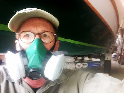
Two days of work.  The first to figure out how to lift SPARTINA slightly off her trailer, tape then sand below the waterline.  Then two some final sanding, one coat of bottom paint, three-plus hours of drying and then a second coat of paint.  There are a few small areas near the rollers and supports that I could not get to.  I'll take care of them tomorrow.  I used West Marine's Bottom Shield which they describe as a hybrid that combines a hard surface that self-polishes like an ablative.  We'll see.  About $60 for the paint, probably another $60 for the brushes, rollers, tape, gloves, etc.  This summer I'll feel much better about leaving SPARTINA on the river for a week at a time, giving me the chances to sail before and after work.  Sanding was the worst, painting was pretty easy.  Glad I got it done.


Friday, April 13, 2018

another weekend, another storm

I can predict the weather.  If I have a couple of days off, like this Sunday and Monday, there will be a storm.  That is a routine that has gotten very old this spring.


Before coming to work today I towed SPARTINA down to the river, rigged her and backed her down into the water.  I wanted to check the waterlines I had drawn on her.  From midships forward to the bow the waterline was perfect.  Midships to the transom I had drawn it a little high.  Easy enough to fix now that I have a mark (not to mention a natural waterline drawn by pollen floating on the river).  The weekend lost to weather, I'll begin prepping the hull for bottom paint.


As for our recurring weekend storms, wake me when they are over.


Monday, April 9, 2018

striking the waterline


Striking the waterline with the help of a nice laser level loaned by Kevin B. of Slip Jig fame.  I just made a series of points with a sharpie.  I'll get her on the water this weekend to see if the lines are right.  If so, a coat of hard anti-fouling paint in the next couple of weeks.

Saturday, April 7, 2018

hurricane days


A journal entry by Webb, his hurricane plan now that he is a resident of Hilton Head Island, made me realize there has been a change in my life.  Maybe I had known it and just didn't want to admit it.  But it is clear to me now, my hurricane days are over.


I smiled reading Webb's plan.  It reminded me of my own plans as storms slid up the coast towards Hatteras Island.  Food, water all the gear tucked in plastic bags to keep it dry.  Driving south on Highway 12, the only car in the southbound lane while the northbound lanes were bumper to bumper with tourists evacuating the island.  The village of Buxton, Buxton being considered a "high" spot on the island, served as a home base.  We always got two rooms in the hotel, one on the second floor in case the first floor floods and one on the first floor in case the second floor loses its roof.  Since we needed to collect information before the storms we stayed outside as long as we could, driving around the island in a four-wheel-drive on the flooded roadways.  When the wind got too strong and things - pieces of signs, fences and roofs - began to fly through the air, we would go inside and hunker down, sometimes putting mattresses and couches up against the plate glass windows in case they imploded.  I remember the peak of one storm, eating cold beans out of a can and playing cards with a co-worker.  There was nothing else to do as the wind shrieked outside.


Communication on the island is much better than a decade or so ago.  Cell service is now considered a public safety need and some of the first boats and helicopters coming to the island after a storm carry crews to repair the phone towers.  That is excellent for us as we need to get information off the island as soon as the storm is over.  We've also used satellite phones and in fact there were times when I "rented" out my rented sat phone to colleagues desperate for a line off the island.  As a last resort I have found a very weak wifi"guest" signal near one of the island's utility office.  I suspect the office gets the service via satellite connection.  More than once the power people have come out of the building to ask why I was parked in their lot in the middle of a storm.  I point to the laptop, they smile.


I have found "mandatory" evacuations are not really mandatory.  Vacations renters are made to leave both for safety and liability reasons.  People who live on the island often stay because they know once they leave the island the might not get back on for days or weeks.  Hurricanes tend to move massive amounts of water from one side of the island to the other, and then back again.  With just a few tiny inlets in the Outer Banks the water goes over and sometimes through the island, rupturing roads and cutting off access to Hatteras.


I've been trapped on Hatteras five times, I think, following hurricanes.  Sometimes because the island was cut in half and I was south the cut.  The other times was because the sand dunes, several feet tall, were pushed on top of the two lane road that leads off the island.  It can take days to move all that sand off the roads.   


Some of the nicest days are those immediately following a storm.  Hurricanes are fast moving - as opposed to the nor'easters that linger - and are often followed by a cool dry front that brings blue skies and comfortable temperatures.  The worst times are in the weeks and months following the storm.  Heat and humidity does return, power for air conditioners, refrigerators and hot water may not.  Homes are flooded, businesses damaged and no customers anyway even if they could reopen.


A hurricane, seen from the island, is spectacular.  The light is different, the water is different and every storm is different.  I have seen the island flood from the ocean side and I have seen it flood from the Sound side, and one time before dawn I stood on a little bridge and watched the floodwaters come from both the ocean and the Sound at the same time.


There is always a tinge of guilt as I cover he storms.  I feel a bond with the islanders around me, they have always been kind to me before, during and after hurricanes.  They have offered shelter and, more than a few times, fed me.  But at the same time I know that even after the worst storms I'll catch an emergency ferry off the island in a matter of days, leaving the damage behind and returning to the comforts of my own home.


Looking over Webb's hurricane plan I suggested he add a small hibachi-type grill and a couple of frozen steaks.  Some of the best steaks I have ever enjoyed were on the days after the storms with clear skies and the knowledge that everyone, despite the coming days, weeks and maybe months of discomfort, survived.  No one has died on Hatteras during the storms I've covered.   


There are so few people in my office these days I cannot imagine being able to sneak away to the island for a storm.  Where I live is in an area vulnerable to hurricanes, anywhere within a couple hundred miles off the east and gulf coasts is vulnerable.  So there will be, regrettably, more storms.  But it won't be the same as being on a long narrow island caught between the ocean and the Sound, waiting on a storm of uncertain path and power barreling up the coast.  

My hurricane days are over.  Those are days that I will always remember.

Monday, April 2, 2018

a second halo


We sailed under a sun halo yesterday, the second time we've done so in nine days.  What does that mean??


I launched under clear skies but by the time we were down river the overcast moved in along with a chilly and gusty wsw wind.  For a while I was second guessing my decision to sail.  But midday the skies cleared and it was beautiful sailing.  A few snowbirds headed up the river on their way north.  I suspect with the cold winter and even colder early spring the migration north on the icw will be a little bit late this year. 

Nearly loaded up to sail today but a last second check of the forecast - which included blue skies, rain, gusty cold wind, which all proved to be true - caused me to just take the day to relax.  I needed a break.