"When I think of all the fools I've been, it's a wonder that I've sailed this many miles." -Guy Clark

Monday, November 29, 2021

day fourteen - hello, sweetheart!


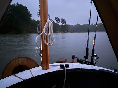
Just as I'm tucking the boom tent away I hear Kristen call.  She's making hot tea and invites me to join her.  I raise the anchor, motor over and hop on board MAGDALENA, a nice way to start the day.  Kristen is heading back to the Choptank.  With strong NNE winds I think the Bay will be too rough for me.  I'll explore the Patuxent instead.  


Cast off 8:25 with a single reef tucked in the main.  It's very gusty.  Out on the Patuxent River at 8:40, a second reef tucked in 8:55.  I look south and see MAGDALENA coming out of the creek and headed down the Patuxent.  Grey, gusty and cool, not a day for exploring.  I turn back to Mill Creek.  Calmer in the creek I turn to starboard on Cuckold Creek.  It is lined by houses and I see no point of sailing through everyone's back yard.  I return to Mill Creek at 9:15, anchor down in Kristen's spot 9:30.


After cleaning up the boat I motor over to the dock at Stoney's Clarke's Landing, tying up at 11:00 as they open.  It's very quiet, no customers, no waiters and I'm not even sure if it is open.  I walk in through the back door.  Silence.  I walk through a dining area, then through another door into the bar.  A guy is sitting at the bar, a woman behind the bar and they are having a quiet discussion.  She glances over at me and with a loud friendly voice says "Hello, sweetheart!"


The restaurant is open but being a Sunday morning there are no other customers yet.  The woman tells me to pick a table, no rush to order and says it's fine if I want to take my time, drink some iced tea and catch up on the news on my phone.  So I do.  After a while I do place an order for a rockfish gyro, a blackened rockfish filet served on a bed of veggies with spicy cucumber sauce.  Excellent.  


12:45 anchored out with the boom tent up to wait out the wind and the rain.  I catch up on the log book, listen to some football, read and nap.  An enjoyable afternoon.  I get a text from Kristen.  She had left Mill Creek a little before 9:00, arrived Dun Cove just after 6:00, over nine hours of hard motor sailing into 18 to 24 kts wind and accompanying waves.  With darkness comes more rain.  


 6.79 NM

Sunday, November 28, 2021

Christmas parade


Nice photo of the boats circling before the start of the Christmas parade at Nauticus.  Look closely and you'll see Rudolph on the bow of SPARTINA.  Guess who leads the parade.

Thursday, November 25, 2021

day thirteen - rum and coke, and good company


Checking Instagram I see Kristen has posted a message from Dun Cove off the Choptank saying she is waiting from the small craft warning winds that are forecast.  I message her asking where she is headed today.  Her plans match mine.  Sail off anchor 7:40 with a low overcast, making 3.9 outside of Mine Cove.  8:10 crossing the mouth of the Manokin River, 4.6.  Deal Island in sight 8:30, 4.8 as the wind builds.


Round up in the lee of Little Deal Island at 9:00 to tuck in a reef.  Setting the main I'm suddenly surrounded by dolphins.  They brighten the morning for me.  I don't know how many there are, maybe five or six, maybe more.  The stay with SPARTINA for about 10 minutes, 5.2 with the single reefed main, jib and mizzen.  Barge and tug ahead off starboard bow, I fall off to give them more room.  Overcast starting to break up.  Barge and tug head to the east, plenty of room to sail now.  


Approaching lower end of Bloodsworth Island doing 5.0, fall off to cross Hooper Strait and round Lower Hooper Island, 4.7 kts.  A little blue sky showing in the overcast. 


 Noon off the southern point of Lower Hooper Island, starting to cross Chesapeake Bay heading NW.  


Spot a freighter of some kind coming from the south heading up the shipping channel.  Passing Hooper Island Light at 12:50, 5.0, freighter from the south passes well ahead of us.  See a second freighter, this one to the north coming down the channel.  Choppy water in the shipping channel at 1:20, 4.5 in the rough water.   Second ship passes well ahead.


Pushed by a wave gps shows 6.7 as we approach the western shore.  Get a text from Kristen, she is at Drum Point entering the Patuxent River.  I reply that I'm still a few miles to the west.  Leaving the shipping channel at 2:00, green marker with a bell ringing as it pitches back and forth in the swell.


Cedar Point at 2:10, calmer water.  On the Patuxent River at 2:40, making 4.6 and get an invite from Kristen who is anchored on Mill Creek.


Pass under the bridge 3:15, 4.9 with both wind and tide in my favor, 6.6 in a puff.  


Round the narrow sand spit called Patience Point as water swirls with the incoming tide.  Enter Mill Creek at 3:40.


A handful of boats anchored on the creek, Kristen has the prime spot up near some wooded cliffs that completely bock the wind.  We tie SPARTINA up and let her drift behind Kristen's Cape Dory MAGDALENA.  I've crossed paths with Kristen a couple of times on the Bay and it is always a treat.  We talk about our day of sailing then break out a chart book and talk about other places we have sailed.


Kristen ducks in to the cabin and soon I hear sausage stir fry sizzling in the pan while I hop on SPARTINA to set up the boom tent for the night.


Kristen passes up a bottle of coke and a thermos with rum, we enjoy an excellent dinner on the beautiful creek as darkness falls.  Cast off to anchor just after 8:00.


 37.71 NM for the day

Wednesday, November 24, 2021

day before Thanksgiving sail

Beautiful noon sail today, excellent wind, a little chilly but had my thermals on.  The extra video is from Kiwi Dave (you'll know he is a Kiwi when you hear his accent) who was anchored in Craford Bay was he waits for a weather window to sail south around Cape Hatteras.  Thanks for the video, Dave.


I hope everyone has a great Thanksgiving Day.


Monday, November 22, 2021

day twelve - back north


Cast off 7:45 and under power after a visit to the Corner Bakery for a chocolate eclair and a cinnamon twist.  Bruce and Nancy wave goodbye as I pass their chartered sailboat.  Green marker 17 at 8:30, finally out of the wind shadow of the trees so round up and raise full sail in a nice NE breeze.


Ware Point at 9:10, cut inside the green marker past the crab pot markets to slip out on the sound, though I am not sure which sound.  It could be Tangier Sound, or maybe Pocomoke Sound.  Beach Island in sight at 9:20, making 4.2 on a starboard tack past the shoal that extends out from the island.  


Fall off the wind at 11:00 to cross the shoal south of Fox Island.  At 11:30 not another boat in sight, just a beautiful day with good wind and blue skies.  Perfect!  Making 4.4 with wind on the starboard beam, crab pot floats tell me we are crossing the shallows.  Pass below Fox Island at 11:50 and we are definitely on Tangier Sound now.  Pass the state line buoy at 12:10 making 5.0.  


In the lee of the marshes south of the Little Annemessex River at 12:20, calmer water and doing 5.3 as a ferry coming from Tangier Island passes by on the way to Crisfield.  Soon the mail boat COURTNEY THOMAS, which also carries passengers, passes by as it heads southbound from Crisfield to Tangier Island, then for the ferry STEVEN THOMAS passes on its way to Tangier full of passengers.  A lot of visitors headed for the island today.  


Wind falls off 1:00, then no wind at all.  Under power with main and jib furled, trolling in search of a striper off the mouth of the Little Annemessex.  A WNW wind arrives at 1:50, full sail and making 2.4.  Off the white sand beaches of Janes Island at 2:30.    


Make a slow but pleasant crossing of the mouth of the Big Annemessex River headed for the marshes just south of Pat Island.  A lot of shallow water in the area so use Navionics on my phone to wend my way into Mine Cove.  Anchor down 3:50.


Spaghetti for dinner, excellent.

26.15 NM


day eleven - do you have a phone?


Sail off anchor 7:05 with a single reef tucked in the main.  Comfortable, cool night.  Crisp NE wind this morning, clear skies and a little chilly.  A downwind run out of Pompco Creek.  


7:30 off the beach at the north end of Parkers Island.  Entrance to Onancock Creek in sight at 7:50, sailing just off the shore.  Turn into the Onancock Creek 8:00, round up to shake out the reef and begin tacking up the channel.   Steady tacking, shallows particularly on the red side of the channel, large dark clouds moving in from the NE.  In the narrower part of the creek at 9:00, tall trees on shore blocking the wind.  Under power.  


Turn up the north branch of the creek past the deadrises to see if friends John and Maria are out in the yard of the waterfront home.  They are not.  Turn back to the main creek, docked 9:45 at Onancock Wharf.


So I'm putting the bowline on a cleat when I hear someone say "Hello."  I glance up to see a man standing a few feet away.  

"Are you the dockmaster?" I ask.  "Yes," he says, then "Do you have a phone?"  Odd question, I think as I say "Yes, I do."  "I kinda like to know when somebody is coming" the dockmaster says with a not too friendly look on his face.  So that's what this is all about.  


His next question is "When did you decide to come here?"  I tell him "I don't really know, maybe yesterday, maybe last evening, maybe this morning when I woke to the nice breeze.  I just kind of sail and go where the wind takes me."  


The dock master looks to his left and right, up and down the dozen slips on the wharf.  There's one local boat in the slip at the east end of the dock, one sailboat at the west end and SPARTINA in the slip marked "8."  All the other slips are empty.  "I mean," the dockmaster says, "it's not like I don't have room."  

"So I'm ok here?" I ask.  He pauses, glances at the slip number, says "Yeah, ok."  "Good, I'll be up at the office soon to pay."  The dockmaster walks away.


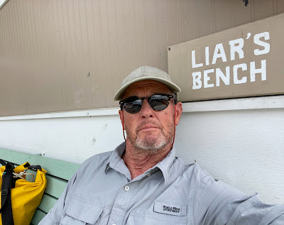
It's a busy day in the nice little town.  I refuel, charge batteries, top off the water bottles and then grab some lunch at Mallards on the Wharf, an excellent Salmon BLT on flatbread with wasabi/lemon aoli.  In the afternoon I walk a few blocks to resupply my snacks at the North Street Market.  And I drop by to see friends John and Maria, then relax and drink a soda in the shake on the liar's bench.


Evening I'm back at Mallards for an enjoyable dinner with Bruce and Nancy, the couple on the chartered sailboat at the end of the dock.  A crab cake and an unusual but excellent key lime Smith Island seven layer cake.  I tell Bruce and Nancy about my conversation this morning with the dockmaster.  They laugh and tell me they had a nearly identical experience themselves.  We list off different things a dockmaster could say to arriving sailors.  "How you doing?," "Welcome to Onancock," "Can I help with the lines?".  Somehow "Do you have a phone?" did not make the list.  The evening with the couple was a special treat.


9.05 NM


Saturday, November 20, 2021

day ten - long walk, longer sail


Cool, grey morning with a strong NE wind.  As I attempt to lower the centerboard it hits bottom.   Low tide, lower than usual I think because what the weather radio is calling a "backdoor cold front" has blown water out of the Honga River.   I haul in the anchor line to see if that will pull us to slightly deeper water.  It does but when I raise the anchor off the bottom the wind blows us back into the shallow water.  I toss out the anchor again so we don't lose any more ground.  It is so shallow the anchor shaft is standing up out of the water.  Swimsuit and water boots on, I step over the side of SPARTINA to find the bottom is sand and solid enough to walk on.  I walk forward to pick up the anchor then keep walking to open water.   About 200 yards and the water is not quite knee deep.  A couple hundred more yard and it is up to my waist.  Not the way I want to start the day.  Anchor set in the sand, back on board, get my clothes back on.


Sailing south on the Honga River with a double-reefed main at 7:45, making 4.5.  Shake out the second reef at 8:05, 4.9.


Pass by the deadrise MADISON with a crew and a dog on board, get a friendly wave.  Full sail at 8:45 as the wind slacks a bit.


Hooper Straits at 9:05, 5.5 in very rough water.  Waves and chop slow us to 2.0 to 3.5 at times, doing 5+ after crossing the middle of the straits on leave the rough water behind.  Dark grey clouds overhead.  Approaching Deal Island at 9:50, lots of boats off the NE corner of the island.  Getting closer I can see it is a fleet of oyster boats with mechanical tongs.  The tongs drop down to the bottom, grab oysters and rocks and whatever then hauls it all up to a culling board where the crew sorts through the catch.  The boats move very slowly so I see no reason why I can sail through the middle of the fleet.  I get a few looks, a couple of waves.


Much calmer at 10:30 in the lee of Deal Island.  Overcast lighter and maybe a hint of sun.  


Darker clouds moving in from the NE at 11:45, making 4.3 with wind just aft of port beam.  I have no planned destination for the day and wind is perfect for making my way south on Tangier Sound.  


Entrance channel to the Little Annemessex River in sight.  Consider going into the river and then taking Broad Creek behind the marsh down to Pocomoke Sound.  Decide to bypass the river and sound.  Heading towards tiny Fox Island.  At 1:50 pass the buoy that marks the Virginia/Maryland state line.  2:45 past Fox Island and turning to SE to cross the shoal that runs from Fox Island to Watts Island.  Crab pot markers help me avoid the shallows.  Making 5.4 with wind forward of beam.


At 3:15 on a SE heading see an old house next to a tree on a sandy point straight ahead.  Skies are getting brighter.  Check the GPS to see if it is Beach Island.  It is.  Pass the island and tack into the marshes behind at 4:10.


After my experience with the shallow in the morning I use the Navionics app on my phone to find my way through the marsh.  Anchor down near a little island on Pompco Creek at 4:40.  The sun comes out.  All is well after a long day of sailing.


Sausage and biscuits for dinner, perfect.

39.62 NM

Friday, November 19, 2021

day nine - windless


Under power at 7:05 after a peaceful, calm night.  Heard the watermen heading out at 5:00 but did not feel the wakes of the deadrises as they passed nearby.  The forecast shows no wind all day but I want to make my way south.


7:40 due south of Hills Point, off Oyster Cove at the mouth of the Little Choptank River at 8:25.  Mizzen up but making no pretense of sailing.


Pass James Island with sadness.  A little over a decade ago it was a chain of three island with solid stands of trees on each.  Now just tiny remnants of the islands and dead or dying trees remain.  


Refuel at 9:40 and take note that SPARTINA has covered 11.16 NM under power with a single tank of fuel.  I do not like to motor but that is good information to have on hand.  


Off what I call the Bamboo Channel at 10:35 just north of Barren Island.  The old channel, now silted in and marked with warnings signs, once gave direct access to the north end of the Honga River.  Local waterman may know the passage through the shoals but I don't.  I continue south past Barren Island, refuel a second time, then turn SE and across the shallows to the bridge that connects the the island of Fishing Creek to the north and Middle Hooper Island to the south.  I think I feel a little breeze.


Under the bridge and on the Honga River at noon.  And some wind arrives.  Full sail.  Making just 1.9, very pleased to be sailing.  Off Smoke Point at 1:00, an old decaying house is tucked behind the marsh grass next to a dead tree on the point.  Making 1.8 at 1:30, tacking south, sometimes losing ground, but enjoying a fine afternoon.


2:10 skirting the marsh approaching Windmill Point, jibe at the point and sail along the shore of Asquith Island.  


Turn back to the pretty little basin just off of Paul's Cove.  Anchor down 3:05.  


Evening, clouds and swirling winds.  Weather radio mentions isolated thunderstorms.

A disappointing Kung Pao Chicken for dinner.

26.5 NM