
I was up just a little after 6, false dawn showing to the east. Small craft advisory (again), strong wind out of the north. I packed up the sleeping gear, raised the single-reefed main, mizzen and jib, sailed off anchor from Pungers Cove just as the sun came up.
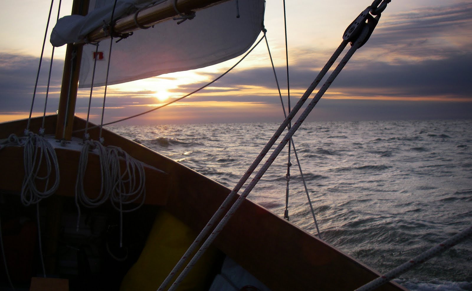
I was sailing north into the wind and made a series of long tacks at around 4.5 kts from South Marsh Island to Deal Island, then back across Tangier Sound to the south end of Bloodsworth Island. One more tack out into the sound and then back to the the north end of Bloodsworth.
It was a rough day and a pretty good amount of spray came aboard. So much that when I heeled over the water up in the bunk flat reached almost to the top of the cook kit (on the starboard side) and light kit (port side). Just before 9 a.m. I hove to out in the sound and went forward to pump out the water. It always surprises me how peaceful it gets, even in rough water, when the boat is hove to. Sure, the flapping jib makes a lot of noise, but the boat itself becomes very calm. It took about five minutes to get the water out and then I was back sailing again.
The next tack carried me NW from the sound along the north shore of Bloodsworth Island and right into Hooper Strait. The wind seemed to fall off a little, the water calmed down and the sun felt warmer in the strait. Below cormorants take flight from the Hooper Strait Light.

As I entered the Honga River I looked back south to see the sun glistening off the water. It wasn't yet 10 o'clock and I was into the Honga River doing 5 knots up past Rippons Harbor. I shook the reef out the main and enjoyed a very pleasant sail. I knew I was in some very traditional water when I saw a marker saying "Hand Tonging Only", picturing the waterman hauling up oysters with only the 20 foot long tongs and a lot of muscle.

I followed the Honga River up around Smoke Point and made a couple of tacks to line myself up for a sail through the bridge that connects Hooper Island to Middle Hooper Island. I aimed for the opening of the bridge on a beam reach, knowing I had some room on either side of the channel as I had seen a few deadrises come in through the bridge and cut across what was marked on the chart as shallow water.

I passed under the bridge doing over five knots. Once beneath the spans the sails backed for a moment in the blocked wind but the momentum carried me through and the sails caught the wind on the far side of the bridge. Now that I was outside I had to pay attention to the channel, there was a shoal on the north side just a foot or two deep. I followed the markers out to deeper water on Chesapeake Bay.

One long tack out onto the Bay and one long tack back in brought me into Tar Bay, the shallows inside the Barren Island shoals. By this time it was mid-afternoon, a little too late to try and make Punch Island Creek. Barren Island would be my anchorage for the night.
I tacked inside, looking at a protected cove up behind the north end of the island. The water was getting shallower and shallower. Spartina's steel centerboard finally touched the bottom. But it wasn't the usual sound of the board going into sand or mud, it was the clanking sound of the board hitting an oyster reef. "Hey, oyster reef. I wonder if there are some stripers around" I thought just as the drag on my trolling rig started clicking.

I hove to in the shallows and reeled in a nice striper. With fresh seafood on board I decided to take the easy way out and sailed south into deeper water and a little cove at the lower end of the island.

And there's dinner. Thin slices of sweet potato, sweet red pepper, bits of garlic and fresh striper all cooked on the griddle.

That night was a spectacular night under the stars. All that wind was from a cold front that brought crisp, clear air down to the bay. I don't think I have ever seen the Milky Way to clear and bright. It was a pretty good day of sailing and a very nice night watching the stars.
steve
distance sailed 35.3 nautical miles
moving average 3.6 knots
max speed 7.7 knots


4 comments:
Great post, Steve. What a perfect, perfect day. How do you top that?
I hate this word - or at least, I hate its too-frequent use, because it is so overused these days, but ... awesome. What a great day, and sounds like a great night too!
What software are you using to plot your course like that?
Thanks!
That is my gps data, imported directly from the gps to google earth. By next spring I hope to have the Garmin charts on the gps which should give another good view of the track. steve
I bought a Garmin 441S chartplotter only a few weeks ago. I've used it to get me out and home again, but I'll have to learn how to download the course plotting like that. Not only is it just plain cool, it also seems to me that it would be very helpful in just knowing where you actually were.
Post a Comment