"When I think of all the fools I've been, it's a wonder that I've sailed this many miles." -Guy Clark

Wednesday, November 6, 2019

a few photos from Curt / daily logs


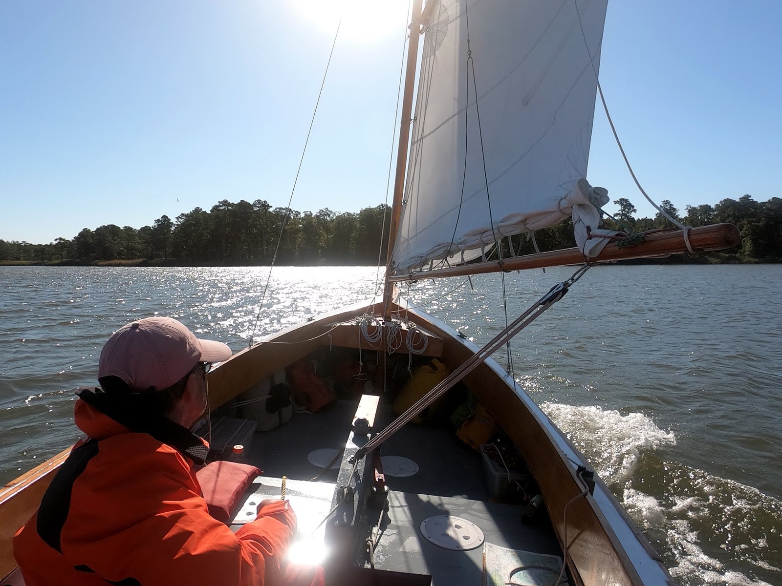
Here are some nice photos that Curt shot of SPARTINA on Chester River, and at bottom anchored on Langford Creek.  

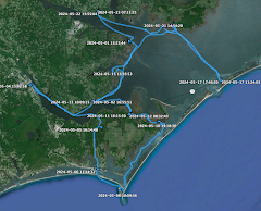
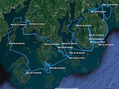
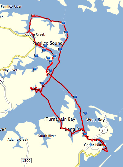
You can see at the right that I've added the track and daily logs from the fall sail.  I've been having fun going back through my notes and photographs to build the log.  I think it was definitely one of my most enjoyable and, at times, challenging sails.


I really like this photo below.  A peaceful morning on the creek.  


day nine - unexpected company

I wake after a calm night, tuck away the sleeping gear and begin to take off the boom tent.  Unhooking the bungee at the aft port corner of the tent I am surprised to look out and see a yawl anchored nearby.  It's ANNIE, a Drascome longboat cruiser.  I knew that Curt was somewhere on the Chester River, I did not know he was right next door.


I raise sail and just the hint of a morning breeze carries us over as Curt put out fenders so we could raft up.  I'm invited on board for breakfast, Curt fixing oatmeal on his camp stove while I bring my own steak (buffalo bar) and eggs (chocolate and sea salt Rx bar).  It's a pleasant and relaxing morning, I see Curt maybe a handful of times each year so we have some catching up to do.  


We talk about the days sail with a favorable forecast of wind and tide to carry us to Chestertown.  Curt talks about doing some explore along the way, I talk about looking for some fish.  We each wondered how the two yawls would sail, I'm thinking Annie will be the faster of the two and Curt saying maybe not.


We cast off 8:30, ANNIE following SPARTINA'S tack down Langford Creek to the Chester River.  As we get out on the open river our plans - Curt's for exploring and mine for fishing - go out the door.  The sailing is too good.


A steady wind of the starboard quarter, we find the two yawls performs very similarly.  We sail side by side, sometimes ANNIE nudging ahead, sometimes SPARTINA taking the lead.  We sail close enough to each other the we carry on a relaxed conversation.  


Curt slides to the north side of the river for a while as I cling to the southern shore.  He dips in to look at a classic old buyboat tied to a dock, I head over to look at a couple silos that look like they have been converted to a home.  


Easy, relaxed sailing, probably the best trip I've made up the Chester.


Passing Nichols Point 10:00, 5.4, 11:00 5kts up river.  Jibe 11:15 Melton Point, jibe again 11:15 Northwest Point, ANNIE always not too far away.


At 11:40 I dip into explore Southeast Creek, meeting up with ANNIE again as I turn back to the Chester.  


Another jibe at Ralph's Wharf, tide and wind carrying us along.  


We round up and drop sails at Chestertown, motoring into the new floating docks.  The dock master comes down to have us move to smaller docks - why I don't know, the season is virtually over and there are very few "large" boats at the larger docks.  But that's what he wants so back out and around the corner, backing into a smaller slip which is a little tricky with the tide and wind but the dock hand helps out.  Tied up at 1:00.

Curt and I explore Chestertown, one of my favorite Eastern Shore towns with old brick buildings, cobblestone streets and trees showing fall colors.  Sandwiches for lunch at Play It Again Sam a couple blocks from the waterfront.  A little more exploring than then we each straighten up our boats.  Crabcakes at 98 Cannon for right on the waterfront.  Curt heads off to ANNIE, I grab a beer and watch a football game on the patio with some Philadelphia Eagle fans before climbing under SPARTINA'S boom tent for the night.


Running total 231.8 NM

Monday, November 4, 2019

day eight - creek sailing


A slow drift down Queenstown creek with the sails tinted yellow by the rising sun.  A cold night - 52 degrees - with wind ripping through the trees.  Making 2 kts on the creek, slipping out on the Chester River just before 8:00.


A stiff north wind on the river, making 5.3 with double reefed main, mizzen and jib.  At 8:30 pass Piney Cove and lose the protection of the land.  Making 5.5 and very very rough, the same waves as yesterday, though now we sail into them instead of across.  


Waves come in groups of three, the first lifting the bow, the second pointing the bow up higher and giving us a little leap off the wave.  The bow then turns down and buries into the third wave, coming up quickly as the spray showers the deck.  Wearing foul weather gear and my rubber boots, we press on.  I catch a set of square sails coming down river, the SULTANA flying by with the wind on her stern.  


We make a straight line towards Grays Inn Creek, suddenly calm and quiet in the wide entrance at 9:20.  I realize it is the weekend as boats are out trolling for striper or running trot lines for crabs.  Wonderful sailing up the western branch of the creek, then back down to sail upwind - a series of short tacks on the narrow water - on Herringtown Creek.  


Still cool and brisk I keep my foul weather gear on.  Blue skies and sunshine.  A woman watches from a screened in porch as we sail by.  


Leaving the creek at 11:30 I shake out the second reef, then round up again to shake out the first.  The wind on the river has dropped, the white caps are gone.  Full sail.  In the middle of the Chester River there are seagulls diving on the water over a school of feeding stripers.  I make a few casts but no luck.  Then try trolling and get one hit but lose the fish.


Langford Creek entrance at 1:00.  Last year I explored the eastern branch, this time I explore the western branch.  Tuna, crackers and cheese for lunch.  I strip off the foul weather gear and enjoy the warmth of the sun.  The western branch is beautiful, wide with coves and creeks along the way.  A deadrise runs back and forth on trotlines.  A few homes along the shore but I find the creek to be lined with marshes and undeveloped shoreline.  Much larger than I had expected,  many excellent and private anchorages, I make a note to come back here again.  

Anchor down 4:15 on the eastern fork of the creek near Hawbush Point.  An excellent beef Hot Pot for dinner.


Running total 215.5 NM

Thursday, October 31, 2019

day seven - broadsides


I'm up early at the Mariner Hotel, the wind howling outside.  Gusts 30+ miles an hour.  The forecast is for the wind to drop to the mid-20s in a couple of hours.  I carry loads of gear down to SPARTINA, the waterproof duffel with freshly washed clothes, the electronics pelican box with charged batteries, charts and notebook.


A breakfast bar with a bottle of soda at the hotel, then a walk along the waterfront where I find an old, decaying deadrise that looked to me like a painting.


At 9:30, with hotel key turned into the office, I push off from the dock and motor over to the boat ramp.  Just about every public boat ramp in Maryland has a porta-potti nearby, a convenient place to empty SPARTINA'S portable head.  Cast off again at 9:45, round up about 20 yards from the dock, raise the jib to sail out of the harbor.


Outside the breakwater raise the mizzen and bring up the centerboard for the downwind sail.  Very very windy, making 4.6 and rolling in the swell that wraps around Swan Point.  


Steep waves on the stern and I watch them creep up towards the boomkin, each time SPARTINA'S hull lifting as the waves slide beneath us.  Blue skies and wonderful sailing, making 3.4 to 4.6 as the waves carry us along.  


The sail down Eastern Neck goes by in no time and I'm looking for the fish trap off of Wickes Beach. I'm surprised to see it outside of us, I've sailed into the shallow water much closer to the shore than I expected.  No worries, the board is up and I see no signs of shoals.  We jibe at 11:10 and make 7.4 down the face of a wave.  


Strong gusts at Hail Point and the wind seem to be building.  A local boat runs close to shore inside of us, we've got deep enough water for sailing.  I lower the centerboard to sail across the wind.  Calmer water at 11:45 as we sail in close to the point.  I briefly consider turning up in to Hail Creek but it is too early in the day.  As we leave the protection of the top of Eastern Neck we're exposed to the steep waves running down the Chester River.  They are steep, almost vertically faced waves that hit SPARTINA broadside, the waves coming in groups of three.  They slap the side of the hull and white water bursts up alongside sending spray flying across the cockpit as SPARTINA heels to starboard.    


I think I see a low cliff that is near the entrance of Queenstown Creek.  I scan the area with the binoculars but in the waves I cannot see the entrance markers which I think are northwest of the narrow channel.  I trust my GPS - which I'm very glad to see is working - and sail due east towards the marker on the tiny chart.  Just as the red buoy pops up out of the waves into view the GPS shows 7.8 kts.  We turn slightly downwind at the first marker, passing the next - Green marker #3 - at 6 kts.  Past the sandbar and into the calm waters of Queenstown Creek at 12:15.  We jibe and sail west and south around the corner to the town dock.  


Tied to the dock at 12:30, I walk the few blocks to Queenstown Pizzaria for the usual - a small Philly cheesesteak, fries and iced tea.  I remember the first time I ordered lunch there.  The guy brought me the sandwich and I was a little surprised by the cheesesteak nearly filling the basket so I tell him I had meant to order the small sandwich.  He says "That is the small sandwich." 

Motoring down Queenstown Creek in the afternoon I share the water with a deadrise making the last few runs of the day on a trotline.  Anchor down Ditchers Cove 2:15.  I lay back in the cockpit and fall into a deep sleep under the warm sunshine.  

Waking an hour later I see a family, husband, wife and young daughter kayaking up the creek. The woman says "You've anchored here before, haven't you?"  I told her I had.  "It was a stormy day" she later reminds and I tell her she has a good memory.  They ask about SPARTINA and the trip, I ask about their farm with the beautiful old stone buildings.  They are nice people and I enjoy their company.  They paddle away, but not before inviting me to visit them at their farm next time I'm on Queenstown Creek.


A buffalo bar and a cup of fruit makes for a light dinner.  I break out the sleeping bag liner and an extra thick shirt, it is going to drop to 50 degrees overnight.  Wasn't it 90 degrees just a few days earlier?

Running total 186 NM

Tuesday, October 29, 2019

day six - surfing down the waves


Sailed off anchor at 8:20 after a rougher night than expected.  Rain, wind and chop arrived in the early morning hours.  The stiff wind was out of the east and SPARTINA was exposed to the waves running down the long fetch of the Sassafras River.  That same east wind should help us with the run down the bay.  Overcast and gusty, we make 2.1 with wind on the stern to the cut off of Pond's Bar.


Marker 5 we catch the wind and make 6 kts, then 3.3 down the narrow channel.  Shake out the reef at 9:00, slow going with wind on the stern, sailing wing and wing.  The GPS seems to be working but I keep the backup turned on just in case.  Just as I feel good about the GPS it loses contact with the satellites.  Try to jibe to Grove Point just before 10:00 but struggle to find a good angle.  Hazelnut Rx bar, steak (beef stick, a new item) and mixed tropical fruit for breakfast.  


Still can't find a good angle to Grove Point so we follow the north shore of the river.  At the river entrance, slipping out on to Chesapeake Bay, we jibe again and turn southwest to Grove Point, waves rolling down the bay lifting SPARTINA'S stern and sliding under us.  A light rain falls.  Tuna and crackers for lunch.


Off Worton Point just after noon, the mist gone and the overcast a little light, making 3.9.  Pass Fairlee Creek 1:05, 4.6 kts.  GPS shows 6.8 during the gusts off of Tolchester Beach where the shipping channel comes in almost to the beach itself.  We stay further offshore for the good wind and cross the channel twice with no traffic in sight.   Making a steady 5.8 at 1:50, the waves pushing us along nicely.


The Bay Bridge coming off Kent Island is in sight just after 2:00, Swan Point juts out to the south at 2:45.  Lighter wind, making 3.5 but it doesn't feel like we are moving at all.  We round Swan Point and as always I mistake Swan Creek for Rock Hall.  Four good tacks into the wind and we round up to drop sail just outside Rock Hall's breakwater.


Docked 4 p.m. Rock Hall Landing Marina, exact same slip I used last year, at 4 p.m., checked into the nearby Mariner's Motel a few minutes later, a couple guys down from Pennsylvania steaming up crabs in the parking lot.  They tell me they are down for about four days, running trot lines from a small skiff during prime crabbing season, steaming up each day's catch every evening.  "Gonna have a big crab party when you get home?" I ask them.  The one guy tells me he'll be too tired to party.

Dinner with friends Fred and MaryLou on the waterfront, a visit to Rock Hall wouldn't be the same without seeing them.  Do the laundry, clean up the boat, charge the batteries, fill out the log.  A good night's sleep before tomorrow's forecast high winds.


Running total 171.3 NM

Sunday, October 27, 2019

watch and gps


I've got a new watch for SPARTINA to replace the one that failed on the last trip.  Average life span for a watch on the boat is about two years.  This one, like all the others is water resistant to 100 feet.  And like the others, this one is set for daylight savings time and will stay that way for the duration.


As for the Garmin GPS 64s, I continued having problems with it for the remainder of the trip.  I used the old 62s as a backup and that seemed to work fine.  I have had a couple long "chat" sessions on the computer with Garmin.  At first they said the problems I encountered were my fault, I had not upgraded the operating system.  So I upgraded from 5.0 to 5.5 (or something like that), went out in the backyard and found I still could not lock on the satellites.  At that point they admitted that they were getting a lot of calls from 64s owners with the same problem (couldn't they have told me that at the beginning???).  The work around to is set the device to GPS only instead of GPS+GLONASS.  So what is GLONASS?  The answer from the all-knowing internet is below.  I have not field tested yet with GPS only.  Garmin says they will get back to me when their engineers solve the problem.

----------------------------------------------

GLONASS, or "GLObal NAvigation Satellite System", is a space-based satellite navigation system operating as part of a radionavigation-satellite service. It provides an alternative to GPS and is the second navigational system in operation with global coverage and of comparable precision.

Saturday, October 26, 2019

day five - a double gps day


Sail off anchor 7:00 after a peaceful calm night.  In the wind shadow of the trees I slowly drift away from shore.  Looking out on the river I can see wind on the Elk River.  One sailboat tacking out on the water, the anchor light still glowing and the two people aboard bundled up and looking as they had been sailing all night.  


Mixed berry Rx bar, buffalo bar and an apple for breakfast.  Water rushing around green Marker "21" shows I will be sailing against a full running flood tide.  Lots of tacking in our future.  


Tacking downriver at 8:20, we make a long run into Piney Cove, hoping for and finding less tidal current in the cove.  Back and forth on the river, sometimes gaining ground, sometime not.  We find a particularly strong current at Hylands Point, the narrowest part of the river.  Several short tacks as I cling to the eastern side of the river hoping for less current, then a long deep tack into the Bohemia River at 10:15 where cruising sailors anchored on their journey south wave and give thumbs up to the little wooden yawl.


Out of the Bohemia at 10:45, tacking with a scratchy voice on sports radio talks about a come-from-behind win.  Off Cabin John Creek at 12:30 making 4.7.  We sail in a hot wind as the temperature climbs to a record-setting 90+ degrees.


Tacking off Turkey Point at 1:45 I notice strange readings on the GPS.  8.9 knts?  A question mark instead of a cursor?  Gaps in the red track?  I text sailing friends Barry and Curt asking if they know of anything going on with the GPS system.  I speculate to them that maybe that attack has begun.  Barry responds with a statement from the GPS folks that says the system will be down for one minute.  


And I am told, yes, that the attack on the country has already begun.  But that is an entirely different conversation....


The one-minute has come and gone, yet I still can't hold a lock on the satellites.  The connection seems to come and go.  I open the aft deck plate next to the transom and pull out there backup GPS, insert batteries and boot it up.  It takes a while to find the satellites, once found it seems to lock on.  I leave them both in operation, the older one to keep the track and the newer one with the more detailed charts.


We round the red clay cliffs at Grove Point, entering the Sassafras River at 3:30.  A pleasant conversation with a Laser sailor and he runs alongside SPARTINA to ask about the boat.  Anchor down near the mouth of Turners Creek at 5:00.  Soon I realize that waves are rolling off the main river and it could be an uncomfortable night.  I raise anchor and motor north to Money Creek.


Spaghetti and a can of peaches for dinner.  While having dinner I realize that for the third time in five days I had changed my anchorage.  A gaggle of geese nearby make more noise than is appreciated.  They eventually quiet down.


Running total 144.4 NM