Monday, October 19, 2026


Friday, October 16, 2026
crossing the Bay

The calmest of evenings yesterday on Forked Creek off the Magothy River, followed by a bouncy crossing of the Bay this morning with wind on the stern and waves rolling up on the beam Now is Rock Hall for laundry, etc and to wait out some weather.
All of the above follow a couple great days in Baltimore as the tall ships gathered for The Great Chesapeake Bay Schooner Race.
Should be sailing on Sunday with plans to enjoy the Chester River for a week or so.


Wednesday, October 14, 2026


Thursday, October 8, 2026
a little bit of everything

Twelve days into the fall sail on Chesapeake Bay and I am just now able to sort the apple phone/google sign-in issues and make a post.
First of all, thanks to friend Matto for the photo above, taken I think just after dawn on Tilghman Creek. SPARTINA and Matto’s TRIM had a pleasant raft-up there, including Matto’s friend Rossco.
The trip has had a little bit of everything. Rain and sun, great wind, good friends in St. Michaels. I’ve stayed mostly on pretty little creeks, most often by myself but at times with a few neighbors.
Fall is in there air, easily noticed because of cool nights, flocks of geese and changing of the leaves in the trees along shore.
I am in Fredericktown on the Sassafras River right now, maybe heading south tomorrow and then over to the western shore of the Bay. Will have to see which way the winds are blowing.


Saturday, September 26, 2026
the haul out

It is nteresting to me that on 13 days of this 29 day trip, I ran into people that I knew. Some of this was planned. Our oldest daughter and her husband were going to be camping in the area, so we did plan to get together. I did know that Matto on TRIM and Bobby on LAGNIAPPE would be sailing up in Maine, so we did make an effort to cross paths. Bruce and I had emailed ahead about sailing LOON, but the lobster boil was an unexpected treat.
But there were the chance meetings - George and Pam on the sloop MOONLIGHT; Ruby, my shipmate on the Schooner VIRGINIA; Sarah, the artist who made a beautiful painting of SPARTINA in Oriental months earlier; Michael, who I have come across on each of the last three Maine sails; and Luke, whom I had met on the dock in Southwest Harbor last year and kindly gave me a ride to the grocery.
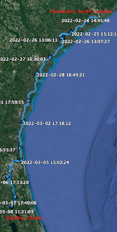
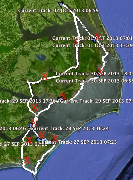
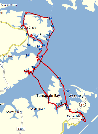
People have commented that I am a "loner" when it comes to sailing, and that is true. But I really do enjoy, maybe treasure is a better word, these chance meetings along the way. I have run into people I know by chance on my winter cruise down south, the spring sail on Pamlico Sound and the fall sail on Chesapeake Bay.
Someone told me a while ago that the coastal community is about 15 miles wide about 2000 miles long. I think there is some truth to that.
Friday, September 25, 2026
day twenty-nine - back to the boat yard

6:30, blanketed in fog. Put on the wool sweater and foul weather bibs. A teasingly light wind as we sail off the mooring, ghosting out of the cove.
7:15 a little more wind, 1.8. Making 2.6, then 4.1 tacking against the tide, listening to a lobster boat somewhere in the mist. Then less wind, tide carrying us toward the rocks, motor sailing.
8:45 rounding Stinson Neck. 9:10 at red marker "2", sailing north at 1.6. Pass Green ledge to starboard, Crow Island ahead to port. 2.4 with wind over starboard quarter. 10:10 pass "EE", the red and white buoy that marks the east end of Eggemoggin Reach. Sun pushing through the fog.
10:35 Smuttynose Island to port, Mahoney Island to starboard. Fog lifting and Naskeag Point plainly visible. Follow the shoreline into Herrick Bay. Coming through the mooring field see friend Michael's beautiful Hinckley 41 sailboat. Sail by to take a closer look, it is a surprise when he comes up from below and calls my name. It is good to see him.
Turn north towards the dock. Drop the sails and tie up to the dock. The trip is over. I will haul out at dawn tomorrow.

11.86 NM
day twenty-eight - welcomed

Wake to find the rain and wind gone. The fog lingers.
I've got to haul out in two days. I could easily be back at the boatyard on Herrick Bay by this evening. Instead I'll split the trip home into two shorter days. Today I hope to reach somewhere up around the Southeast Harbor area on the east side of Deer Isle.

Anchor up and under power 9:15. Time to spare so I head towards Stonington, might as well start off the day with a pastry. The fog is thick and I navigate through Merchants Row with Navionics on my phone. I take my time, motoring slowly through the islands and past the ledges.

10:15 docked in the very quiet Stonington Harbor. Not another boat at the town dock.

A cinnamon roll and a glass of iced tea, with an unrequited hope for a lifting fog.

12:10 sailing at 2.1 in thick fog. Navigating with the compass on the centerboard trunk, Navionics on my phone and GPS, and struggling to maintain a straight course. Find myself almost 90 degrees off course at the east end of Russ Island. Maybe too much information. Choose to go by just Navionics on the phone.

12:55 hear a load diesel coming up the channel. The Isle au Haut Ferry OTTER appears out of the fog, moving fast, throwing a big wake. I would think they would have seen me on the radar, they certainly see SPARTINA now.....and keep coming at full speed. The ferry goes by and I turn 45 degrees to bounce over the wake they leave behind.
1:15 Grog Island to port, sailing at 1.4. 1:45 here the engine on a lobster boat but don't see it. 2:00 thicker fog, making 0.5. Motor sailing.
2:45 Navionics tells me Eatons Point is ahead but I can't see it. I can hear a barking dog, so land it near. Light rain falling. Turn to port when I see rocks, then round the dark shape in the fog. I see a sailboat at a mooring, a hillside covered in trees to the east. A power boat at a second morning. I begin looking a place to anchor. See a third mooring, this one marked "guest." Maybe I'm the guest. Sails down, tie up to the mooring. Boom tent up. And now that I'm done sailing... the fog begins to lift.

Evening, clear skies and the sun feels good. I hear some noises from the floating dock, a man is launching his dinghy. He rows towards SPARTINA and I'm wondering if I'll be welcomed or asked to leave. Gary arrives with a smile, he tells me I am his guest and I am welcome at the mooring. How nice. He comes alongside and out of a cooler he produces two cans of beer, letting me choose one and he opens the other. We have a nice conversation about sailing, boats, Maine and travel. He is a really good guy and I am happy to meet him.
Gary tells me to give him a heads up when I am in the area next year, he'll have me up to his house for a visit. I look forward to that. Gary reaches in the cooler and hands me two more beers. I thank him for his hospitality.

8.24 NM
Thursday, September 24, 2026
tracking URL

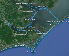
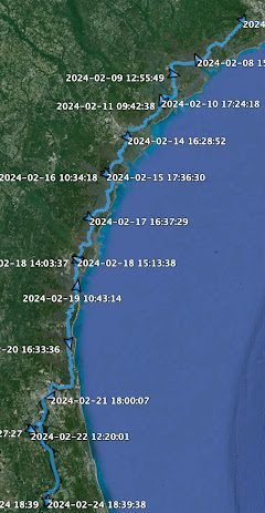
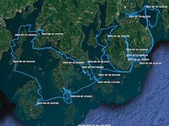
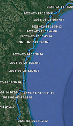
Here is the tracking map for the fall sail, or copy and paste the link at the bottom of this post. Hope to start the Chesapeake Bay sail as soon as this nor'easter moves on. Hopefully Sunday, maybe Monday. It reminds me of the nor'easter that had me seeking shelter off the Patuxent River during last year's Bay sail. Anyway, at least I'm not out there for this one.
https://maps.findmespot.com/s/NN47#history/assets
day twenty-seven - a morning walk

Morning comes with a light overcast and mild wind. Gusts roll through the anchorage now and then. The forecast calls for strong winds and rain in the afternoon. Looking at the charts, I am already in the perfect spot for the weather. But I've got time for a visit to Stonington before the rain arrives.

An easy sail, wind on the beam, makes for a short commute. 4.3 into the harbor. Tie up at the town dock, just a couple of boats there on a grey day.

Ice tea and catch up on email at 44 North. Then a walk along the waterfront. A quick sandwich, cast off before noon with an easy sail back to Round Island.
Heavy rain arrives early evening.

6.34 NM
day twenty-six - a sail through the islands

Morning comes with a welcome north wind. All quiet on LOON to the south. Sail off anchor 6:35.

I immediately put Bruce's local knowledge to use, four tacks north and then slip through the cut in the bar just below Pond Island.

After so many foggy mornings, I delight in the warm sunshine. The north wind is perfect to sail across to Merchants Row.

Terns feed on a tide line outside the cut. 7:15 less wind. 8:15 better wind at Green Ledge and can feel the strong ebb tide running.

8:35 pass between the two rocky islets marked on the chart as the Lazygut Thrumcaps. 8:45 making 2.8 and feel less of the running cross tide coming into Merchants Row.

10:20 tied up at the town dock in Stonington. Iced tea and wifi at 44 North Coffee, then a salad for lunch at Stonecutters Kitchen. Pick up a few items at the convenience store, cast off 12:20.

I find the afternoon wind is out of the south, blue skies and perfect day to wander around the islands south of Deer Isleand. Full sail on Merchants Row.

Leave Green Island to port, cut north of St. Helena and Bare Islands, tack at the rocky shallows on the east side of Coombs Island. Four tacks carry us to just south of Ram Island and from there I can see the windjammer ANGELIQUE anchored in the cove on the north side of McGlathery Island. I take a turn into the cove and watch as they raise sail.
ANGELIQUE heads east, I turn southwest between McGlathery and Gooseberry Island. Follow the shore around McGlathery Island, pass the cut and jibe to Round Island at 3:15. Follow the shore of Round Island and make a series of tacks between Round and McGlathery Islands, anchor down 3:40. Just a great day on the water.

18.54 NM
day twenty-five - the lobster boil

Foggy, quiet morning on the Benjamin River. I have no specific plans for the day. Might head to Merchant's Row, might head to the Opecechee anchorage just above Swan Isle. Sail off the morning 7:20 with a light north wind. A couple of tacks through the mooring field to enjoy the boats, then motor sail down the channel as wind falls off.
7:45 on the north edge of Eggemoggin Reach. Wind, what little there is, is now out of the south. Cold and damp with fog, I put on the wool sweater. I get a text from Bruce, who had me out for a sail on his Friendship Sloop LOON.

It is an enticing offer, one that persuades me that Opechee - an anchorage surround by Pond Island, Sheep Island, Black Island and Opechee Island - is now my destination. I tell Bruce I am headed that way. I will check in with him at noon to confirm that I will be there, and we will also discuss then who is buying the lobsters off a lobster boat.

8:10 ghosting in light air, doing less than 1.0. Motor sailing. 9:05 hear a diesel, can't see the boat. White glare ahead, the morning sun shining through the fog. Blue haze to the stern, blue skies overhead.

9:25 Conory Ledge to starboard, sailing east at 1.4. Fog beginning to clear. 10:00 tack. Making 1.6, ebb tide helping us along. 10:30 tack at White Island. 10:55 tack at Hog Island. 11:20 tack at the east end of White Island. Wind that had been out of the east now swings to the south and fills in, making 3.4. Wind on the beam and improving, 3.9 and blue skies overhead. I'm headed for the Casco Passage which runs west to east between the Opechee and the north side of Swan Island.

Bruce checks in earlier than expected, he's already got the lobsters on board.

I respond that I've got tins of mussels and trout filets on board, they could be nice appetizers for the lobster boil.


I've got wind on the beam and at 12:00 enter the Casco Passage with small Johns Island and the larger Opechee Island to port. 12:15 a green buoy shows I've got a helping tide, less wind above Swans Island but still making 3.4.

Turn north then northwest to round Black Island, and with a brisk wind slip into the anchorage. Anchor down 1:20.

LOON rounds Black Island, sails into the anchorage and make some easy tacks before dropping anchor just southeast of SPARTINA.

Once settled, Bruce and Nancy row over in the dinghy BAX, come up alongside to say hello. We visit for a while and Bruce points out that it is still early in the afternoon, we ought to go for a sail. It is a fun sail and Bruce, who knows these islands well, shows me a cut through the bar between Pond and Opechee Islands that could have saved me a lot of time over the years. I thank him for the local knowledge.

Bruce and Nancy head back to LOON, telling me they will pick me up in an hour or so, plenty of time to rig SPARTINA for the night.

On shore at Sheep Island, Bruce and Nancy are busy building a fire. My job is to collect seaweed, not the old stuff along shore, I need to wade out and get the fresh stuff off the rocks.

Fresh lobster and corn, tinned trout filets for an appetizer and a beer chilled in the cool salt water. All that and good company. What more could I ask for?
A nice hug from Nancy, she's staying on shore to gathering the cooking gear, Bruce rows me back to SPARTINA. I thank him for an enjoyable afternoon and evening.

14.0 NM
Subscribe to:
Posts (Atom)