"When I think of all the fools I've been, it's a wonder that I've sailed this many miles." -Guy Clark
Showing posts with label life on board. Show all posts

Tuesday, April 5, 2011

moving things around


Made a few adjustments on the packing chart this morning.   This is for cruises when there are two of us on the boat.  This chart is a couple of years old and a few items have moved here or there but it is really pretty accurate as far as weight distribution.


With two of us on board, plus all the food and gear, there is a lot of additional weight, particularly up forward.  And up forward, as you see from this photo of Bruce on Spartina leaving out of Engelhard, is where it is often very comfortable to sit.  So I've been wanting to shift a little weight aft to make sure we maintain a good balance on the boat.  

I've marked in red things that could probably move aft and be stored in the four compartments under the cockpit seats.  These storage areas are very much under utilized, on a typical cruise we use 50% or less of the space in there.  We'll look at moving the tool kit, spare anchor and chain for their usual storage spaces below the bunk flat to the very aft compartments under the seats.  And we can also move some of our food - most likely the fruit cups - to the forward compartments under the seats.  That fruit I consider to be one of our luxury items on the boat - not in the sense of cost but in the matter of weight.  A few dozen fruit cups, "fruit in heavy syrup" as the package says, are in fact a fair amount of weight.  So why not move them aft a little bit?  


The amount of weight isn't the issue, Spartina can handle that just fine.  It is the distribution of the weight I'm looking at and I think this will make things a little more comfortable.

steve

Friday, October 1, 2010

Day Seven - Smith Island


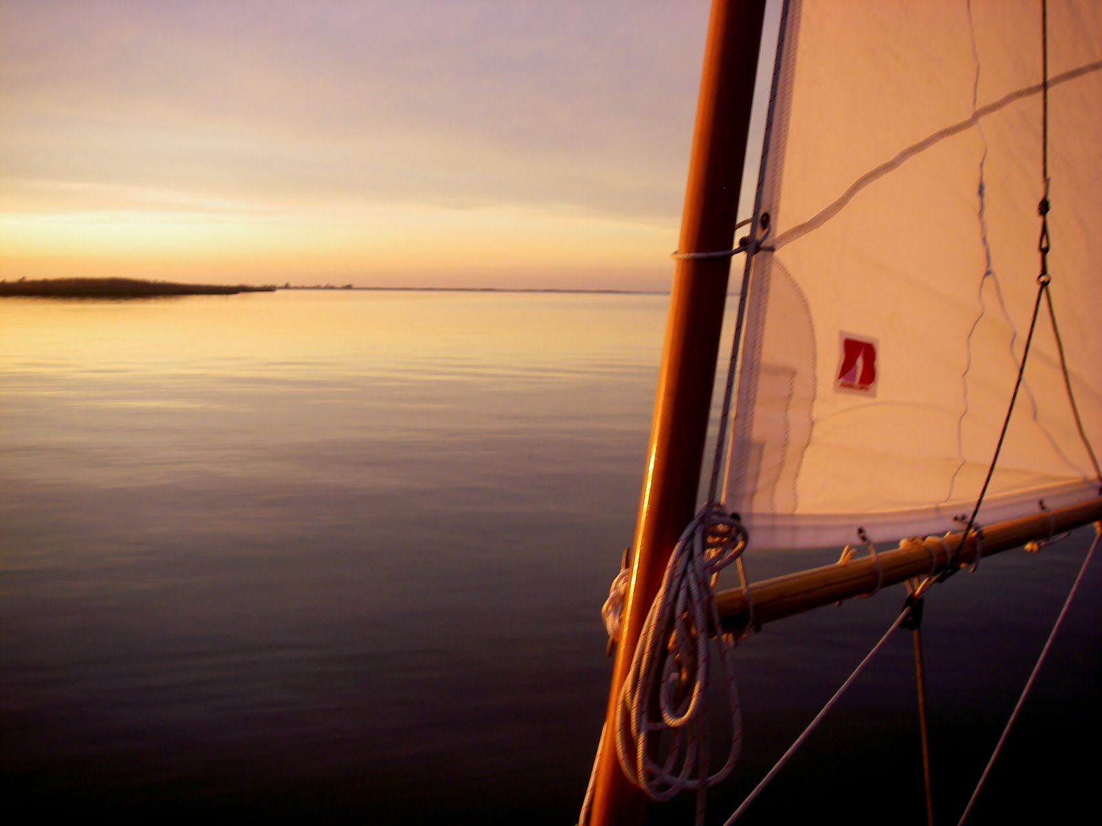
Another clear morning, headed east out of the creek under full sail at sunrise. The wind was forecast to be light out of the north in the morning, switching to southwest in the afternoon.


At the south end of South Marsh Island I turned southwest into Kedges Straits, the water that separates South Marsh Island from Smith Island. I photographed Solomons Lump Light, which dates back to 1895. You can see that the light tower sits off the to the side of the brick platform. A lightkeepers house once stood on that open space, but was removed when the light became automated in the 1950's.
Watching my position in relation to the light showed that I was moving east back into Tangier Sound. The wind was dropping and the incoming tide was carrying Spartina sideways (from my experience tide is much more a factor in Chesapeake Bay than in the Sounds of North Carolina). I started up the outboard and motorsailed through the straits and down the western edges of the Martin National Wildlife Refuge, the northern end of Smith Island. The wind picked up as I sailed past the jetties that are the western entrance to Ewell. Bruce and I had sailed out of those jetties a year earlier.

Sailing in the shallows on the western side of Smith Island I got an education in local navigation. I was looking for Sheep Pen Gut near the community of Rhodes Point to cut across the lower portion of Smith Island to Tylerton. My chart showed a marker southwest of the gut with a channel 50 feet wide by 5 and 1/2 deep. The word "gut" should have told me something. It didn't say creek or channel or river. It said gut. I've heard that term a lot on Tangier and other places on the eastern shore. I've seen it used for everything from a 20 yard wide channel to a tiny opening barely wide enough for a kayak. (I think - but don't know for a fact - that the term gut comes from the dutch word "gat" which means hole or opening).

So I looked for a nice channel with a marker and didn't see it, sailed right by Rhodes Point (I could see the houses behind the marsh) and realized I must have passed the gut. So I turned back north over the shallows toward the north end of Rhodes Point. I saw a small skiff rushing right along the marsh headed south. I guess it must have been heading for the gut. I looked over the side to check my depth and when I looked back up the skiff was gone. I didn't see where it went but figured it had to have slipped into the gut.

I headed out into deeper water, went north a bit and then came south along the marsh until I saw the small opening angled from northwest to southest, the marsh in front and behind overlapping so it was hard to see from off the shore. As I got close I saw that it was in fact marked - but only by three small tree limbs stuck out in the water.


If you look at the satellite photo of Smith Island above you'll see Spartina's path, in blue. What I came to realize was the only waterway connecting the villages with the standard 15 foot tall red and green markers is drawn in white and red. That is The Thorofare. There are dozens of creeks and guts in and around the island, but the only well marked passage is The Thorofare. All the others are marked by sticks, pipes, pvc or whatever was handy to the waterman at the right time.

Below you'll see a typical channel marker for Smith Island. They are there for the local watermen who know what the markers mean, which side to pass them on and what tides are good for the channels. For non-locals like me it is use at your own risk.

So I entered Sheep Pen Gut and, with sails down, motored south along the Rhodes Point waterfront, a mixture of well-kept homes, vacant homes, crab shacks and crumbling piers. At the south end of Rhodes Point, near a boatyard with a marine railway, the channel turned east towards Tylerton.

I rounded the corner to find three pipes jutting out of the water marking some shallows. But I wasn't sure which side to pass on. I chose the north side, it was next to the lift for hauling workboats out of the water and figured there had to be deep water there to bring the boats in and out. I slid right up on a shoal (the centerboard was raised so the flat part of the hull sat firmly on the mud). I used my oar to push back off the shoal and backed right up on another shoal. So I pushed off, that made a tight turn back to the channel and went on the south side of the three pipes.

There were navigation markers (finally!) "5", "3" and "1" that led me from Rhodes Point to Tylerton about a 1/2 mile away. I motored down the channel and tied up at the public pier (I'm assuming it was a public pier, it wasn't marked as such but had a "use at your own risk" sign on it). There was an old crab house on the pier, a bushel of live crabs sitting outside and a bushel of steamed craft right next to it. A gentleman on shore told me Spartina would be fine where I left her.

Spartina was tied up just after 11, a perfect time to walk to Drum Point Market for some lunch. It was just two blocks to the market (I think the entire village is just six blocks by eight). This was a real treat, I was very happy to be there as this was one of the restaurants that was listed in the NY Times piece that was the basis for the Crabhouse 150 sail last year. We didn't make it to the Drum Point Market on that trip, but it was well worth the visit this time.

There's my crabcake sandwich above. I haven't consulted with Bruce about it but when I compared it to our crabcakes from last year it would have come in a very strong #2 overall (those crinkly chips made from fresh cut potatoes where a real plus). The other Smith Island crabhouse, Ruke's, retains the #1 rating based solely on their generous use of jumbo lump crabmeat.
But none-the-less this was a great lunch, sitting on a nice enclosed porch on a very pretty day, watching the locals as they passed by on the narrow lane.
Lunch was great, but it did not last long enough. By just after noon I was untying the lines and getting back out on the water.
It took me a while to figure out which way to go. I wanted to head south on Tyler Creek and then turn east at Horse Hammock Point. But there were no markers (that I could see). Finally three small fishing boats leave the waterfront heading south and I followed along. The channel went south, then curved east and then south again, all marked by the occasional stick or pipe placed out in (at least it seemed to me) the middle of nowhere. Once I spotted the markers and watched the small boats ahead of me, I began to see the path of the creek through the shallows.

By 1:30 I had crossed over the shoals at Horse Hammock Point and was sailing north along the eastern side of the island. I say "sailing" but it was almost a drift. I think the tide was carrying me more than the wind. But that was ok, it was my last full day on the water, I was very happy to just ghost along under the gentlest of breezes. It took a couple of hours to make it up past the little island that marks Drum Point. There the wind and tide failed completely, so I started up the outboard and rounded Terrapin Sand into Back Cove. Dropped anchor in the beautiful marshed lined bay at 4:00.

Once anchored and with the boat cleaned up I jumped over the side for a really relaxing swim in the warm water of Back Cove. I can't begin to describe how great it felt. I just floated there for the longest time, checked out the hull of Spartina, swam down and looked at how the anchor had set in the soft bottom. And then I floated and floated some more. Afterwards I stood up on the foredeck and poured my last gallon of fresh water over my head for an open air shower.

That night for dinner, the last meal of the trip, I took a hint from our last dinner on the Tag Team 200. Instead of cooking ( and dirtying up pots and pans) I made dinner out of the leftover appetizers. Smoked oysters, anchovies on crackers, cups of fruit and peanut butter crackers. Just right for a nice, simple meal in a pretty cove. (I do wish I had had an ice cold Carib Beer, like we had on the Tag Team sail.)
I filled out my logbook, read the last chapter of The Lost City of Z (perfect timing to finish the book on the last night of the trip), and relaxed.

The bivy was all set up and it was probably time to go to bed. But instead I just stood there on the aft cockpit seat, resting my arms on the main boom. The breeze was warm and out of the southeast. The moon, nearly full, was rising to the east. And I could look out over Black Cove, past the marshes and see Tangier Sound and the lights of Crisfield in the distance. I stood there for the longest time - 30 minutes, maybe 40 or maybe an hour, I don't know. I just stood there and soaked it all in. It was almost time to go home, but I wanted to enjoy that last night on the water.

steve

distance sailed 21 nm

ave speed 3.3 knots

Friday, September 24, 2010

so the sheriff asks my wife if she knows where I am.....

I can't begin to describe what a great trip this was. Eight days, all sunny. Beautiful water, coves, bays and rivers. The gps odometer showed 191 nautical miles/220 statute miles of sailing. Below is a photo from one of the cloudier days. Really.


And fresh fish was on the menu a couple of times. In this case a striper. I also had good luck with bluefish.

Anchorages were nice and peaceful, like this little unnamed cove off of Broad Creek, which is off the Choptank River.

There were four days of small craft advisories while I was out, this was the third day of warnings with wind up in the 20 knot range with gusts higher. I was sailing upwind on the Tred Avon River, a two mile stretch of river directly into the wind to get to Oxford, Md., the northern most point on the trip. The yawl, under mizzen and jib, handled it very easily. As my friend Kevin (of Slip Jig fame) said, it was "blowing like stink out there" (we missed each other in Oxford by a matter a minutes).

And of course of some (beautiful) calm water mixed in there.

Hey, I don't look too terrible after six days on the water.

It was just a great trip. Lots of fun, adventure. I made a couple of mistakes here and there, pushed myself a bit and learned a little bit about sailing (and myself).

As for the sheriff, the Sommerset County, Md. Sheriff's Dept. called my wife yesterday asking if we owned a green jeep wrangler that seemed to have been sitting at the Rumbley, Md boat ramp for a long time. A concerned citizen had called in about it. Yes, she said, I was out on a sailing trip. She tried to explain my approach to safety and SPOT satellites and all that but by the end of the discussion she felt like she was being lectured (when it should have been me being lectured).

Deputy - "The Bay can be a very dangerous place."

My wife - "Yes, I know, that's why I am at home in my living room."

Deputy - "Well can you have your husband call us when he gets in?"

I did call the Sheriff's Office this afternoon and thanked them for their concern. I told them I had checked with the road dept. (who controls the ramps) and they said it was ok to leave a vehicle there in the parking lot. And pointed out that I had talked with the marina owner next door and told him that I would be out for a week.

And again, I thanked them for checking on me.

"OK, but how about letting us know before you go out next time?"
I will let them know. There will be a next time. It was a great ramp and a great place to sail.

I have a lot of cleaning up to do but hope to start posting daily logs in a few days.

steve

Wednesday, September 15, 2010

the sail away blues

I always have an unsettling mixture of emotions on the first day of a cruise. This will be my ninth trip on Spartina so I've got a little bit of experience, some good equipment and a decent idea of what I'm doing. But the feelings are always the same - excitement, apprehension, self-doubt and a little bit of guilt thrown in.
Excitement, because this is a trip I've been planning for months and I think it will be a great adventure. I can't wait to get out there.
Apprehension, because there are a lot of unanswered questions. What will the weather be like? Will it be too windy? Will there be enough wind? Will I make good decisions? Did I pack everything I need? What am I getting myself into?
Self-doubt, isn't that little emotion always hiding there somewhere on the boat. Do I know what I'm doing out there, out of sight of land with waves and wind on the bow? Hey, is that a thunderstorm coming my way?
And yes, guilt. After all I'm essentially ditching the family for a week. Once I turn off the phone and cast off the lines I'm concerned about one thing - me. Wife, daughters and dog will have to fend for themselves until I'm done fooling around on the boat.

That's me above in a photo shot by Bruce heading out of Engelhard, NC on Far Creek on the first day of the Skeeter Beater. I've done eight cruises, four solo and four with Bruce along. Having a good sailing partner like Bruce is a real plus. Interesting conversation, a lot of help with the sailing and a second opinion sometimes saying "Is that what you really want to do?"
I'll be on my own on this trip and I bet sooner or later I'll find myself saying "What would Bruce think of this?"

These are the notes from the first day of the Tag Team sail last June. When I look at the notes it sounds so simple and straightforward. But it doesn't begin to communicate the research, planning, packing and thought that goes into a cruise. Details about marinas, distances and prevailing winds were analyzed, thought and rethought, charts examined and satellite photos studied. And after all that, the first day boils down to a simple sail across the Pamlico River.


Of course the first day always includes the drive, in the case above a drive in the rain to Germantown, NC for my Spring solo sail. Two hours of rain. Talk about a sense of foreboding....


And on the first day, after the drive, comes the boat rigging and loading. Rigging takes about 45 minutes, loading another 30. Hot and sweaty, in a light rain (again) in Crisfield at the start of the Crab House 150. I always wear shorts and tee shirt on the drive to the ramp, with my sailing clothes tucked in a bag in the jeep. So after I get all worked up with rigging the boat I can change into nice clean clothes for the start of the sail.


Above is photo from Crisfield, this one in 2007 on the first day of my first cruise with Spartina. After packing the boat I sat there looking at it wondering if I packed everything I needed. I wasn't sure about that, but figured I packed enough to at least survive for a few days.
And talk about nervous, my heart was pounding. No SPOT (I didn't know what a SPOT was back then) and no GPS (I couldn't afford one). I did maybe 60 miles on that four day trip, Crisfield to Great Fox Island to Watts Island and Tangier. Then hunkered down while a front passed through, sailed back to Great Fox Island and then back to the ramp.

That's Spartina splashing through the chop on the first day of the Tag Team sail last June. Weather is always a big question when I leave the dock. Sometimes good wind, sometimes no wind and sometimes way too much wind. And throw in a little lightning or a sun that seems to want to blind you and you realize that sailing is only a small part of the deal. The rest is coping with the elements.

Above is Spartina drying out at the end of the first day of my Spring 2008 sail on Pamlico Sound. I was sailing south single-handed from Engelhard with a strong wind out of the SW. Reefed and then double reefed I spent hours beating into the wind and the waves. Once or twice I thought of turning back to the ramp. I hove to three times to bail out the boat. After one bail out I didn't sail two minutes before taking another wave over the bow. And finally tacking into Wyscocking Bay I see both a thunderstorm and a coast guard patrol boat coming my way. The thunderstorm moved on quickly, the patrol boat watching me until I entered the protection of the bay. I wanted to wave to them but worried my hand raised in the air would be misconstrued as a call for help. Calm water never felt so good.

And evening, on the first day of the Weekend Walkabout. That was a day that started with driving two-plus hours in the rain, rigging and loading the boat in the rain and sailing away from the dock under grey skies. That beautiful evening, I figured, was the reward for it all. Take all the money you want and you couldn't buy those colors, the glassy calm water and the rich glow of the sails.
That first day of a cruise is always an interesting one. And it is only in the evening of that first day that I start to feel comfortable.
Yes, I know why I am out here. Yes, I know what I'm doing.

steve

Thursday, July 1, 2010

Day Two - bays and rivers, canals and creeks

We had the anchor up at 6:15. It had been a warm night, a few bugs but not too bad as we were zipped behind the mosquito screens in our bivy's. We motored past Dawn Patrol to say good morning and then headed out on the ICW. There was a nice breeze out of the east (where was that typical SW wind???) and we headed south at around 3 knots.


Approaching the canal section of the ICW at marker 14 we started motor sailing, the trees along shore were blocking the wind. For the next hour or so we switched back and forth from motor sailing to sailing. Sometimes we caught a nice breeze, sometimes we liked having the outboard running when we had to deal with oncoming traffic. Just after 8 a.m. we passed the fish processing plant and shrimp boats near Hobucken and turned east on to Jones Bay.

The night before, anchored in faux Dixon Creek, we had talked with Paul and Dawn about our plans for the next day. They were heading south on the Bay River to Chapel Creek to see their friend (and designer of their Core Sound 20) Graham Byrnes. We were planning to check out the little town of Vandemere and visit Jones Bay, Ditch Creek and the Dump Creek along the way. You can see the tracks from both boats below. We both started out on the ICW, Dawn Patrol continued south on the ICW while Bruce and I headed east (into the wind) on Jones Bay and then down the creeks to the Bay River.

Tacking into that wind on Jones Bay was a great ride. I tried to use up every inch of the bay, tacking up almost to the marsh grass before coming about. Sometimes I felt the centerboard touch bottom as we tacked, sometimes not. In the soft mud it didn't matter. Wind was strong enough that we were doing 5.5 knots. Bruce caught up on his rest (below) while he adjusted from the west coast to east coast time zones.

(Steve is correct that I was catching some ZZZs and at first I attributed it to time zone changes. But I think as the trip wore on and I was really feeling sleepy a lot, the tiredness was in part due to the heat and humidity. It really zapped me. Usually we are on our cruise weeks earlier or later in the year when all the heat and humidity aren't so potent. Steve just smiles and says,"don't you just love all the weather?'"or "You get used to it." That's like what we say in the west when the temp. is 120f, "Yea, but it's dry heat." We had days in the 90's and high humidity. Most of the time it was tempered by being on the water with a nice breeze blowing. That's when the sailing was great and life was good. Bruce)

We found the entrance to Ditch Creek and followed it south and then east until it turned into Dump Creek. I had passed through this area just six weeks earlier, it was just as pretty as I remembered it.

The creek, or ditch really, is not more than 15 or 16 feet wide. We dropped our sails, raised the cb and rudder, and motored down the narrow waterway. It took just 15 or 20 minutes to transit the creek. But it was a beautiful ride through the marsh. We had planned out the trip looking for just this sort of passage. In fact we had a total of four small canals built into our route.

(The canals are really fun to go down, nice for photography, and sort of reminded me of the Disneyland jungle ride, complete with croaking frogs and buzzing insect noises. Only these were real and were accompanied by routine visits from the dreaded deer flies. These incideous creatures can land on you and you can't feel them until they take a chunk out of your hide. OUCH! Then an itchy welt appears. These particular flies had a fetish for our feet and ankles. By the end of the day I had three bites on the ball of one foot. How they bit the bottom of my foot, three times, remains a mystery, but I had the itchies for several days and could feel the welts every time I took a step. Demon Bugs, they are. Bruce)

As we left the creek we could see the peaks of Dawn Patrol's sails to the west as they left the ICW at Gale Creek Point and turned up the Bay River bound for Chapel Creek. We followed a mile or maybe more behind them. We eventually lost sight of Dawn Patrol as they rounded Bell Point and sailed southwest to see Graham. We headed directly into the Vandemere waterfront.

I've got to say the visit to Vandemere turned out to be a disappoinment. Broken down piers lined the waterfront, what looked like vacant buildings lined the street beyond. We motored along and followed a power boat up a creek. There was a narrow boat ramp with an old pier beside it. A woman with kids crabbing on another pier pointed us toward a few nice sailboats tied up across the inlet at yet another pier. She thought it was a marina but it looked more like a private pier to us. So we turned back out of the creek and without having set foot on land we sailed back down Bay River towards Bonner Bay.

Entering the Bonner Bay a couple of hours later we could see a thunderstorm passing to the west of us with some lightning that reached down to the ground. We hoped Dawn Patrol was on the far side of the storm (she was, we later learned).

We spent the afternoon sailing in the bay and tracking the shore line, Bruce at the tiller while I cast a lure up along the marsh. I had my usual fishing luck - none - but that was fine as it was a nice afternoon and a beautiful bay. Bonner Bay, which is at the junction of the Bay River and four large creeks - Riggs, Spring, Long and Dipping Vat Creeks - was a great spot that reminded me of Wysocking Bay and Mouse Harbor. Lots of open water, lots of anchorage. Plenty of room for good sailing and plenty of protected water nearby.

We were fishing along a shoreline (A, above) about 4 pm when we saw the cat ketch rig of Dawn Patrol heading in off the Bay River. She looked beautiful in the afternoon light. We raised sails and headed out of meet her on the way in (B), turning to sailing along with her and get some photographs. With plenty of calm water in the bay we dropped anchor and rafted up for dinner (C) and compared notes on our day of sailing. (Bruce and I later moved a little to the east to anchor for the night (D)).

Paul and Dawn talked about their trip down the ICW, the visit to see Graham Byrnes and the thunderstorm that they had dodged. It sounded like a great day. The skies cleared for a very nice evening.

We had dueling shrimp dinners that night, Dawn fixed stir fry shrimp with asian noodles, Bruce fixed shrimp tacos with black beans, cabbage, cheese, cilantro sauce and guacamole. Both boats were doing very well in the food department.

And then of course the evening was spent relaxing and talking. By this time it was becoming evident that we all got along so well that we would be spending much, if not all of the trip together.

(I couldn't agree more. I really enjoyed our evenings with Dawn Patrol. Bruce)

And the great afternoon was followed by a great sunset with spectacular clouds off to the east.

As we re-anchored to the east of Dawn Patrol we got a pretty nice view of her at twilight.


I think I shot the photo above, a nice cloud and some of Spartina's rigging, and Bruce got the photo below of her mizzen boom and the setting sun. Nice photo Bruce!

steve

Distance 29 nautical miles
Max Speed 5.9 knots (tacking into the wind on Jones Bay)
Average Speed 2.7 knots (includes drifting along the shoreline in Bonner Bay)
Moving Time 10 hours 34 minutes

Sunday, May 9, 2010

Day Two - lessons learned and great sailing

I'm still trying to figure out the calculus of mosquitoes - when, where and how many will there be? I'm learning slowly and got a good lesson on the topic when I woke up anchored in Mouse Harbor on day two. I could hear the mosquitoes buzzing outside the bivy when I went to sleep, when I woke up in the middle of the night and again when I woke up in the morning. It wasn't the typical buzzing of a few mosquitoes hanging outside the bug screen. It was more like surround sound. Not good on a boat that doesn't have a stereo. I was fine inside the bivy, but suspected I would have to deal with the mosquitoes at some point.

The thick fog that night had left heavy dew on Spartina's deck. When I climbed out of the bivy in a cloud of mosquitoes I saw that the wet decks were covered with dead and dying mosquitoes. Thousands of them. I had never seen so many. The white foredeck was almost black with the bugs.

No, I did not take any photographs. I was too busy unhooking my bivy to clear space in the cockpit, raising anchor and cranking up the outboard to get away from the marsh. I ran a couple of hundred yards away, anchored and stowed the sleeping gear. Then I ran out more into the open water of Mouse Harbor and let Spartina drift while I cleaned off the decks. It was really a mess. No fun at all, but my notebook shows that an hour and five minutes after waking up to the hum of all the skeeters I was under full sail.


The fog was still thick. I had just learned about mosquitoes, next I would learn about navigation. My goal that day was to work south past Little Porpoise Bay and Big Porpoise Bay to reach Middle Bay and maybe Jones Bay. It would be simple enough, just follow the shoreline out of Mouse Harbor then head south. I had my satellite photos in hand as I sailed and motor sailed (the wind fell off) away from Island Creeks around a point to Voliva Bay and past a second point to Fate Bay. I could see Sound Point from there and knew that just around the corner would be Pamlico Sound.
I was trying to judge the distance to Sound Point so I (finally) took a glance at my gps. It showed that I had already left Mouse Harbor, sailed past Little Porpoise Bay and was halfway across Big Porpoise Bay. Wow, I was miles away from where I had expected to be. In the grey fog, with no rising sun to give me a sense of direction I had lost my bearings and completely misjudged distances. While rounding what I had thought was the point at Voliva Bay I was really passing Sound Point. What I thought were little coves on the shoreline were really large bays. In this case it was no problem. In fact I was happy to be a few more miles into that day's trip. But it was a great lesson for me on navigation and fog. Sure, use landmarks to keep track of your position. But confirm it with that gps.

Early that morning while I was pouring buckets of water on the decks to clear off the mosquitoes I had to wonder why I was out there. I got the answer just after 9 a.m. as the skies cleared for a beautiful day and a pod of dolphins playfully swam by Spartina. The bugs and the fog seemed like distant memories and I was having a great sail towards Middle Bay.

I had a light breeze out of the southwest as I tacked across Middle Bay then rounded Sow Island Point into Jones Bay. The wind dropped a couple of times and I motor sailed until the breeze filled in again. About halfway Jones Bay I could see large sailboats, the snowbird fleet, heading north on the ICW at the very end of Jones Bay. I turned left and entered the north end of Ditch Creek, a pretty little patch of protected water surrounded by marshes on all sides. For thirty minutes or so I tacked back and forth across the creek enjoying the scenery. Working my way to the east I found the entrance to Dump Creek. I dropped all of my sails and motored down the narrow (about 15 to 18 feet wide), shallow (about 2 and 1/2 feet deep) creek towards the Bay River. Though it is called a creek it must have been man-made, it was a perfectly straight cut across the marshes.

At the south end of the creek, still under power, the marsh opened up into a wide natural creek that led to the Bay River. I pulled off to the side and anchored for a few minutes, then motored out on the river to raise my sails in a building southwesterly breeze.

It is common on Pamlico Sound for the wind to kick up in the afternoon and that is exactly what it did on day two. I made a couple of wide tacks across the Bay River and rounded Bay Point back out on to Pamlico Sound, most of that time moving along under full sails at 5 knots or better. This time I was headed north back to the beautiful Middle River. I had just gotten a glimpse of it earlier in the day, now I wanted to go back and explore the shoreline.

The wind carried me across the mouth of Jones Bay, around Sow Island Pt. and into the Middle River. I dropped the main and skirted along the marshes on a wonderful afternoon ride.

Just before 5 I dropped anchor, fixed dinner and read my book. Below is my view of the world that evening.

The clouds and fog were gone, a beautiful clear evening with the promise of a bright star-lit sky. And no mosquitoes!

As for the mosquito calculus, here are my new rules....

The higher the wind the closer you can anchor to the marshes.
On calm evenings anchor as far as possible from the marshes.
On calm, damp evenings anchor even farther out from the marshes.
The catch can be on a breezy evening with a forecast of calming winds in the middle of the night. Anchor out as far as possible where you can still get some protection from the wind and the swells. And hope for the best.
(as I have said before, dealing with the bugs is not much of a price to pay for great day on the water)

22.3 nautical miles (for the day)

2.5 kt moving average (that is a running total for the trip, slower than usual because of exploring the marshes)

9 hours 56 minutes sailing

steve