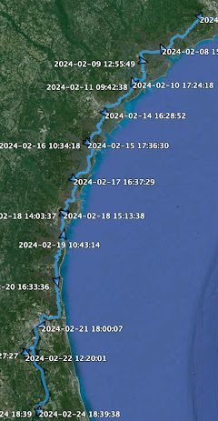
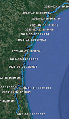
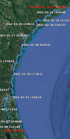
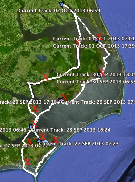
I've started (finally) the daily logs for the spring walkabout. You will find them both by scrolling down through the blog or by looking over at the column to the right where you will find "Tangier Sound Walkabout daily logs".
I've had a few readers asking about the online availability of the Chesapeake Bay Magazine article. I've emailed the editor asking about that. I hope to hear back from him this week.
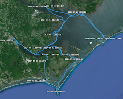
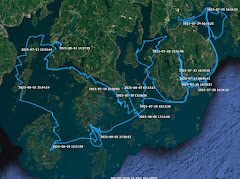
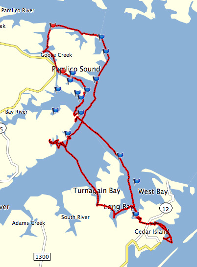
Here is a cleaner version of the track from the trip. I finally figured out how to get rid of all the other data that google earth layers on there. I still cannot access Garmin G2 Bluecharts on my mac, which is a big disappointment to me. I bought the bluecharts and can see them on my gps, but not on the laptop. I spent an hour on the phone the other day with garmin techs, they were not able to help me. I'm open to suggestions if anyone has experience in this area.
I wake feeling as if I had slept in. Check my watch hanging back near the mizzen mast, it is just 6 a.m. I remembered waking in the night to a sky full of stars, then waking again to clouds, wind and chop. The clouds still hang low this morning, a hint of light on the eastern horizon.
I sail off anchor under mizzen and jib. The wind is out of the E at 15 with gusts over 20 according to the report from the nearby Bishops Head weather station. My course is due west across the Honga River to the Thorofare between Middle and Lower Hooper Islands. Leaving Crab Point Cove I sail comfortably with following waves. I find myself wondering if the low, dark clouds make the wind seem stronger.
The entrance to the Thorofare is hard to find. The channel runs north-south and as I approach from the east it is hidden by the marshy point on the south side. What I take to be two local navigation markers slightly to the north turn out to be duck blinds. I am heading for them as my gps finally tells me that entrance is to the left. I am almost in the channel before I recognize it.
It is a beautiful passage, first through a narrow channel and then over wide sand flats. That water is light green and very clear, the wind perfect to carry us under the two small sails between the islands. A green plastic chair sits on an islet looking towards the bay. I envy whoever gets a chance to use the chair and enjoy the view. My centerboard touches the bottom and I raise it, then it touches again and I raise it more. The rudder starts to drag in the sand so I swing that up. But I don't need the board or the rudder to tell me how shallow it is, I can look over the side and see.
The water gets shallower, the board is now up all the way, the rudder down just low enough to Spartina direction. I can feel the hull sliding over the sand and wonder if I will have to get out and walk the boat across the flats. Then the sand falls away and we sail out through the mouth into Chesapeake Bay. I round up and drop the anchor on the edge of a sandy beach to reset the cb and the rudder. I also tie a reef into the main.
Delighted with having sailed through the Thorofare, something I have wanted to do for a few years, I raise anchor and sail south in the lee of Lower Hooper Island under mizzen, jib and the single-reefed main. The wind is strong out of the E, the water calm in the lee of the island.
As the shore of Lower Hooper Island falls away to the east we get the wind and the waves funneling through Hooper Strait. It is rough, with waves in series of three coming from the SE. The first two waves in each set we handle fine, the timing of the third waves comes with the bow diving into the face of that last wave and a burst of spray flying off the starboard side. Then I wait for the next set of waves.
Spartina feels solid heeled under the wind, the waves make the crossing fun and exciting. I think maybe I'm getting to be a better sailor. Then I think maybe I'm just learning to trust John Welsford's design a little more.
It is about three miles strait until we are in the lee of Okahanikan Point on the NE corner of Bloodworth Island. The waves disappear, the wind holds steady. I tack once to get in closer to the island where the water is even calmer, then sail south toward Adams Island. By 10 a.m. I'm in the lee of Adams, with Spring Island visible to the east and Holland Island to the south.
I sail in the lee of Holland Island, eventually turning into a small sand cove at the south end. Just over a hundred years ago the island was home to over three hundred people. Now it is bits of sand and marsh, with debris for commercial fishing washed up on the shore. There is a cemetery, but I suspect it is to the north through the marsh and do not know how to get there.
I content myself by walking along the beach, photographing shells or whatever else I can find. I spent 30, maybe 40 minutes relaxing, then push Spartina off the each to continue south.
I tack west into the wind to reach the lee of South Marsh Island. The second tack carries me into Pry Cove on the southwest shore. The cove is wide, shallow and, as I had suspected from looking at the charts, excellent protection for just about any wind. But it is only early afternoon, too early to stop for the day. Instead I sail farther and farther into the cove looking for a small opening to Kedges Straits.
I round a point and see the opening. I also see from looking at the shoreline that the tide is down almost two feet. I drop all sails to motor to the cut, soon finding Spartina sitting on the mud. I cut off the outboard, use the oar to push off the mud into deeper water. The channel looks like it might be deeper to the left so I come at it again, this time to the south. I see two sea gulls watching me from near the entrance to the cut, exactly where I had hoped to find a couple of feet of water. They are standing in an inch of water.
I swing around, motor out into open water and raise the sails. I will save that channel for another day when the tides are higher.
I leave Pry Cove and turn south across Kedges Straits. The wind is not quite as strong and it has swung to the SE. The strait, being open to the wind and waves, feels similar to the Hooper Strait crossing from a few hours earlier. I shake out the reef in the main and point up a little higher.
I pass the Solomons Lump Lighthouse and reach calmer water in the lee of Smith Island. I turn to early into Back Cove and find Spartina crossing a shallow sandbar.
I raise the cb and rudder and drift until there are a couple of feet under the boat. Then I sail into the cove, choosing a protected bay about a mile north of where I had anchored two nights earlier. Anchor down at 4 pm.
I wake at 6 a.m., no rain is falling but water is puddled along the forward edge of the thwart near my head. I reached out with the sponge and sop it up, squeezing the sponge over the side without leaving my sleeping bag. The corner of the bag is damp, most likely from water dripping down through leak in the boom tent. And I can feel dampness along the edge of my sleeping mat inside the bivy.
It is cold, dark and windy. The wind had swung, as forecast, to the NE. The clouds are thick, dark and very low. I wish I had shoes, the deck is cold.
I motor out of the creek and reach open water at 6:35. Under sail a few minutes later, the wind fails. I motor out of Back Cove and start to cross Kedges Straits under power. The wind returns halfway in the middle of the strait and I sail up Tangier Sound with my sleeping gear spread out on the foredeck, trying to dry the bivy and sleeping bag. I've layered on a couple of shirts, a light-weight jacket and my foul weather gear. The darkness makes it feel colder.
Weather radio says I am dealing with two fronts. One that arrived overnight and is dissipating, another one arriving mid-day. The wind seems to be shifting as I tack north between South Marsh Island and Deal Island. Sun reaches down through the clouds at 8:30 to make me feel a little better.
About a half dozen fishing boats are trolling the fishing area marked as Chain Hole just west of Deal Island. I put out a lure and troll for a while, then bring the lure back in. I can easily troll in the rough chop, but decide that I do not want to have to stand on the cold damp deck and reel in a fish as the boat pitches about. Spartina sails comfortably at a little over 3 knots, no spray coming over the side onto my drying sleeping bag and bivy.
Skies lighten throughout the morning. Late morning the wind swings to the W, maybe the second front arriving. I sail NW at 3 knots to the east of Bloodsworth Island. The wind seems, for the first time today, consistent.
Then wind fails, only to quickly fill back in. Blue skies come with the breeze. It is warm enough to take off the foul weather gear, but I'm enjoying being a little too warm and I leave the extra layer on.
Early afternoon it gets almost hot and I strip off the foul weather jacket and my lightweight jacket as I cross Hooper Strait into Fishing Bay. I consider anchoring at Goose Creek a few miles up Fishing Bay, decide it is too early in the afternoon and turn back to Hooper Strait. The water is calm and surprisingly clear, the warm sun feels good.
I duck back out into Hooper Strait and turn NW paralleling the eastern shoreline of the Honga River at 4.4 knots. We are in the lee of Lower Hooper Island and the water is calm and protected. I sail holding the tiller with my knee and enjoy the afternoon.
Looking at the map I see Crab Point Bay offers protection from the E, S and W. I pick out what I think is Crab Point in the distance, but my gps tells me it is much closer. Soon a small stand of trees marks the point. I round it under a failing breeze and enter the cove. My cb touches bottom as I cut too close to the point, I raise the board and continue on.
The water is clear enough I can see the grasses growing on the bottom. It is quiet an peaceful in the cove. Anchor down just before 5:00.
It is a chilly morning. A cool 53 degrees as I leave the house in Chesapeake before dawn. Cooler, at 46 degrees, as I arrive in Crisfeld, Maryland to launch Spartina.
I rig the and load the boat at the Somers Cove Marina, the only boat heading out, it seems, under the lowering clouds and chilly east wind. I back the boat down the nice wide ramp at 10:40. Just a few minutes later I cast off and raise sail in the harbor.
I sail wing and wing out through the narrow passage between the new condos on the north side and the old crab house on the south side. I hear a man at the crab house yell "Bon Voyage!" as the wind fills in away from harbor entrance. By the time I pick him out on the docks he has turned his back and is walking away. I can't tell if he was talking to me or to the waterman in the deadrise that is just now pushing off after delivering his bushel baskets full of crabs.
Sailing downwind on the Little Annemessex River the breeze is stronger that I expected, and the sun starts to break through the clouds. It feels good to be out on the water. I leave the river at 11:30 and turn north on Tangier Sound towards Deal Island. The overcast lowers and the wind cools. I round up and point Spartina into the wind while I put on an extra layer of clothes and decide to find out if my new Buff protects as much against the cold as it protects against the sun. It does.
Sailing up the Sound the wind comes and goes. The shifting wind doesn't help as I try to decide where I want to anchor this first night out. Deal Island? Maybe a little too far with this wind. Hazard Cove? Not much protection from the waves coming in from the south. South Marsh Island tempts me. But in the cool shifting wind it is probably too far for this evening.
I finally decide to turn towards Back Cove on the at the north end of Smith Island.
I round a marshy point at 2:30 and enter Back Cove, a power boat pulled up along the shoreline and two fisherman seated in lawn chairs along the bank. They wave, then one starts fighting a fish and reels in a skate. I ghost along the marsh and make a few casts with my spinning rod. I don't fish too seriously, I think instead about the chill and the fact that I had not brought any shoes or boots along on the boat. I had never needed anything more than bare feet or sandals on any other trip, but I wish I had something for my feet now. Two American Oyster Catchers, with dark heads and bright orange beaks, watch from a little point on a creek entrance as I drift by.
I drop the anchor a little before 4 and grill a potato for a simple dinner. As I wash the dishes the weather radio tells me the wind will change from the light SE wind I have now to a strong NE wind in the middle of the night. My achorage is open to the N and NE. I raise the anchor and motor to a creek a couple of hundred yards away where I will have protection from both directions. The weather radio also tells me rain is on the way.
I set up the boom tent, then the sleeping gear. Still wearing my foul weather gear for warmth, I relax and read a book.
I climb into my sleeping bag early and soon find I am getting a lesson in different kinds of rain. A light sprinkle, then a few heavy drops plopping down on the tent. Then a driving rain followed by a steady drizzle. I fall asleep tucked in the warmth of the sleeping bag and the dry cocoon of my bivy.
distance traveled 11.7 nm
moving time 5 hours 4 minutes
moving average 2.3 knots
The magazine was generous enough to give six full pages plus a little more to photos and story about our nine day trip last May.
This all started on the day before that sailing trip began. Bruce and I were running around like we usually do on the day before a trip, shopping for this or that, getting last minute supplies. Stuck in a traffic jam on a bridge over the ICW I get a garbled phone call. It was the editor of Chesapeake Bay Magazine asking for permission to publish a photograph I had shot a few years earlier. I said "Sure, but you guys better have the photo in hand now. I don't have time to track it down, I'm going on a sailing trip."
"What kind of sailing trip?" he asked. I explained we were going to take my 17 foot open cockpit yawl and sail it up the bay from Onancock to Chestertown. "Oh, I see," he says. "You'll trailer to a spot, sail all day, then pull the boat out and trailer to the next spot." No, I told him. We'll put it in the water and sail north for 8 or 9 days until we get to Chestertown. "Really?" he says. "Give me a call when you get back."
So I called, sent photos and worked on some words. This is the final result. I can't thank the magazine enough for the publishing the story. I'm thrilled with the photo selection (a nice batch shot both by Bruce and myself) a great design and the very helpful editing on the text. The whole process was a treat. This magazine will be something I will treasure for a long time to come.
I am almost caught up after the five day sail and a one day weekend. With any luck I will start the walkabout logs tomorrow. In the meantime I want to mention a couple of new pieces of gear that I was very happy with on this last trip.
Above I am sporting my new redfish pattern (or puppy drum pattern, for those of us on the east coast) UV Buff. I bought it, based on recommendations for friend and self-confessed gear head Kiwibird, for the sun and the heat. On this last trip I was very glad to have it both for the heat and for the cold. Much of the time I wore it around my neck like a scarf. When the sun got to be too much or the temperatures got to be too low, I pulled it up over my face. And I was very happy with the result. In fact I'm considering ordering another Buff for the June trip, in the speckled trout pattern. Thanks Kristen for the advice.
And there, tucked away in a phone pouch, is my new ACR PLB-375 ResQLink+ personal locator beacon. It stays in the pouch on my pfd/harness whenever I am sailing. Having the SPOT is fine for tracking and safety, a plb adds a little more safety. And this model is so compact I forgot it was there. Pretty cool.
I rec'd an email from a friend with a valid email address. "Hello" or "Hey" was the subject line. I made the mistake of opening it, and it hijacked my email. My apologies to those who rec'd the email from my account. Lesson learned.
I seem to be running into a lot of snakes these days. That should not be a surprise to me. Anyone who spends time along natural shorelines in the south is very likely to be in the neighborhood of a snake or two.
I posted a photograph I shot of a snake on my last walkabout. I was asked by a few people if it was a water moccasin. I knew that it was not a moccasin, but I was incorrect in thinking it was a northern water snake.
Out on a boat this morning on Back Bay I saw a few more snakes. Fortunately, I was with some wildlife biologists who were both thrilled to see the snakes and happy to identify them for me. At the top is a banded water snake. This is, I now believe, the same type of snake I photographed on the walkabout.
And above is a northern water snake, which is often mistaken for a water moccasin because of similar coloration. Moccasins, which we had fleeting glimpses of today but not enough time to photograph, have a triangular "viper" head and a much thicker body.
Both the northern water snake and the banded water snake are non-poisonous. But that doesn't mean they won't bite you.
This last one is the banded water snake, the same one in the very top photograph.
I have never had a problem with snakes. But when I am walking along or near natural shorelines, I do watch where I step.
I had to run over to one of my favorite places, the eastern shore of Virginia, today for work on a day that started out with spitting rain but turned out to be beautiful.
It was one of those hidden places on the Bay side of the shore, the kind of place you would never find unless someone told you to drive down this road to that road and make a turn here, look for the sandy lane through the woods.
The place was hard on the bay, but back at the house you would hardly know it sitting in the middle of a thick pine forest.
It was a very nice visit, very relaxing. It is taking me years, but I'm getting to know the eastern shore a little bit better.
Plus I learned where all of my old fishing lures ended up.